Comparison of SMOS ice thickness extent with NSIDC sea ice index
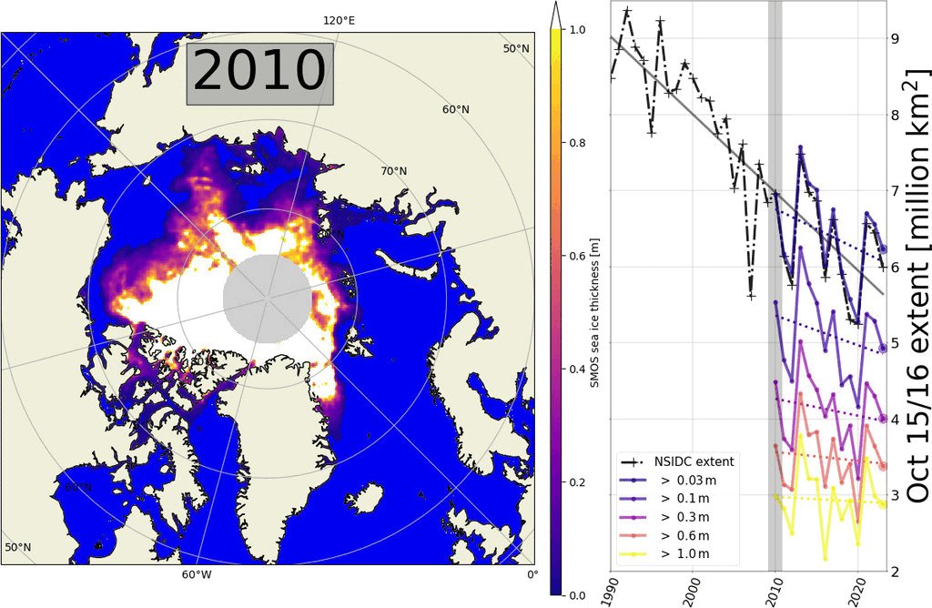
An analysis of the first data from the Arctic freezing season shows that SMOS ice extent is lower than in the previous two years. The graph shows the SMOS ice extent for October 15 and 16, an average of two days. The data looks reasonable and is also consistent with the NSIDC sea ice extent.
Please note that missing data is filled with the average of all previous years. The gap filling was in particular necessary for the beginning of the time series for the 2010/2011 season with persistent RFI sources in the Greenland Sea (see Kaleschke and Tian-Kunze, 2021).
October 2023: RFI problems in Russian Arctic
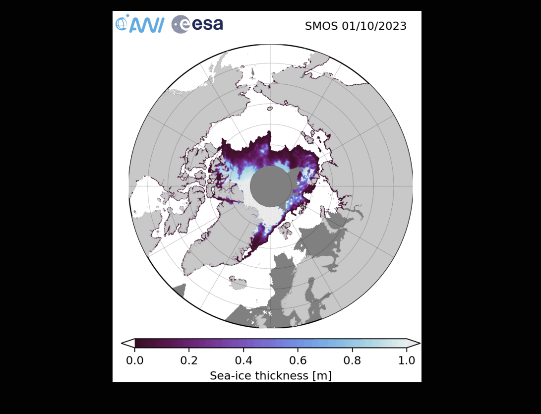
The animation shows the SMOS sea ice thickness product in the first days of October. Data gaps (dark gray) occur primarily over the Russian parts of the Arctic Ocean. Such persistent RFI problems did not occur since the season 2010/2011.
Further analysis is required to evaluate whether it is possible to reduce data loss while maintaining data quality through improved (relaxed) RFI filtering techniques.
For more information on RFI see https://rfi.smos.eo.esa.int/
References
L. Kaleschke and X. Tian-Kunze, "SMOS Sea Ice Thickness Data Product Quality Control by Comparison with the Regional Sea Ice Extent," 2021 IEEE International Geoscience and Remote Sensing Symposium IGARSS, Brussels, Belgium, 2021, pp. 1110-1113, doi: 10.1109/IGARSS47720.2021.9553630.