Page History
How can I remove things in the LayerTree?
The VEF supports a delete mode that allows users to remove layers and folders from the LayerTree. This can allow the user to only keep the layers and folders that they want to work on. It also enables a cleaner LayerTree.
In the LayerTree header you will find some icons (top right), one of these is a delete icon represented by the trash bin as highlighted below.
...
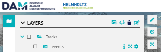
Clicking on it enables the delete mode after which the user can delete folders and layers from the LayerTree by clicking on the :cross_mark: ![]() icon. The items in the layer LayerTree will be highlighted (in red) on hover.
icon. The items in the layer LayerTree will be highlighted (in red) on hover.
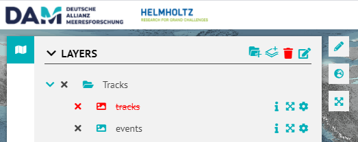
To disable the delete mode click on the trash bin icon again.
How can I edit names
...
of Layers and Folders in the LayerTree?
The Visual Explorer Explorer also supports an edit mode in the LayerTree. This enables the user to change the names of the folders and layers in the LayerTree. This comes in handy particularly when using the DrawTools, as the user can rename the drawn shapes from a generic to names of their choice.
In the LayerTree header icons, you will find the edit icon as shown below, clicking on it activates the edit mode.
...
The short video below shows the idea regarding how the DrawTools can be used as an expedition planner. The user can draw stations as points and track lines as polylines.
The user can add drawings to a folder, colour color them, annotate them and export them (as a GeoJSON) when they are done. These can then be used/imported in any Desktop or Web GIS environment that supports the GeoJSON format.
| View file | ||||
|---|---|---|---|---|
|
...
Overview
Content Tools