This is the Use Cases document for the Visual Exploration Framework (VEF) Viewer Prototype. This page aims to be a guide for the user, to better understand the tools and functionalities of the VEF Prototype and how to use them. This page is being actively updated and will be extended further.
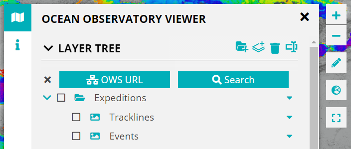
Use Case: Removing items in the LayerTree.
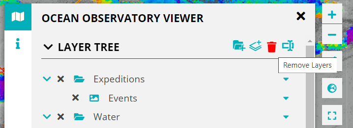
The VEF supports a delete mode that allows users to remove layers and folders from the LayerTree. This can allow the user to only keep the layers and folders that they want to work on. It also enables a cleaner LayerTree.
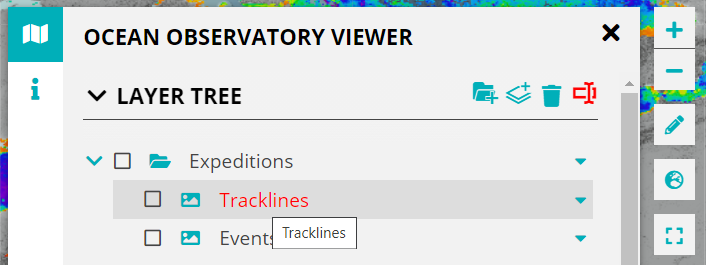
In the LayerTree header you will find some icons (top right), one of these is a delete icon represented by the trash bin as highlighted below.
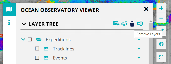
Clicking on it enables the delete mode after which the user can delete folders and layers from the LayerTree by clicking on the ![]() icon. The items in the LayerTree will be highlighted (in red) on hover.
icon. The items in the LayerTree will be highlighted (in red) on hover.
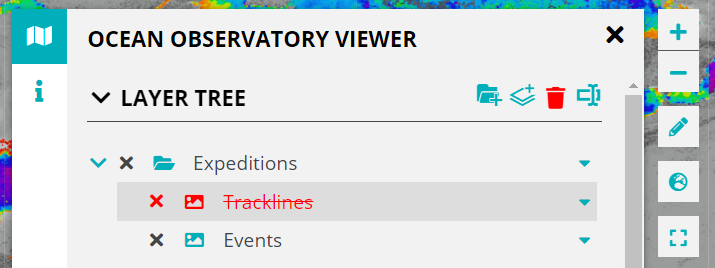
To disable the delete mode click on the trash bin icon again.
Use Case: Editing Titles of Layers and Folders in the LayerTree.
The Visual Explorer Explorer also supports an edit mode in the LayerTree. This enables the user to change the names of the folders and layers in the LayerTree. This comes in handy particularly when using the DrawTools, as the user can rename the drawn shapes from a generic to names of their choice.
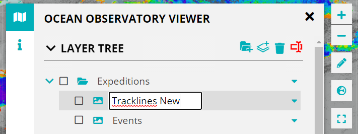
In the LayerTree header icons, you will find the edit icon as shown below, clicking on it activates the edit mode.
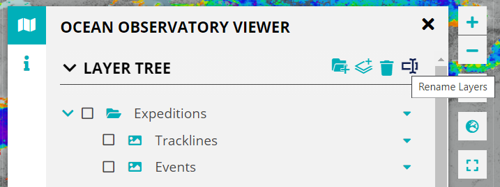
The items in the LayerTree will be highlighted on hover. The user can edit titles by clicking on existing titles.
Fill out the input field with the new title. The new title is saved by either pressing the enter key on your keyboard or by clicking outside the input field.
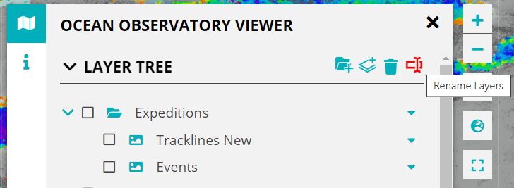
Once done, disable the edit mode by clicking on the edit icon again.
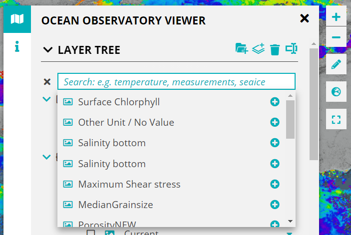
Use Case: Search for Layers on ServCat.
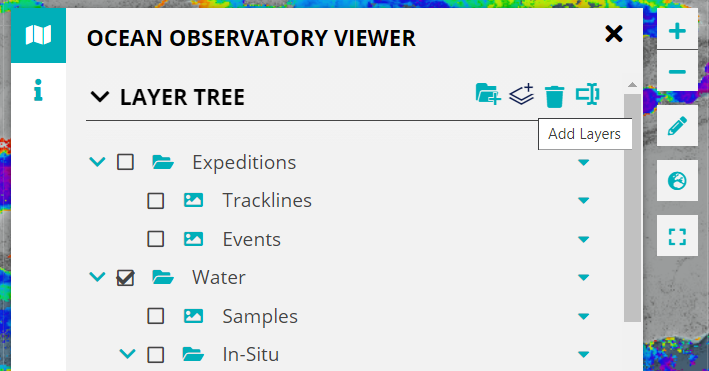
Click on the Add Layers button in the LayerTree.
Two buttons appear. Clicking on Search opens up a search bar. By default some layers are shown in a dropdown that can be added to the LayerTree and the Map.
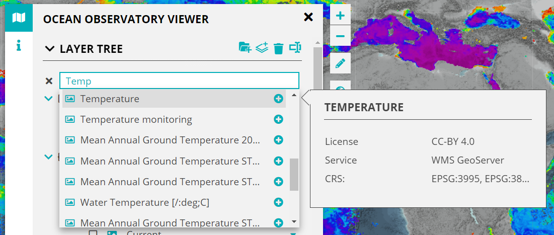
Click on a layer to add it to the LayerTree and the Map. The "add" icon (![]() ) changes to the "checked" icon (
) changes to the "checked" icon (![]() ) when the layer is clicked on.
) when the layer is clicked on.
Alternatively type in the keywords for the layer you want to find. Further information about the layers can be viewed by hovering over the layer entry in the dropdown.
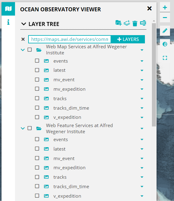
Use Case: Add OWS directly to the viewer with a URL.
The Visual Explorer Framework supports the integration of OGC Web Services (OWS) directly to the viewer via a URL. Currently WMS and WFS are supported with further support to follow.
To add a service to the viewer click on the Add Layers button as done for opening ServCat.
Now click on the OWS URL button.
This opens up a search bar where you can add/paste a valid OWS url.
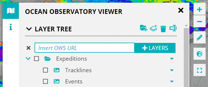
Add the URL and click the button next to it.
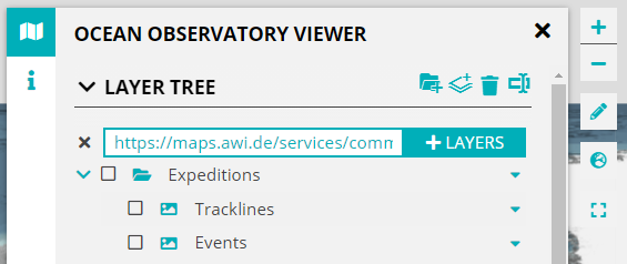
The OGC web services will be added to the LayerTree and the Map.
Use Case: Using the DrawTools to plan an expedition.
The short video below shows how the DrawTools can be used as an expedition planner. The user can draw stations as points and track lines as polylines.
The user can add drawings to a folder, color them, annotate them and export them (as a GeoJSON) when they are done. These can then be used/imported in any Desktop or Web GIS environment that supports the GeoJSON format.
 DrawTools_ExpeditionPlanner.mp4
Overview
Content Tools