Versions Compared
Key
- This line was added.
- This line was removed.
- Formatting was changed.
| Info | ||
|---|---|---|
| ||
We updated the CS2SMOS processing to the latest input versions of the source data (SMOS L3C sea ice thickness v3.3 & CryoSat-2 L2P sea ice thickness v2.6) CryoSat-2 version 2.6 update
CS2SMOS algorithm changes
|
| Info | ||
|---|---|---|
| ||
We updated the CS2SMOS processing to the latest input versions of the source data (SMOS L3C sea ice thickness v3.3 & CryoSat-2 L2P sea ice thickness v2.5) CryoSat-2 version 2.5 update
CS2SMOS algorithm changes
|
| Info | ||
|---|---|---|
| ||
We updated the CS2SMOS processing to the latest input versions of the source data (SMOS L3C sea ice thickness v3.3 & CryoSat-2 L2P sea ice thickness v2.4) CryoSat-2 version 2.4 update
SMOS version 3.3 update
CS2SMOS file format changes
|
| Info | ||
|---|---|---|
| ||
|
| Info | ||
|---|---|---|
| ||
|
| Panel | ||||||||||||||||||
|---|---|---|---|---|---|---|---|---|---|---|---|---|---|---|---|---|---|---|
| ||||||||||||||||||
|
| Panel | ||||||||||||||
|---|---|---|---|---|---|---|---|---|---|---|---|---|---|---|
| ||||||||||||||
Product Description Overview
|
File naming conventionNetCDF files are named using the following convention: <convention-prefix>_<regional code>- <institution>,<platform(s)>,<grid>_<time>_<mode>_<product version>_<file version>.nc
Example NetCDF naming for operationally processed data: W_XX-ESA,SMOS_CS2,NH_25KM_EASE2_20190304_20190310_o_v204_01_l4sit.ncExample NetCDF naming for reprocessed data: W_XX-ESA,SMOS_CS2,NH_25KM_EASE2_20190304_20190310_r_v204_01_l4sit.ncFile FormatThe weekly grids are given in standardized binary data format (Network common data form: NetCDF v4). Global attributes are given in Table 1. The variables are given as grid arrays, see |
Table 2. NetCDF files are formatted according to CF conventions: CF-1.6 ACDD-1.3. We use a scaling factor of 10^-3 and a fillvalue = -2147483647. |
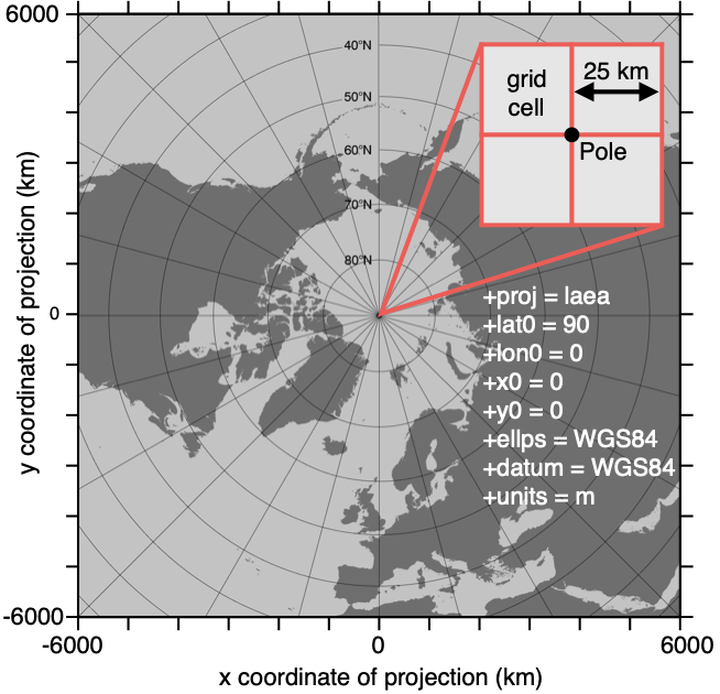 Image Removed
Figure 1: Specifications of the EASE2 25 km grid, which is used for the merged product.
Table 1: Global attributes from an example NetCDF file, covering the week from March 04 to March 10, 2019.
Table 2: NetCDF file content. Note, that we use a scaling factor of 10^-3 and a fillvalue = -2147483647 |
.
|
|
|
|
|
|
|
|
|
|
|
|
|
|
|
|
|
|
|
|
|
|
|
|
|
|
|
Grid
All grids are projected onto the 25 km EASE2 Grid, which is based on a polar aspect spherical Lambert azimuthal equal-area projection (Brodzik et al., 2012). The grid dimension is 5400 km x 5400 km, equal to a 432 x 432 grid. The grid is centered on the geographic Pole, meaning that the Pole is located at the intersection of center cells (Figure 1).
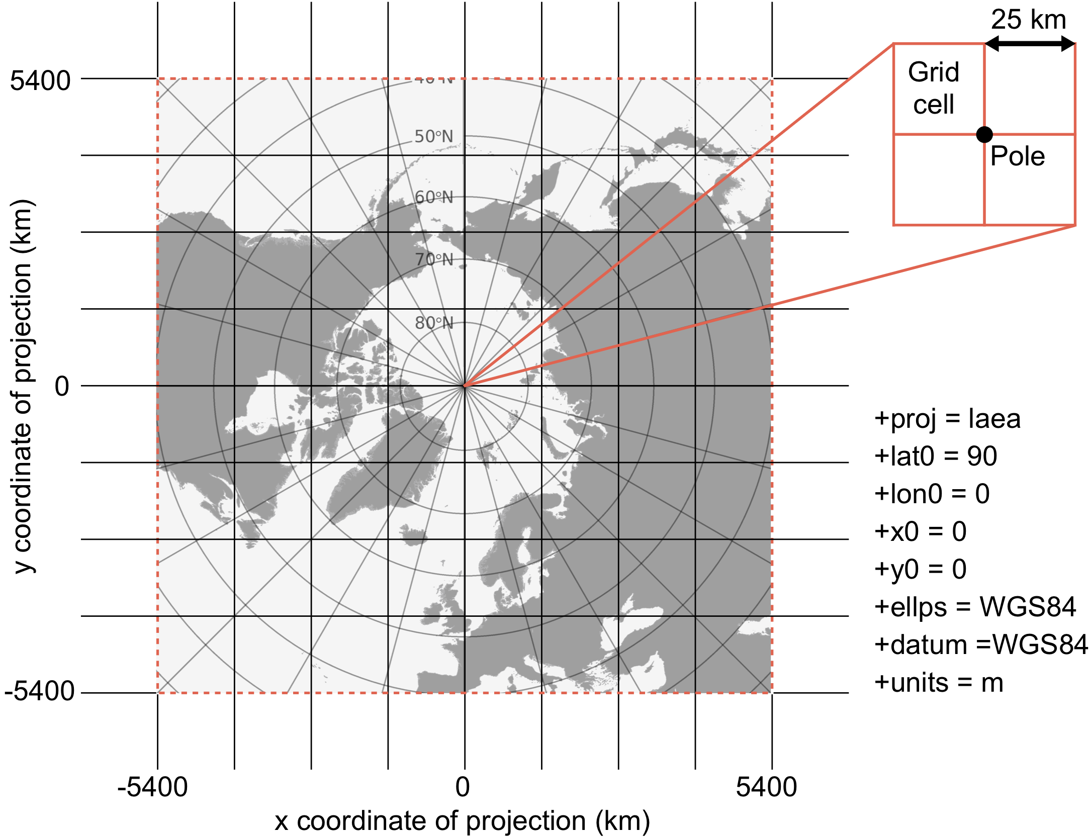 Image Added
Figure1: Specifications of the EASE2 25 km grid, which is used for the merged product.
| Panel | ||||||||
|---|---|---|---|---|---|---|---|---|
| ||||||||
LinksESA Websites: Visualization of NetCDF data: |
| Panel | ||||||||
|---|---|---|---|---|---|---|---|---|
| ||||||||
Points of ContactsResponsible Scientists |