Page History
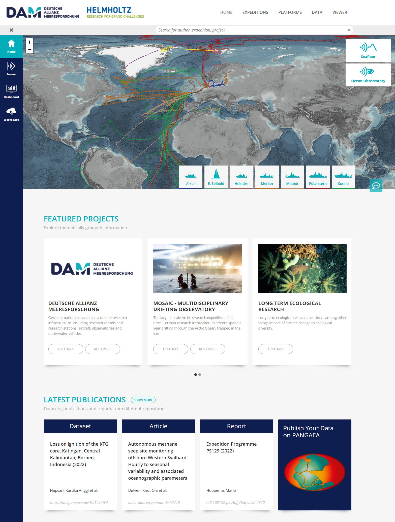
Our portal solution (e.g. marine-data.de is a is a user-friendly one-stop-shop framework for integrated discovery of various types of scientific content, from near real-time data to quality-controlled WebGIS map products. It supports:
Discovery of information on research platforms, devices and sensors
Discovery of campaign specific metadata including its scientific output
Discovery of thematically grouped data and data products in collections and viewer
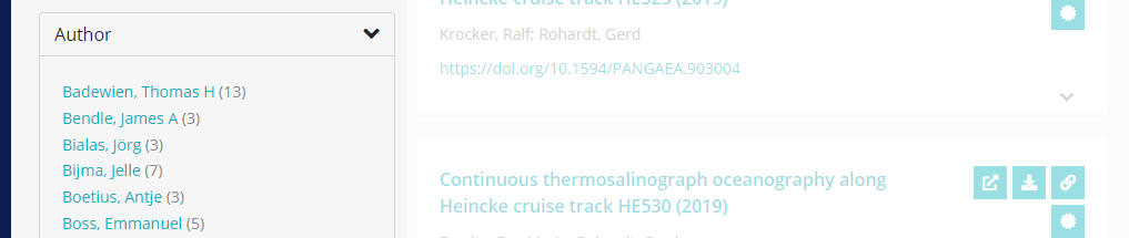
Facetted search allowing hit results to be filtered for repository type, project, platform, etc.
Featured Projects
Featured projects are prepared entry points for thematically grouped information which is of interest for our users. We provide shortcuts for metadata exploration in the data search, links to external project pages or customized data viewers.
| Info | ||
|---|---|---|
| ||
Latest Publications
In the latest publication section, the most recent datasets, articles and reports are listed. It's just a teaser. To search for datasets, articles and more, use the data fulltext search.
Any content is harvested from different data providers. Each provider is responsible for metadata quality and granularity.
| Info | ||
|---|---|---|
| ||
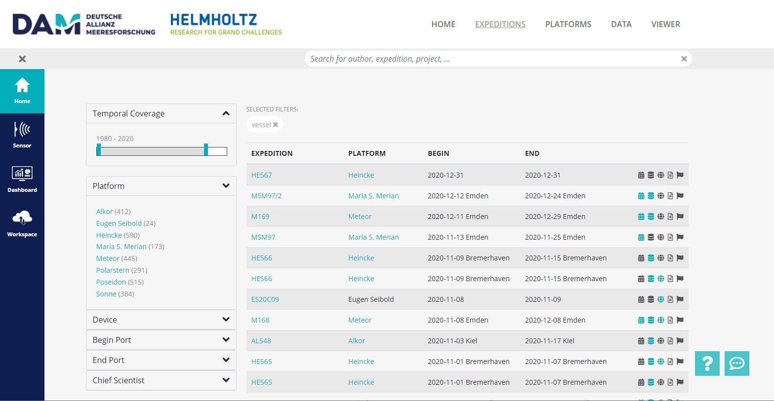
Expeditions
The portal offers an overview of expedition or campaign metadata for research vessels as well as land-based campaigns.
Use the search bar at the top and the facets on left hand site to filter results for specific keywords. Have a look at how to search.
| Info | ||
|---|---|---|
| ||
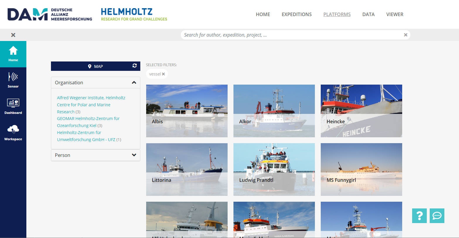
Platforms
The platforms site gives you an overview about existing platforms and devices used in the community. All related information is managed in REGISTRY (formerly known as SENSOR) by device responsible editors.
Use the search bar at the top and the facets on left hand site to filter results for specific keywords. Have a look at how to search.
| Info | ||
|---|---|---|
| ||
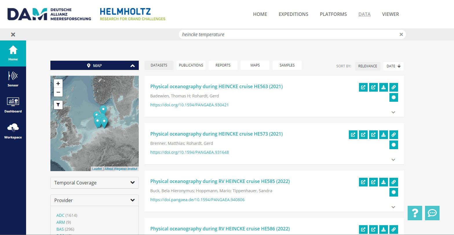
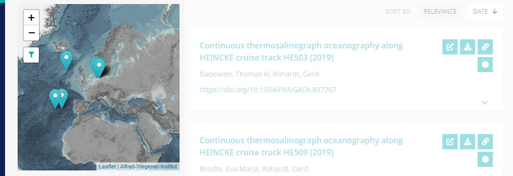
Data
Researching for datasets, articles, reports as well as geospatial projects is offered on the data site.
Any content is harvested from different data content providers. Each provider is responsible for metadata quality and granularity.
Use the search bar at the top and the facets on left hand site to filter results for specific keywords. Have a look at how to search.
| Info | ||
|---|---|---|
| ||
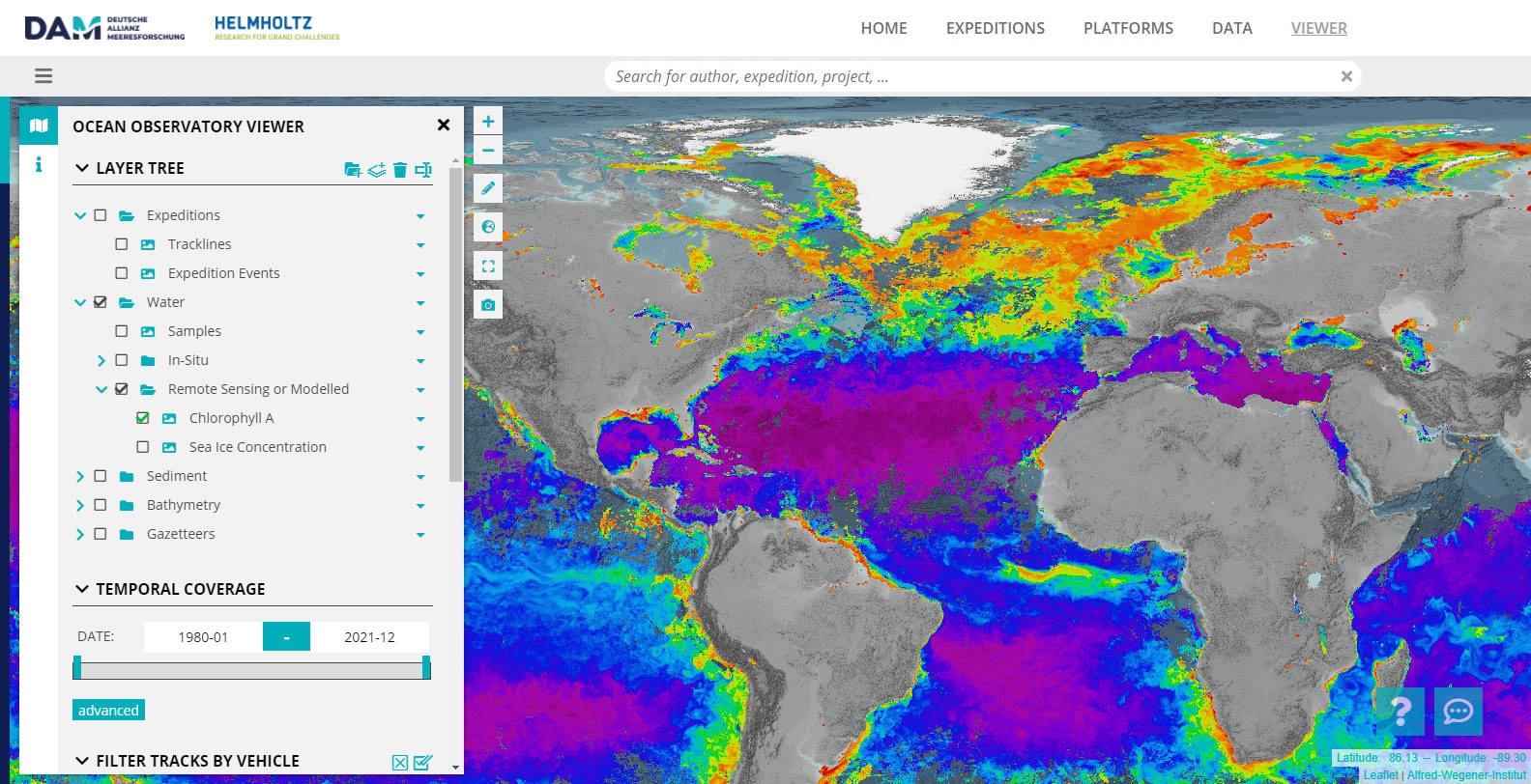
Viewer
The Viewer
comming soonallows to explore curated data products and is highly user customizable. Just start to explore interesting data with the viewer. You find a ahort introduction to the viewer here https://spaces.awi.de/x/54sBFQ.
Read more about our underlying Visual Exploration Framework (VEF) and our SDI (SDI) to provide new data products or services.
| Info | ||
|---|---|---|
| ||
| Anchor | ||||
|---|---|---|---|---|
|
coming soon
To become a data provider for the portal you have to provide metadata for your datasets, articles or map projects. We basically support the defacto standardized OAI-PMH and the OGC CSW metadata harvesting interfaces. One of these standards should be accessible from the internet via HTTP/S without authentication. If you have no catalog and standardized interfaces to your content until now, you might have a look at the GeoNetwork solution. Different metadata schemata and profiles are supported, e.g. ISO19115, but also customized ones. For special cases, also other web-ressources can be harvested, but are not preferred.
Checkpoints for basic metadata
- Title
- Publication date
- Temporal extent (begin date, end date)
- Geographical extent (point, bounding box, polygon or line string)
- Author(s) (lastname, firstname, email, ORCID)
- Abstract or description
- Stable URL to splash page with additional information
- DOI or Handle if existing
- Type of object (data, publication, article, map)
Checkpoints for extended metadata profiles
- Platform metadata, e.g. research vessel, Polarstern
- Device metadata, e.g. Thermosalinograph (device type)
- Expedition or campaign metadata, e.g. PS101
- Event metadata, e.g. PS101/058-1 (date, description, latitude, longitude)
- Measured parameter, e.g. temperature
- URL(s) reference(s) to related data services or download
- URL(s) reference(s) to further information and related content
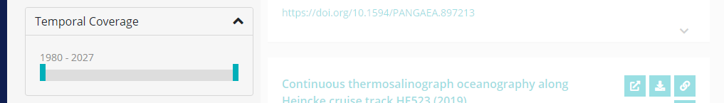
The portals search engine allows to search for keywords, filtering for temporal and geographical extents. Specific content is also searchable by filtering, e.g. expedition identifiers.
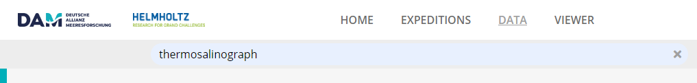
Use keyword search by typing in the search bar at the top, e.g.
- thermosalinograph to find any content for such a device
- PS120 to find any content for such an expedition
- PS120 +thermosalinograph to find any content related to such a device and expedition
- events.name/PS119_40872 to find any content for such an event
- parameters.name:temperature to find any content which explicitly named such a parameter
- 0000-0003-2117-4176 to find any content with such an ORCID
The generic type filter can be used to find only datasets or publications or reports.

Use the map filter and click the filter icon ![]() to find any content which has a geographical extent intersecting with the visible area.
to find any content which has a geographical extent intersecting with the visible area.
Content is filtered for temporal coverage if not collapsed.
Other filters are only visible if available. Click an entry to further restrict your search results.
| Info | ||
|---|---|---|
| ||
Overview
Content Tools