...
| Sensorweb integration | ||||
|---|---|---|---|---|
| ||||
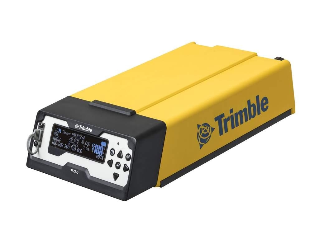
The Trimble SPS855 R750 is a combined radio and GPS receiver. It uses all currently available satellite signals including L1, L2 and the GPS modernized L2C code. |
...
| Sensorweb integration | ||||||||||
|---|---|---|---|---|---|---|---|---|---|---|
| ||||||||||
|
| Sensorweb integration | ||||
|---|---|---|---|---|
| ||||
   |
Trimble 2
| Sensorweb integration | ||||||||||
|---|---|---|---|---|---|---|---|---|---|---|
| ||||||||||
|
| Sensorweb integration | ||||
|---|---|---|---|---|
| ||||
 No images available. |
Contacts
| Sensorweb integration | |||||||||||||
|---|---|---|---|---|---|---|---|---|---|---|---|---|---|
|
| Name | Institution | Role |
|---|---|---|
| Ralf Krocker | Alfred-Wegener-Institute for Polar and Marine Research | Data Provider |
| Reederei Laeisz | Reederei Laeisz | Engineer In Charge |
No contacts available.
Components
| Metadata (Metadata Plugin) | ||
|---|---|---|
| ||
There are two independent systems installed, called TRIMBLE 1 and TRIMBLE 2. Both consist of an antenna GA-830 model and a receiver of type R750. Antennas are installed on antenna deck above bridge. The two receivers are installed in scientific panel on bridge. TRIMBLE 1 is sending NMEA0183 telegrams to motion sensor HYDRINS 1 and DShip. TRIMBLE 2 is sending telegrams to motion sensor HYDRINS 2 and DShip. |
...
| Sensorweb integration | |||||||||||
|---|---|---|---|---|---|---|---|---|---|---|---|
| |||||||||||
Origin Description:
|
Trimble 2 antenna position
| Sensorweb integration | ||||||||||||||
|---|---|---|---|---|---|---|---|---|---|---|---|---|---|---|
| ||||||||||||||
Origin Description:
|
Data logging, storage and archiving
...
| Sensorweb integration | |||||||||||||||||||||||||||||||
|---|---|---|---|---|---|---|---|---|---|---|---|---|---|---|---|---|---|---|---|---|---|---|---|---|---|---|---|---|---|---|---|
| |||||||||||||||||||||||||||||||
degree | speed made good | duration | knots | GPS quality indicator | quality flag | unknown | date | date and time | unknown | time | date and time | gmt | course | attitude | degree |
|
Central geographical ship's position and time standard
...
| Sensorweb integration | ||||
|---|---|---|---|---|
| ||||