Attention:
The Motion Sensors (Hydrins 1 and Hydrins 2) are operated by ship's command only.
Summary
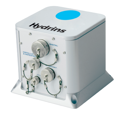
HYDRINS is a high-performance inertial navigation system (INS) optimized for hydrographic survey using multibeam echosounders. HYDRINS comprises a single compact unit and delivers highly accurate real-time position, heading, attitude and speed data.
Hydrins 1
| Manufacturer | iXBlue |
|---|---|
| Model | HYDRINS |
| Serial No. | PH-1904 |
| Type | motion sensor |
| SENSOR-Link | ↪ |
Hydrins 2
| Manufacturer | iXBlue |
|---|---|
| Model | HYDRINS |
| Serial No. | PH-1887 |
| Type | motion sensor |
| SENSOR-Link | ↪ |
Contacts
| Name | Institution | Role |
|---|---|---|
| Ralf Krocker | Alfred Wegener Institute, Helmholtz Centre for Polar and Marine Research | Device Contact |
| Sebastian Immoor | Alfred Wegener Institute, Helmholtz Centre for Polar and Marine Research | Device Contact |
Components
The sensor is an essential device providing motion and position data for a large number of scientific instruments. The system is receiving posiion data from GPS receiver and is delivering positions centered to Hydrins 1.
Several output interfaces are defined to deliver different formatted data strings with different frequency to customers.
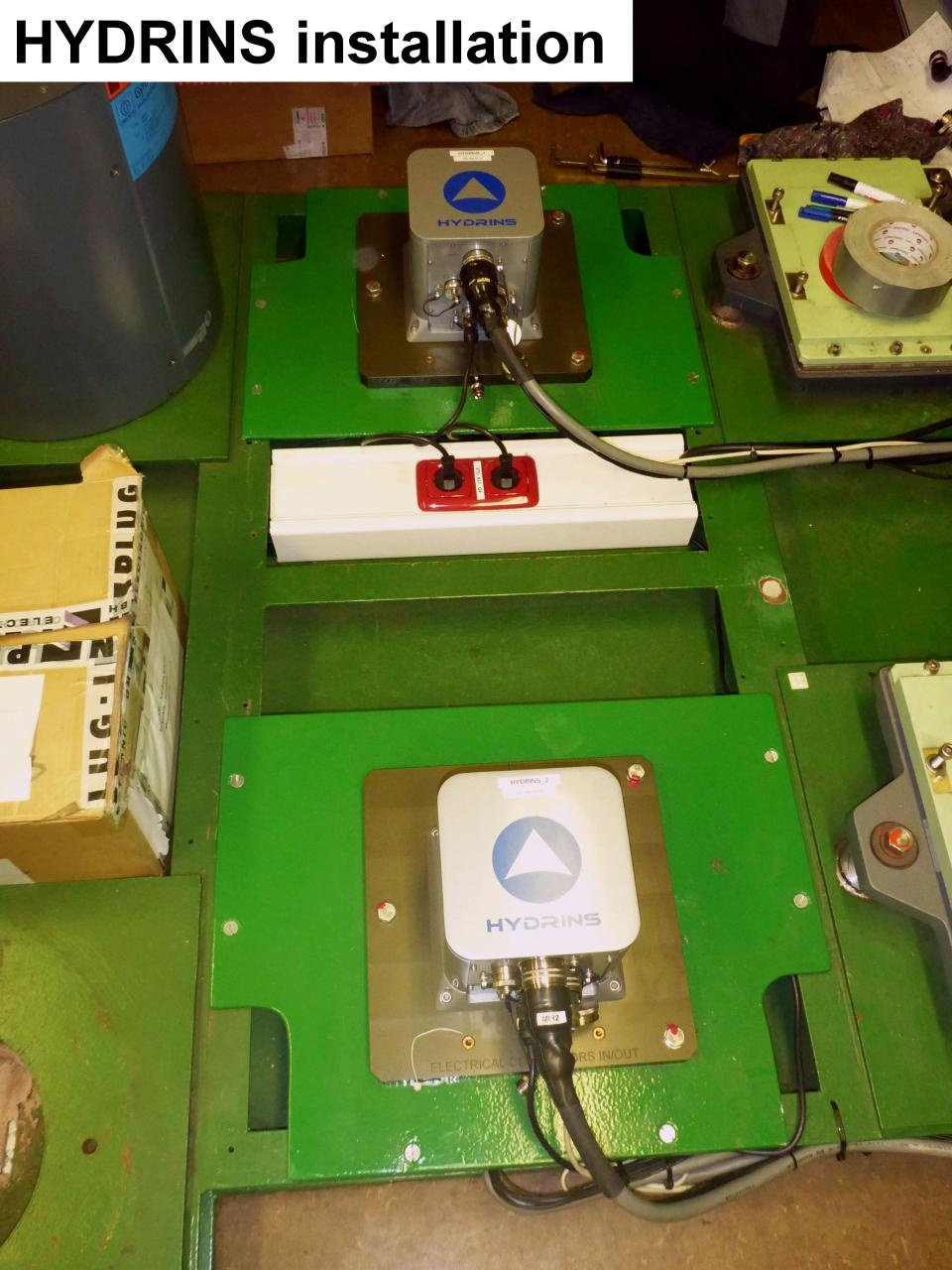
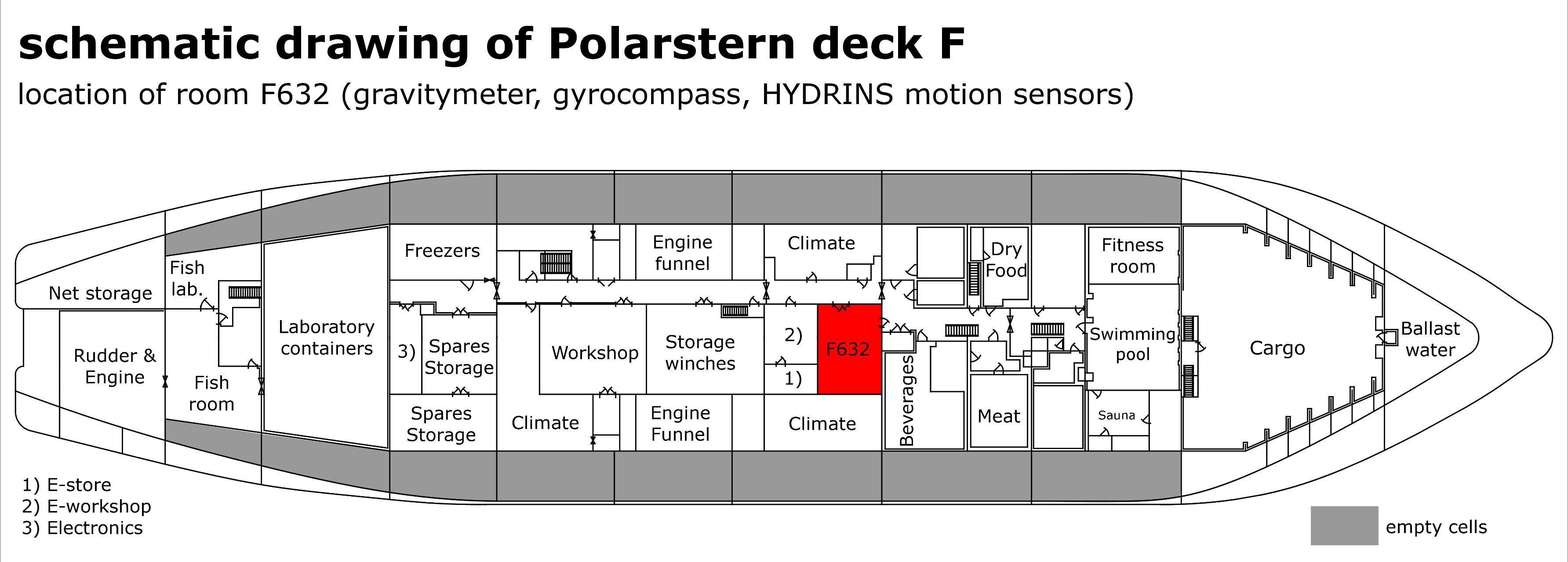
The main device is a three component laser accerelometer. It is installed in Gravity Meter Room F-632. For backup there is a second system installed.
Downstream equipment of Hydrins 1 and Hydrins 2 is ment to select on of both Hydrins to be active one and to deliver data to customers. Additionally converter boxes (Provided by firm FIELAX) are installed to split outgoing data stream and to convert it into several formats requested by customers. Nautical system NACOS is receiving position data from Hydrins as backup.
Several output interfaces are defined to deliver different formatted data strings with different frequency to customers.
The main device is a three component laser accerelometer. It is installed in Gravity Meter Room F-632. For backup there is a second system installed.
Downstream equipment of Hydrins 1 and Hydrins 2 is ment to select on of both Hydrins to be active one and to deliver data to customers. Additionally converter boxes (Provided by firm FIELAX) are installed to split outgoing data stream and to convert it into several formats requested by customers. Nautical system NACOS is receiving position data from Hydrins as backup.
Position
Hydrins 1
| Info | xyz-position from Alignment Survey Report RV Polarstern (June 2016), located in room F632 |
| X | 55.994 m (X-0 is at the center of der rudder (ref. design drawing of the vessel), positive X-axis is forward and along vessel centerline) |
| Y | -2.666 m (Y-0 at centerline, positive Y-axis is portside) |
| Z | 11.6 m (Z-0 is set to the lowest point of the keel, positive Z-axis is upwards) |
Hydrins 2
| Info | xyz-positon from Alignment Survey Report RV Polarstern (June 2016), located in room F632 |
| X | 55.166 m (X-0 is at the center of der rudder (ref. design drawing of the vessel), positive X-axis is forward and along vessel centerline) |
| Y | -2.663 m (Y-0 at centerline, positive Y-axis is portside) |
| Z | 11.599 m (Z-0 is set to the lowest point of the keel, positive Z-axis is upwards) |
Data logging, storage and archiving
Logged parameters
| Parameter | Sensor Output Type | Unit |
|---|---|---|
| latitude | latitude | deg |
| longitude | longitude | deg |
| heading | attitude | deg |
| speed | speed | knot |
| course | attitude | deg |
| gyro heading | attitude | deg |
| gyro heading angle rate | attitude | deg/s |
| gyro pitch | attitude | deg |
| gyro pitch angle rate | attitude | deg/s |
| gyro roll | attitude | deg |
| gyro roll angle rate | attitude | deg/s |
| heave | attitude | m |
| x-velocity | speed | m/s |
| y-velocity | speed | m/s |
| z-velocity | speed | m/s |
Central geographical ship's position and time standard
Time synchronising is received from responsible Trimble GPS receiver (Hydrins 1 is receiving data from Trimble 1, Hydrins 2 from Trimble 2).
Geographical ship's position is received from responsible Trimble GPS receiver (Hydrins 1 is receiving data from Trimble 1, Hydrins 2 from Trimble 2). Positions provided by Hydrins 1 and Hydrins 2 are both centered to Hydrins 1.
Geographical ship's position is received from responsible Trimble GPS receiver (Hydrins 1 is receiving data from Trimble 1, Hydrins 2 from Trimble 2). Positions provided by Hydrins 1 and Hydrins 2 are both centered to Hydrins 1.
Rawdata storage on board
Data storage in DShip system.
Dship
Unevaluated measurement data.
Device name |
hydrins |
|---|---|
Parameters |
course [deg]; gyro heading [deg]; gyro heading ang. rate [°/s]; gyro pitch [deg]; gyro pitch ang. rate [°/s]; heave [m]; position latitude [°]; position longitude [°]; speed [kn]; x-velocity [m/s]; y-velocity [m/s]; z-velocity [m/s] |
Data archiving on land
After the cruise the DShip data set can be extracted from https://dship.awi.de/ .
.
Quality checked positions are published as "Master Track" in PANGAEA https://www.pangaea.de/ (for authorized users only).
Quality checked positions are published as "Master Track" in PANGAEA https://www.pangaea.de/
File format(s) |
*.txt |
|---|---|
Calibration certificates |
NO |