Attention:
The Ship Navigation Platform (NACOS) is operated by ship's command only.
Summary
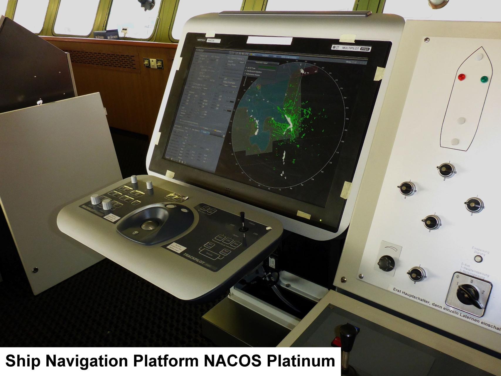
The NACOS ship navigation system is the main software platform for all processes concerning navigation and ship maneuvers.
vessel:polarstern:nacos (1401)
| Manufacturer | Wärtsilä SAM Electronics |
|---|---|
| Model | NACOS Platinum |
| Serial No. | n/a |
| Type | navigation system |
Contacts
| Name | Institution | Role |
|---|---|---|
| Reederei Laeisz | Reederei Laeisz | Engineer In Charge |
Components
Position
| Info | no xyz-position given, operation platform located on bridge |
Data logging, storage and archiving
Logged parameters
| Parameter | Sensor Output Type | Unit |
|---|---|---|
| EW | longitude | ° |
| identifier | quality flag | unknown |
| message mode | quality flag | unknown |
| message number | quality flag | unknown |
| NS | latitude | ° |
| route ld | quality flag | unknown |
| speed bottomtrack across | speed | knots |
| speed bottomtrack ahead | speed | knots |
| speed made good | speed | knots |
| speed watertrack across | speed | knots |
| speed watertrack ahead | speed | knots |
| system course | attitude | degree |
| system course status | quality flag | unknown |
| system heading | attitude | degree |
| system heading status | quality flag | unknown |
| system position latitude | latitude | ° |
| system position longitude | longitude | ° |
| system position status | quality flag | unknown |
| system speed | speed | knots |
| system speed status | quality flag | unknown |
| system speed unit | index | unknown |
| track made good | distance | degree |
| track speed status | quality flag | unknown |
| waypoint ID From | index | unknown |
| waypoint ID to | index | unknown |
| waypoint position EW | longitude | ° |
| waypoint position longitude | longitude | ° |
| waypoint position NS | latitude | ° |
| waypoint position latitude | latitude | ° |
Central geographical ship's position and time standard
Rawdata storage on board
Dship
Device name |
NACOS ship navigation system |
|---|---|
Parameters |
EW; identifier; message mode; message number; NS; route Id; speed bottom track across [kn]; speed bottom track ahead [kn]; speed made good [kn]; speed watertrack across [kn]; speed watertrack ahead [kn]; system course [deg]; system course status; system heading [deg]; system heading status; system position latitude [°]; system position longitude [°]; system position status; system speed [kn]; system speed status; system speed [kn]; system speed status; system speed unit; track made good [deg]; track speed status; waypoint Id From; waypoint Id To; waypoint position EW; waypoint position longitude [°]; waypoint position NS; waypoint position latitude [°] |
Data archiving on land
File format(s) |
*.txt |
|---|---|
Calibration certificates |
NO |