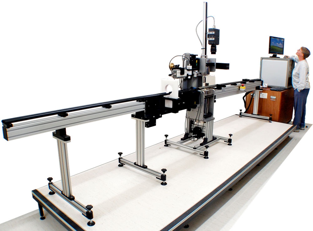
You are viewing an old version of this page. View the current version.

Compare with Current View Page History

« Previous Version 2 Next »

Attention:

Please note that the system can only be operated upon request. Operations with the MSCL-S requires experienced scientific staff on board. The system is not operated by the ship's crew. Announce operations with the MSCL-S to AWI-Logistics prior to the cruise and clarify the data transfer after the cruise.

Summary

Multi-Sensor Core Loggers capture physical measurands of sediment cores automated and non-destructive.


Manufacturer: Geotek Ltd.
Model: MSCL-S
Serial No: NEU
Type: Multi-Sensor Core Logger

Responsible Persons

RoleName
Engineer in ChargeDietmar Penshorn
Data ScientistFrank Niessen

Components

The system consits of the measuring bench with a ballscrew, which pushes core section past 6 to 7 sensors measuring Gamma Density, P-wave Velocity, Magnetic Susceptibility, Point Magnetic Susceptibility, Colour Spectrophotometry, Linescan Imaging and optional Natural Gamma Spectrometry. All sensors simultaneously acquire the data, which is displayed real-time during logging. The acquired data is stored locally in the electronics with simple user interface.

Sensor Type

Gamma Density Sensor

P-Wave System

Magnetic Susceptibility Loop Sensor MS2C

Magnetic Susceptibility Point Sensor MS2E

CM-700D Spectrophotometer

Geoscan V Linescan Imaging

optional: Natural Gamma Spectrometry

Manufacturer

Geotek Ltd.

Geotek Ltd.

Bartington Instruments

Bartington Instruments

Konica Minolta Measuring Instruments (Konica)

Geotek Ltd.

Geotek Ltd.

Components

Gamma ray source (137-Caesium source with energies at 0.662 MeV)
detector
sensor stand mount (alignment of source/detector with center of core)

Geotek ultrasonic (230 kHz) acoustic transducers
Laser micrometer
PRT temperature Probe

Magnetic Susceptibility Loop Sensor MS2C

Magnetic Susceptibility Point Sensor MS2E

CM-700D Spectrophotometer

Geoscan V Linescan Imaging Camera specifications:
Pixel Sensors: 1x 5K CGD
Visible or Ultraviolet light source
ADC resolution: 14 bits per colour channel
correlated double sampling with exposure control
max pixel rate: 3.2M pixels/sec
max scan rate: 200 lines/sec
down core resolution: upt ot 10 microns
camera control: auto focus, aperture and lighting
data transmission: gigabyte ethernet interface
Canon lens mount

three 3"x3" NaI(Tl) detectors with photomultiplier tube and Multi-Channel Analyser (MCA)
detector housings: 6" diameter lead shields
interface and electronics supplied in integrated 19" rack unit

Position

No fix onboard location.

Data logging, storage and archiving

Logged parameters

Gamma Density, P-wave Velocity, Magnetic Susceptibility (Loop), Magnetic Susceptibility (Point), Colour Spectrophotometry, Geoscan V Linescan Imaging, optional: Natural Gamma Spectrometry

Central geographical ship's position and time standard

No time synchronising.
No online ship's position.

Rawdata storage on board

Local storage on MSCL-S electronic. Operator is in charge of data backup.

Dship

No data transfer to DShip.

Data archiving on land

Not implemented, responibility with respective user.

Documentation

http://www.geotek.co.uk/products/mscl-s/

http://www.geotek.co.uk/products/gammadensity/

http://www.geotek.co.uk/wp-content/uploads/2017/06/Discrete_P-wave_System.pdf

http://www.bartington.com/presentation/ms2-ms3-magnetic-susceptibility-system?A=SearchResult&SearchID=2471066&ObjectID=5113146&ObjectType=35

http://www.geotek.co.uk/products/spectrophotometer/

http://sensing.konicaminolta.asia/products/cm-700d-spectrophotometer/

http://www.geotek.co.uk/products/geoscan/

http://www.geotek.co.uk/products/natgam/

  • No labels