CryoSat-2 has now finished its 9th winter from October to April of Arctic sea ice thickness observations. No sea-ice thickness production is now paused for the month of May through September since the snow is warming and will soon start to melt. The impact of snow melt on the sea-ice thickness retrieval is poorly understood and the production will resume in October 2019 with the next version of CryoSat-2 data.
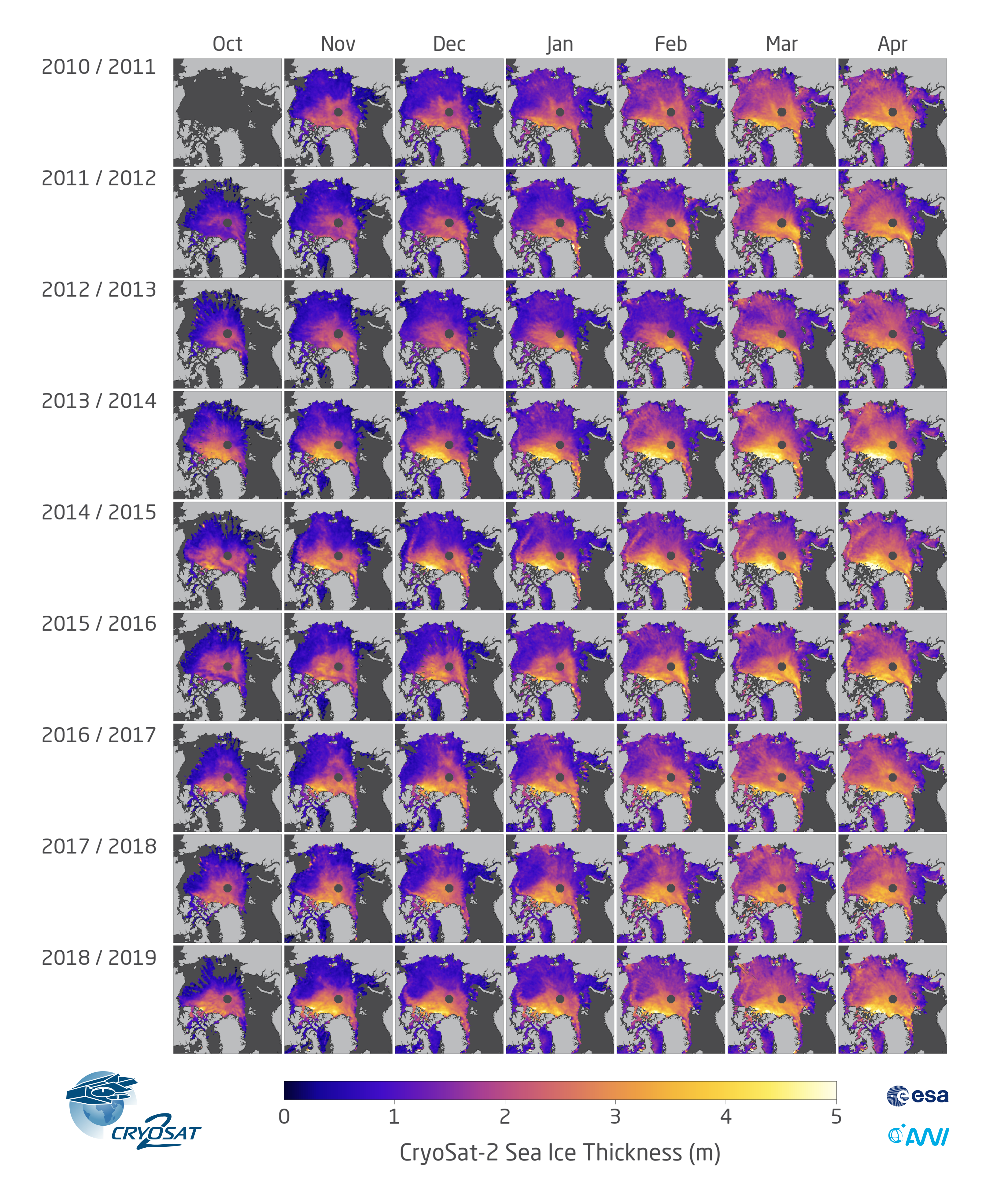
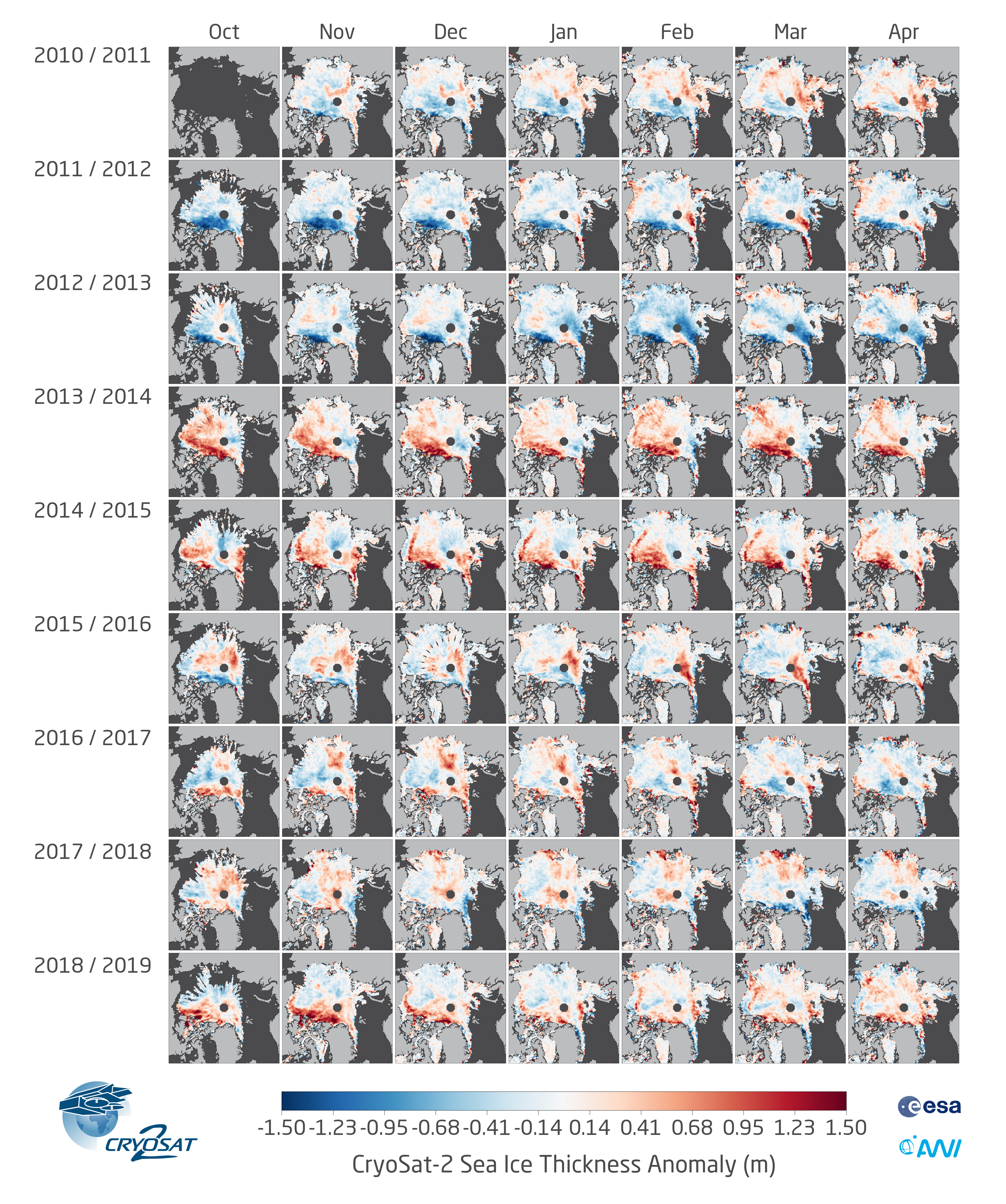
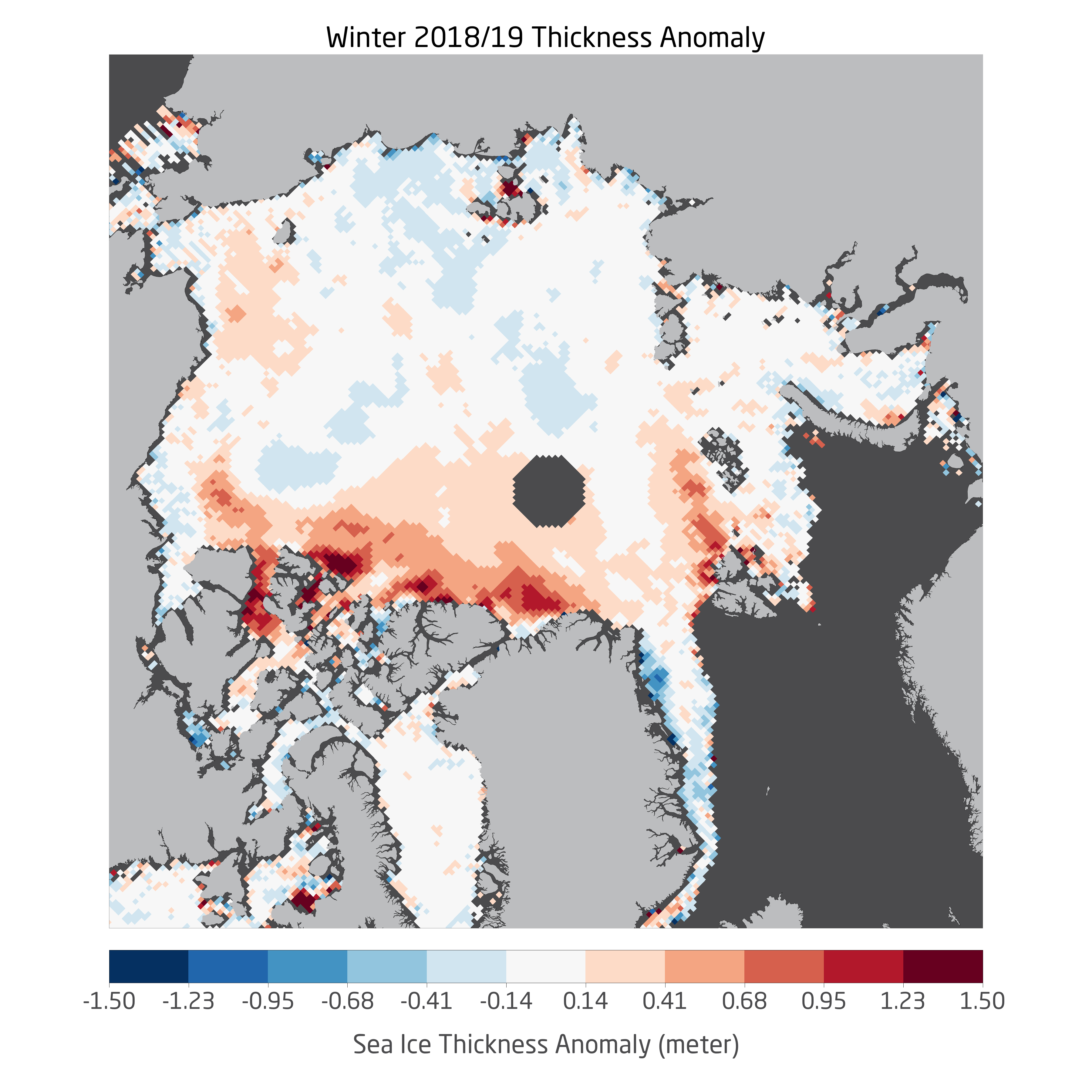
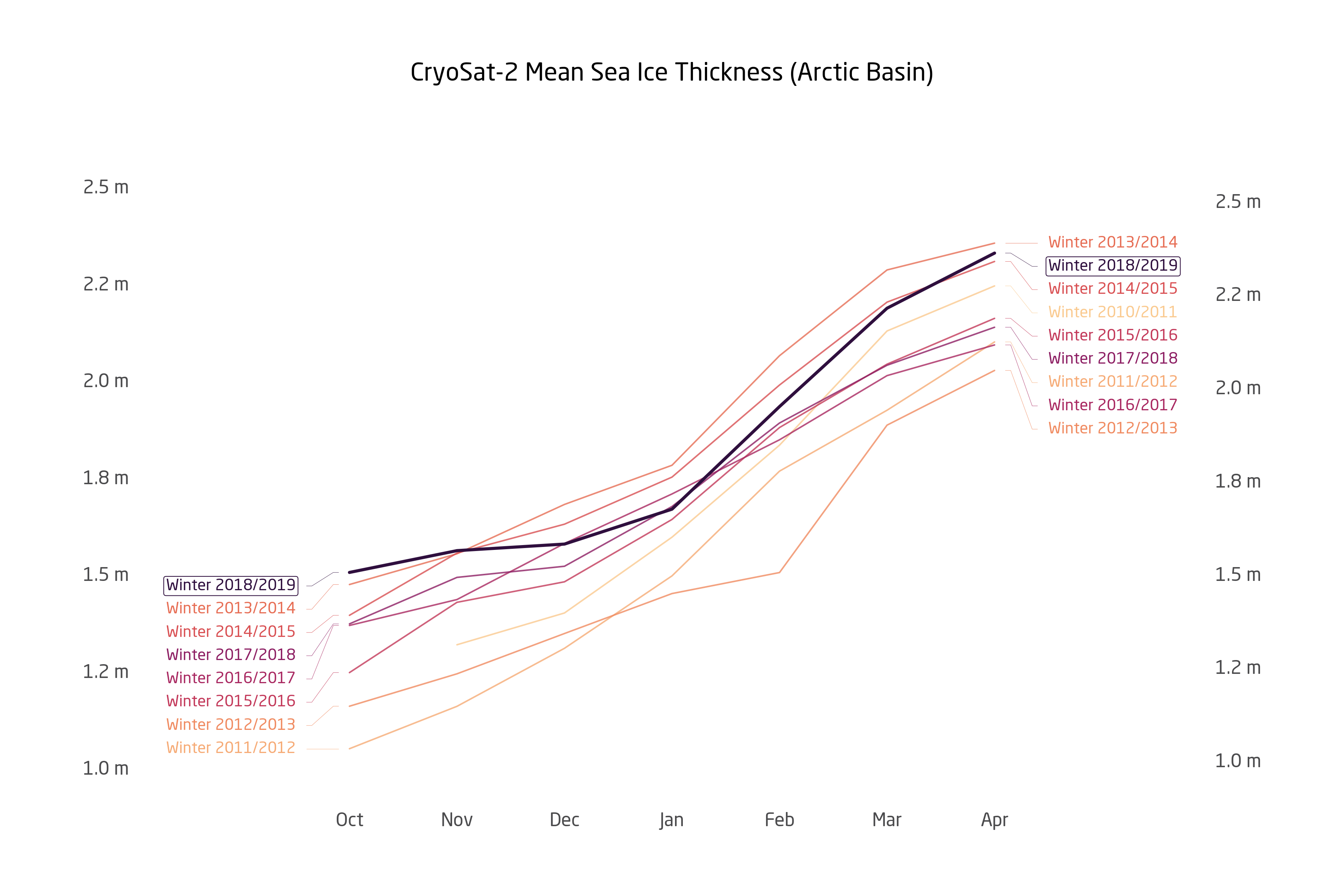
In resume, the winter season of 2018/2019 is characterized by above average sea ice thickness in the central Arctic basin. The main driver is a notable positive thickness anomaly of the multi-year ice in the Canadian part of the Arctic Ocean. But it is important to stress that the above average mean ice thickness does not directly translate into above average sea ice volume, as mean thickness is only a measure for the remaining sea ice. The extent of sea ice instead has been consistently low over the winter season might rank lower in the last 9 years than mean Arctic Basin thickness.
For the computation of sea ice volume with CryoSat-2 we need to fill in gaps in the data, e.g. near to the north pole above the orbit of the satellite and in other regions which are not covered by observations within a month. Such an interpolated product (data processing level 4) is planned for upcoming versions of the AWI CryoSat-2 sea ice product.
| Info | ||
|---|---|---|
| ||
See the this page for data access |