...
| Sensorweb integration | ||||
|---|---|---|---|---|
| ||||
CTD provided by AWI vessel:polarstern:ctd_sbe9plus_321 (3214)The CTD probe measures conductivity and temperature along a vertical transect through the water body. The measured parameter are used to calculate the salinity of the water. Additionally, up to 24 water samples can be taken in different water depths during the CTD measurements. |
| Sensorweb integration | ||||||||||
|---|---|---|---|---|---|---|---|---|---|---|
| ||||||||||
|
| Sensorweb integration | ||||
|---|---|---|---|---|
| ||||
No images available.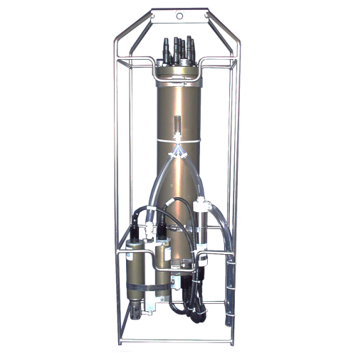 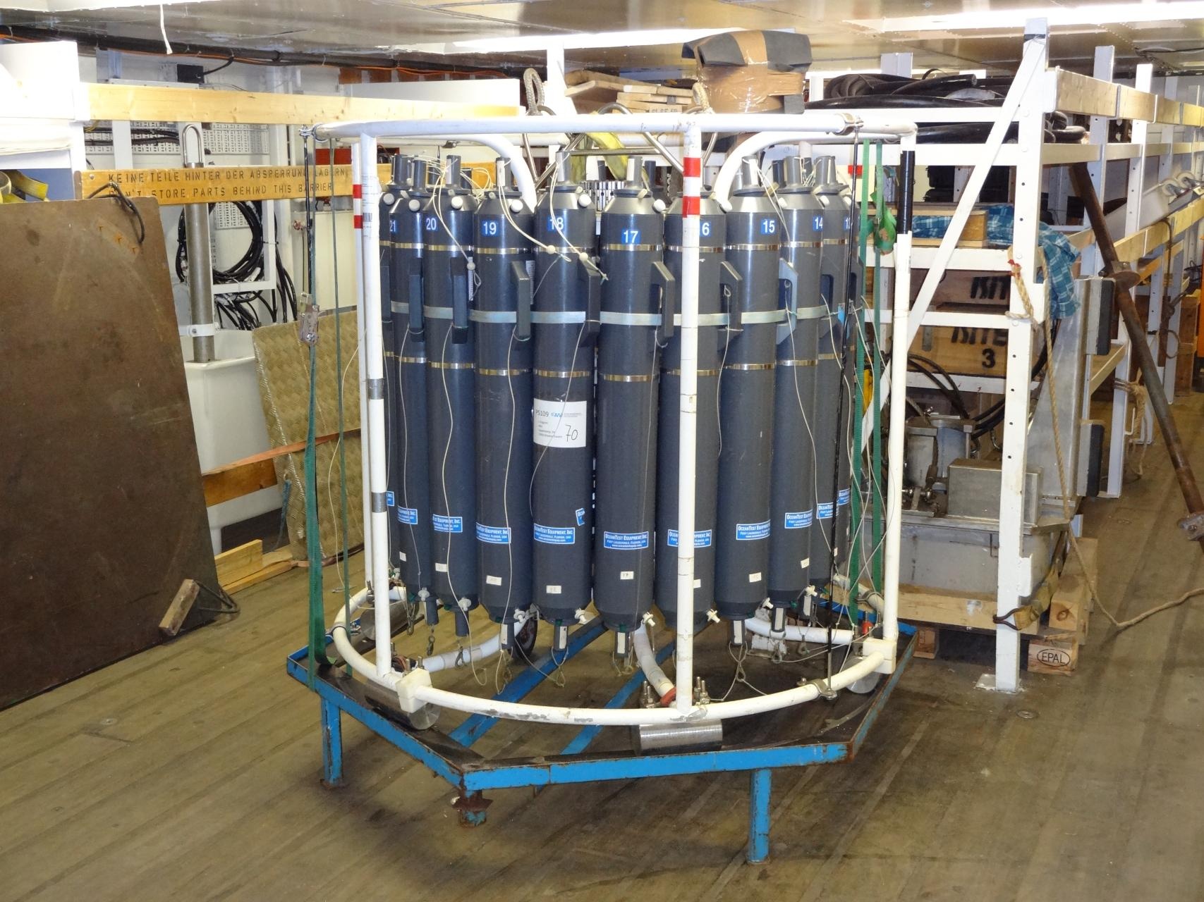 |
Contacts
| Sensorweb integration | |||||||||||||||||||||||||||||||||||||||||
|---|---|---|---|---|---|---|---|---|---|---|---|---|---|---|---|---|---|---|---|---|---|---|---|---|---|---|---|---|---|---|---|---|---|---|---|---|---|---|---|---|---|
| |||||||||||||||||||||||||||||||||||||||||
|
Components
|
Components
| Metadata (Metadata Plugin) | ||
|---|---|---|
| ||
| Metadata (Metadata Plugin) | ||
| ||
Subdevices
| Sensorweb integration | ||||||||||||||||||||||||||||||||||||||||||||||||||||||||||||||||||||||||||||||||||||||||
|---|---|---|---|---|---|---|---|---|---|---|---|---|---|---|---|---|---|---|---|---|---|---|---|---|---|---|---|---|---|---|---|---|---|---|---|---|---|---|---|---|---|---|---|---|---|---|---|---|---|---|---|---|---|---|---|---|---|---|---|---|---|---|---|---|---|---|---|---|---|---|---|---|---|---|---|---|---|---|---|---|---|---|---|---|---|---|---|---|
| ||||||||||||||||||||||||||||||||||||||||||||||||||||||||||||||||||||||||||||||||||||||||
|
Position
| Sensorweb integration | ||||||||
|---|---|---|---|---|---|---|---|---|
| ||||||||
| No local frame definition available. | ||||||||
|
Data logging, storage and archiving
...
| Sensorweb integration | |||||||||||||||||||||||||
|---|---|---|---|---|---|---|---|---|---|---|---|---|---|---|---|---|---|---|---|---|---|---|---|---|---|
| |||||||||||||||||||||||||
|
Central geographical ship's position and time standard
| Metadata (Metadata Plugin) | ||||
|---|---|---|---|---|
| Time synchronising of the computers is regulated via Windows Domain affiliation. UTC time is supplied via NMEA telegram and processed by Seasave software.
Geographical position is supplied via NMEA telegram and processed by Seasave software.||||
Rawdata storage on board
| Metadata (Metadata Plugin) | ||||
|---|---|---|---|---|
| Mass data: The ManageCTD software produces data files in the mass storage.
||||
| Metadata list |
|---|
|| root directory | \\polsrv1\data01\CTD ||
|| directory name | CruiseNo \\ e.g. \\ ANT-XXVI-1 ||
|| file name | several files in the following subdirectories: \\ btl \\ conf1 \\ dsp \\ final \\ mat \\ odv \\ work ||
|| Data volume (MB per day) ca | 50 ||
|| Number of files per day ca | 10 || |
Data archiving on land
| Metadata (Metadata Plugin) | ||
|---|---|---|
| ||
After the cruise, the operator transfers the measurement data along with required meta data to AWI after consultaion with the data scientist and AWI Logistics. Then, the data (including meta data) can be made available on https://www.pangaea.de/ (for authorized users only). | ||
| Metadata list |
|---|
|| File format(s) | raw data: *.hex, *.bl, *.hdr, *.xmlcon; processed data: *.txt ||
|| Calibration certificates | YES ||
|| Location of certificates | PI (calibration data is stored in *.xmlcon file) || |
Documentation
| Sensorweb integration | ||||
|---|---|---|---|---|
| ||||
| No resources available. |