...
| Note | ||
|---|---|---|
| ||
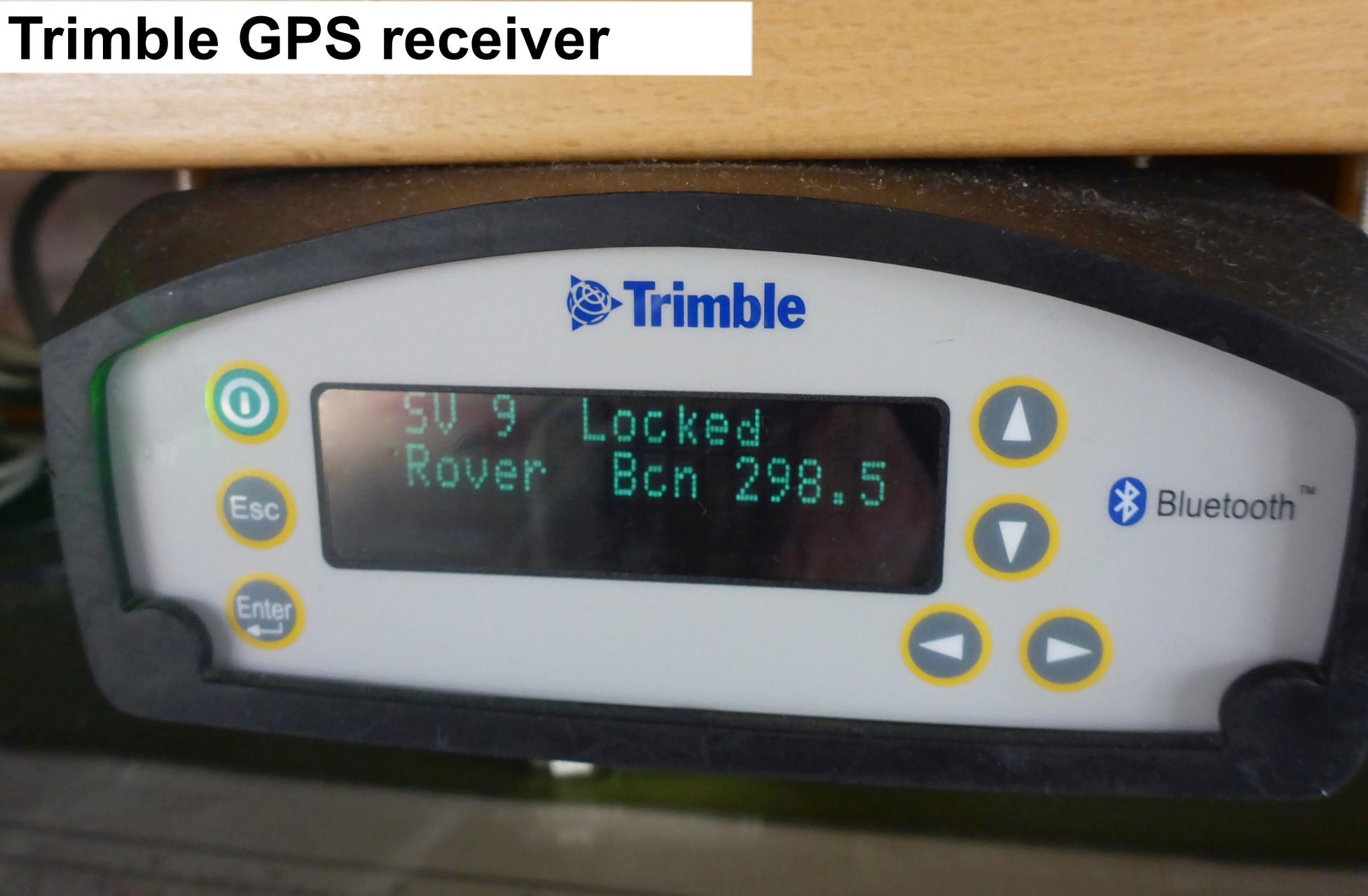
The Trimble GPS receiver provides position data for scientific devices. |
Summary
| Sensorweb integration | ||||
|---|---|---|---|---|
| ||||
The SPS461 GPS Heading and Positioning Receivers are modular, dual-antenna systems for marine construction and hydrographic survey. It may improve accuracy by using DGPS via SBAS, OmniSTAR VBS, MSK Beacon or external RTCM DGPS corrections. The receiver is equipped with a single GA530 L1/L2/OmniSTAR/Beacon/SBAS antenna. Therefore heading, roll and pitch cannot be calculated. |
| Sensorweb integration | ||||||||
|---|---|---|---|---|---|---|---|---|
| ||||||||
|
Contacts
Components
|
| Sensorweb integration | ||||
|---|---|---|---|---|
| ||||
    |
Contacts
| Sensorweb integration | ||||||
|---|---|---|---|---|---|---|
| ||||||
| ||||||
| Metadata (Metadata Plugin) | ||||||
Components
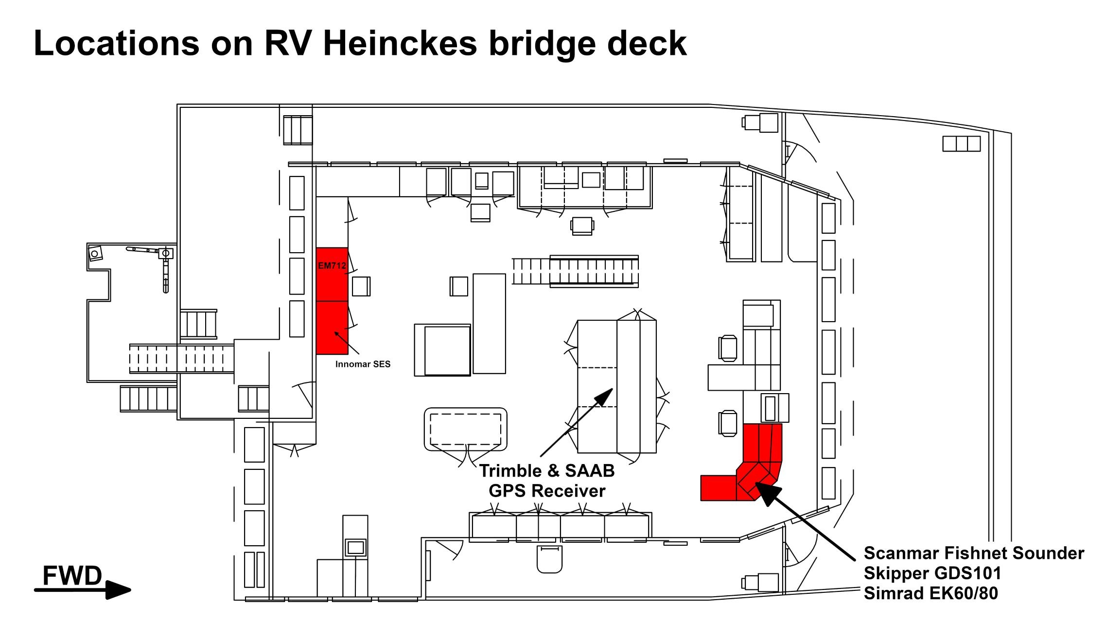
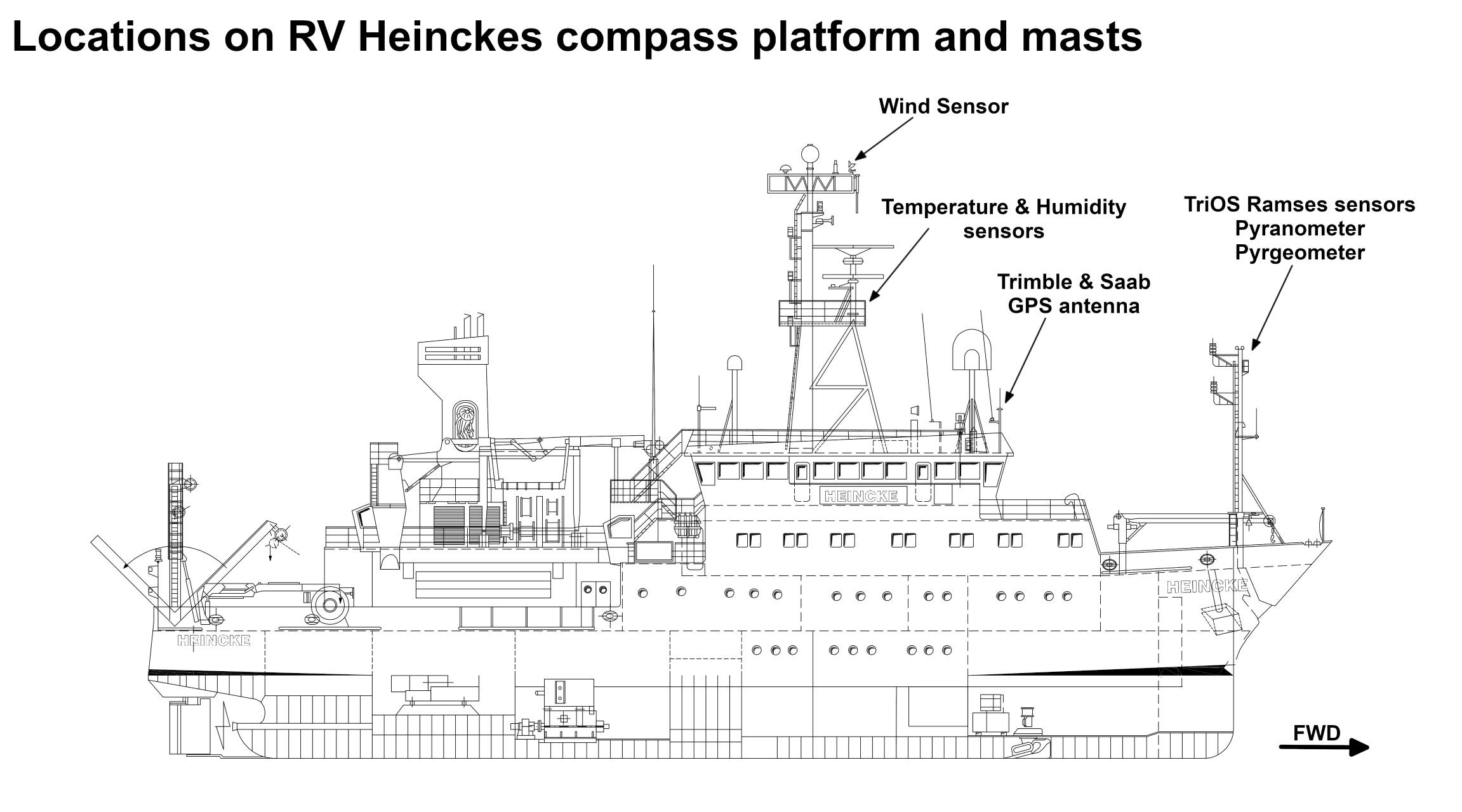
The
...
GPS
...
receiver
...
is
...
installed
...
on
...
the
...
bridge
...
deck.
...
The
...
antenna
...
is
...
installed
...
on
...
the
...
observation
...
deck.
In the registration lab an NMEA stream of GPS records can be received. 4 sockets of RS232 type (DSub9) with following setting are available: 4800 Baud, No Parity, 8 Data Bits, 1 Stop Bit.
NMEA records of type $GPGGA, $GPVTG, $GPZDA, $GPRMC, $GPGLL are provided with 1 Hz.
| Sensorweb integration | ||||
|---|---|---|---|---|
| ||||
No subdevices available. |
Position
| Sensorweb integration | ||||||||
|---|---|---|---|---|---|---|---|---|
| ||||||||
|
Position
...
Data logging, storage and archiving
Logged parameters
| Sensorweb integration | ||||||||||||||||||||||||||||||||||||
|---|---|---|---|---|---|---|---|---|---|---|---|---|---|---|---|---|---|---|---|---|---|---|---|---|---|---|---|---|---|---|---|---|---|---|---|---|
| ||||||||||||||||||||||||||||||||||||
|
Additionally a computer is installed receiving T02 data from this sensor. These data are used to calculate GPS tide. Three different services are available: 1=Uncorrected, 2=Ultra-rapid and 3=Rapid/Final. GPS tide is provided as two column file (date/time, height) to be used by multibeam echo sounder. See more details in Heincke_GPS_Tide_v20191016.pdf.
Central geographical ship's position and time standard
| Metadata (Metadata Plugin) | ||
|---|---|---|
| ||
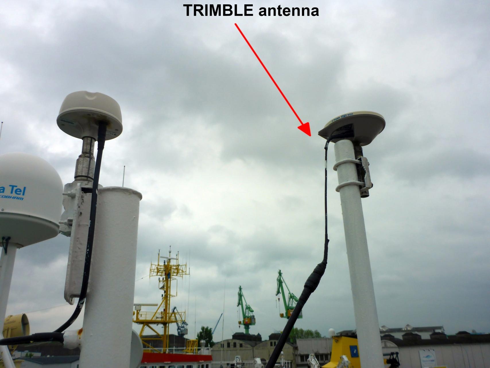
The GPS receiver Trimble is running as time server for several clients on board. The GPS position of the Trimble receiver is centered to the corresponding antenna. | ||
Rawdata storage on board
| Metadata (Metadata Plugin) | ||||
|---|---|---|---|---|
| Data storage in DShip system.
||||
Dship
| Metadata (Metadata Plugin) | ||||
|---|---|---|---|---|
| Unevaluated and uncorrected measurement data.||||
| Metadata list |
|---|
Data archiving on land
| Metadata (Metadata Plugin) | ||
|---|---|---|
| ||
After the cruise the DShip data set can be extracted from https://dms.awi.de. |
| Metadata list |
|---|
|| File format(s) | *.dat ||
|| Calibration certificates | NO || |
Documentation
| Sensorweb integration | ||||
|---|---|---|---|---|
| ||||
...