...
| Sensorweb integration | ||||||||||
|---|---|---|---|---|---|---|---|---|---|---|
| ||||||||||
|
| Sensorweb integration | ||||
|---|---|---|---|---|
| ||||
   |
...
| Metadata (Metadata Plugin) | ||
|---|---|---|
| ||
GAPS: from 22 to 30 kHz; Transponder: 19.5, 20.0, 20.5 or 21 kHz | ||
Contacts
| Sensorweb integration | ||||||
|---|---|---|---|---|---|---|
| ||||||
|
...
| Metadata (Metadata Plugin) | ||||
|---|---|---|---|---|
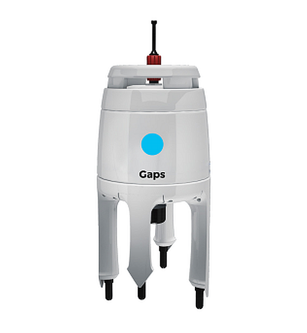
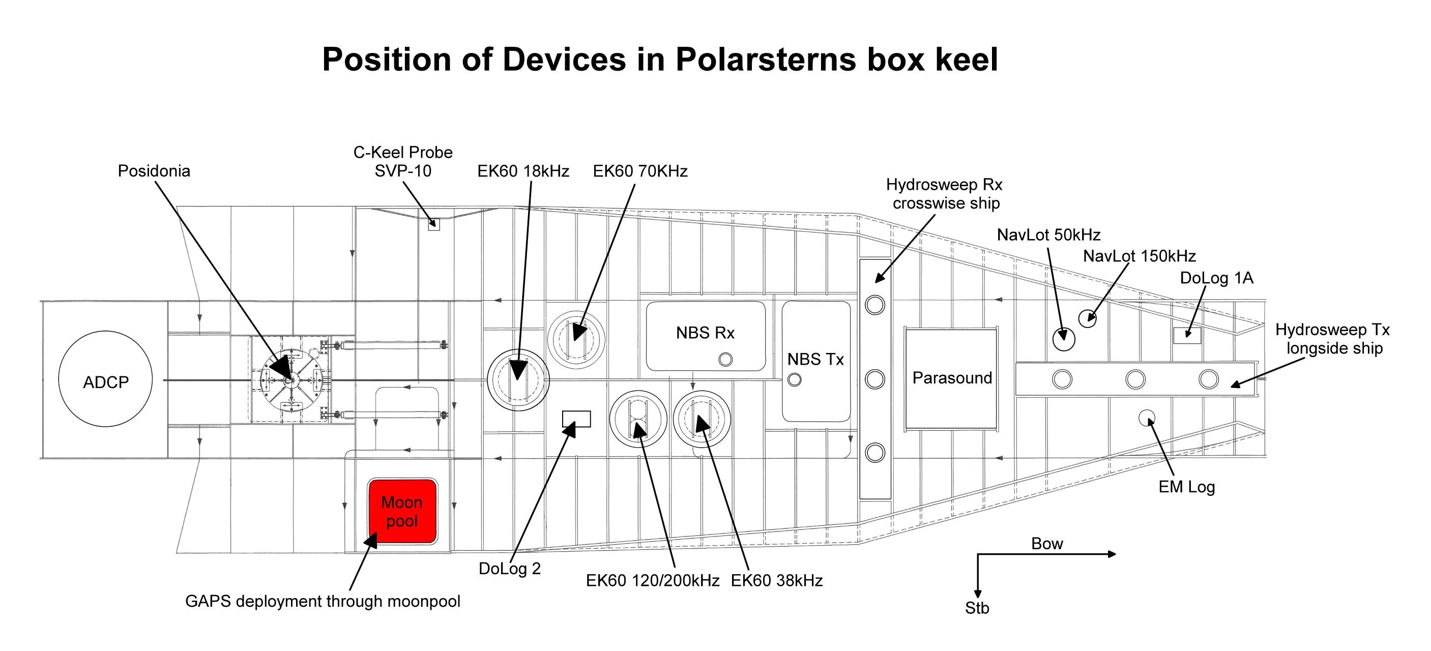
| The system consits of the GAPS itself, mounting for installation in box keel, Easy Connect Box (ECB) and monitoring software "GAPS MMI - Man Machine Interface". Also available on board is one transponder of type MT832E-R and one transponder of type MT832E-HD-R with removable head. The system is hard-wired and the software is installed an configurated. GAPS will typically be installed through moonpool in box keel. The transponders can be mounted to winch wire or to a submarine vehicle. GAPS underwater communication is conducted by using various frequencies, interferences with simultaneously operating Echo Sounders are possible.
GAPS:
GAPS is a bi-directional acoustic positioning system, which communicates between ship (antenna) and one or more transponders. Positions of the transponders are determined relative to the ship or absolute in geographic frame. GAPS must be installed with custom-built mounting through moonpool in box keel and is operated below the ship's hull.
Transponders MT832E-R and MT832E-HD-R:
The acoustic transponders must be mechanically attached to underwater objects or vehicles.
The transponders are synchronized to the GAPS and can be operated in transponder-mode (acoustic transmission and receiving) or in responder-mode (electric transmission and acoustic receiving; cables and plugs for responder-mode are *not available on board). Special mounting for operations of the MT832E-R on winch wire is available, e.g. for determination of exact sampling locations in deep water. The transponders can be operated in water depth up to 3000m. Communication frequency can be selected to be 19.5, 20.0, 20.5 or 21 kHz.
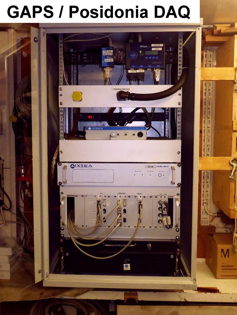
Easy Connect Box (ECB):
ECB is a small interface to connect GAPS, external GPS receiver, PC with MMI-software and data management system DShip. ECB is mounted to the 19" Rack in room E-525a. The rearward switch activates the ECB, the front switch activates the GAPS.
GAPS MMI - Man Machine Interface - Software:
The MMI-Software starts the GAPS and tracks the underwater transponders. The Software is installed on the PC on the bridge and on laptop of laboratory electronics engineer.
External GPS receiver:
On board Polarstern GAPS is connected to the on-board GPS receiver. An external GPS receiver is not necessary on board Polarstern, but it is optional available for other fields of application.||||
Position
| Sensorweb integration | ||||||||
|---|---|---|---|---|---|---|---|---|
| ||||||||
|
...
| Sensorweb integration | |||||||||||||||||||||||||||||||||||||||||||||
|---|---|---|---|---|---|---|---|---|---|---|---|---|---|---|---|---|---|---|---|---|---|---|---|---|---|---|---|---|---|---|---|---|---|---|---|---|---|---|---|---|---|---|---|---|---|
| |||||||||||||||||||||||||||||||||||||||||||||
|
...
| Metadata (Metadata Plugin) | ||||
|---|---|---|---|---|
| Time synchronising of the PC with MMI-Software via Windows-Domain-Affiliation.
Centering of GPS-antenna position to GAPS and to transponders.||||
Rawdata storage on board
| Metadata (Metadata Plugin) | ||||
|---|---|---|---|---|
| Storage of data in DShip system is established for transponders with number 0 (=antenna), 1, 2, 3 and 4.
||||
Dship
| Metadata (Metadata Plugin) | ||||
|---|---|---|---|---|
| Reduced measurement data.||||
| Metadata list |
|---|
Data archiving on land
| Metadata (Metadata Plugin) | ||||
|---|---|---|---|---|
| After the cruise the DShip data set can be extracted from https://dship.awi.de/.||||
| Metadata list |
|---|
Documentation
| Sensorweb integration | ||||
|---|---|---|---|---|
| ||||
...