...
| Sensorweb integration | ||||
|---|---|---|---|---|
| ||||
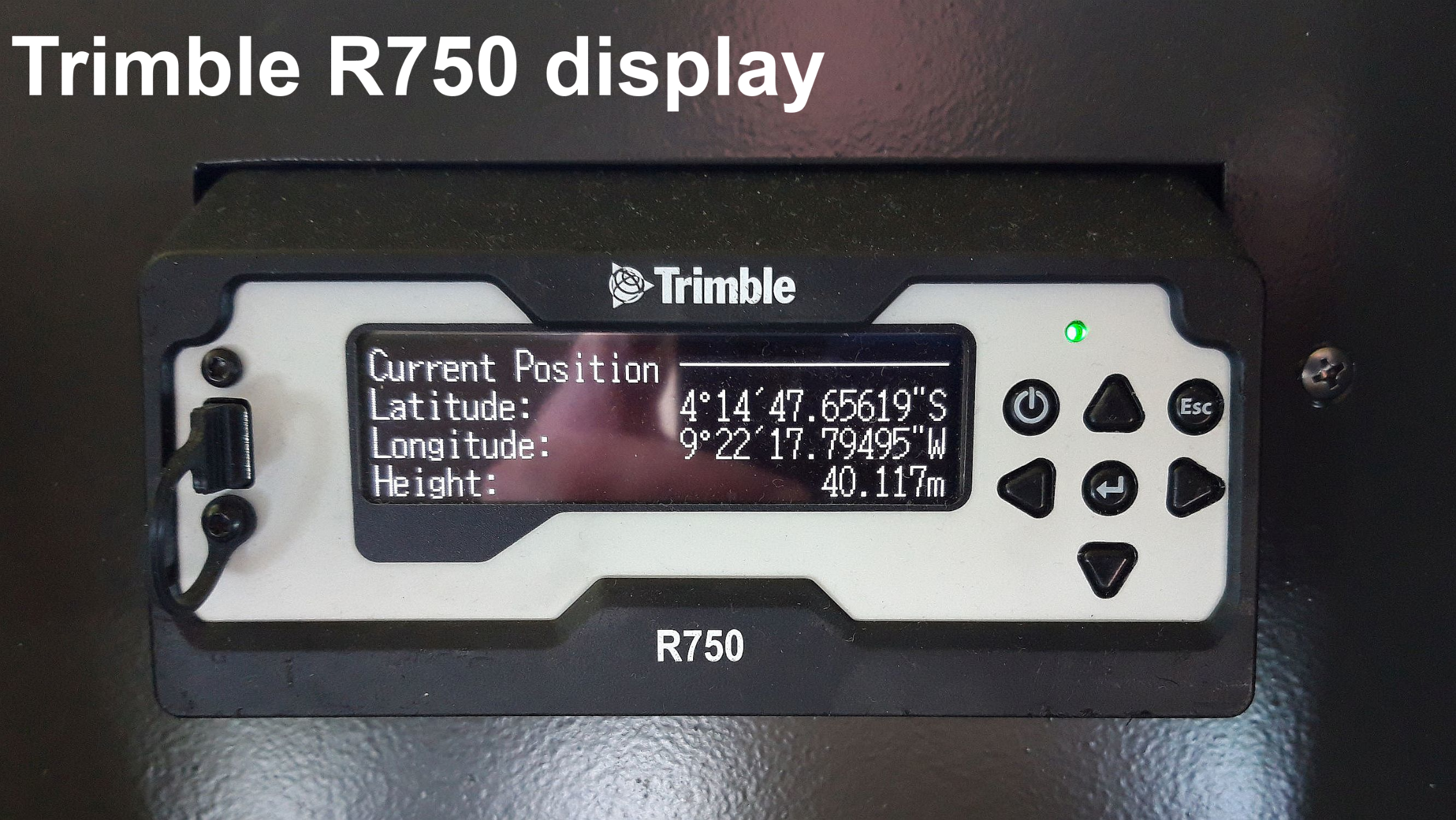
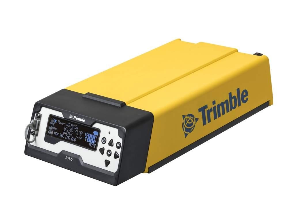
The Trimble SPS852 R750 is a combined radio and GPS receiver. It uses all currently available satellite signals including L1, L2 and the GPS modernized L2C code. |
Trimble 1
| Sensorweb integration | ||||||||||
|---|---|---|---|---|---|---|---|---|---|---|
| ||||||||||
|
| Sensorweb integration | ||||
|---|---|---|---|---|
| ||||
    |
Trimble 2
| Sensorweb integration | ||||||||||
|---|---|---|---|---|---|---|---|---|---|---|
| ||||||||||
|
| Sensorweb integration | ||||
|---|---|---|---|---|
| ||||
  |
Contacts
| Sensorweb integration | ||||||||||||
|---|---|---|---|---|---|---|---|---|---|---|---|---|
| ||||||||||||
Data Provider | Reederei Laeisz | Reederei Laeisz | Engineer In Charge |
|
Components
| Metadata (Metadata Plugin) | ||||
|---|---|---|---|---|
| There are two independent systems installed, called TRIMBLE 1 and TRIMBLE 2. Both consist of an antenna Zephyr Model 2 Rugged. The receivers are of type SPS855. Antennas are installed on antenna deck above bridge. The two receivers are installed in scientific panel on bridge. TRIMBLE 1 is sending NMEA0183 telegrams to motion sensor HYDRINS 1 and DShip. TRIMBLE 2 is sending telegrams to motion sensor HYDRINS 2 and DShip.||||
Position
Trimble 1 antenna position
| Sensorweb integration | |||||||||||
|---|---|---|---|---|---|---|---|---|---|---|---|
| |||||||||||
Origin Description:
|
Trimble 2 antenna position
| Sensorweb integration | ||||||||||||||
|---|---|---|---|---|---|---|---|---|---|---|---|---|---|---|
| ||||||||||||||
Origin Description:
|
Data logging, storage and archiving
...
| Sensorweb integration | |||||||||||||||||||||||||||||||||||||||||||
|---|---|---|---|---|---|---|---|---|---|---|---|---|---|---|---|---|---|---|---|---|---|---|---|---|---|---|---|---|---|---|---|---|---|---|---|---|---|---|---|---|---|---|---|
| |||||||||||||||||||||||||||||||||||||||||||
degree | speed made good | duration | knots | GPS quality indicator | quality flag | unknown | date | date and time | unknown | time | date and time | gmt | course | attitude | degree | number of satellites | quality flag |
|
Central geographical ship's position and time standard
| Metadata (Metadata Plugin) | ||||
|---|---|---|---|---|
| GPS receiver TRIMBLE 1 is running as time server for several clients on board.
GPS positions of TRIMBLE 1 and TRIMBLE 2 are centered to the corresponding antenna.||||
Rawdata storage on board
| Metadata (Metadata Plugin) | ||
|---|---|---|
| ||
Data storage in DShip system.
| ||
Dship
| Metadata (Metadata Plugin) | ||||
|---|---|---|---|---|
| Unevaluated and uncorrected measurement data.||||
| Metadata list |
|---|
|| Device name | trimble 1 GPS \\ trimble 2 GPS ||
|| Parameters| course made good \[°\]; Date; day; EW; GPS quality indicator; month; NS; number of satellites in fix; position latitude \[°\]; position longitude \[°\]; raw time; speed made good \[kn\]; Time; UTC raw \[s\]; year || |
Data archiving on land
| Metadata (Metadata Plugin) | ||||
|---|---|---|---|---|
| After the cruise the DShip data set can be extracted from https://dms.awi.de.||||
| Metadata list |
|---|
|| File format(s) | *.txt ||
|| Calibration certificates | NO || |
Documentation
| Sensorweb integration | ||||
|---|---|---|---|---|
| ||||