Attention:
Please note that the system can only be operated upon request. Operations with the MSCL-S requires experienced scientific staff on board. The system is not operated by the ship's crew. Announce operations with the MSCL-S to AWI-Logistics prior to the cruise and clarify the data transfer after the cruise.
Summary
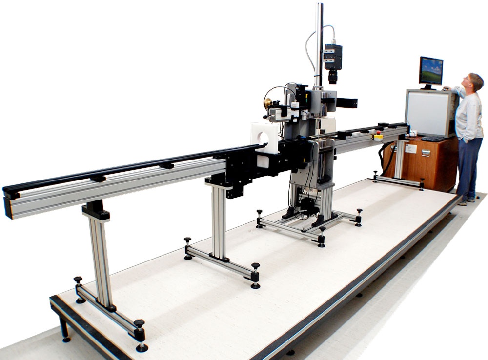
Multi-Sensor Core Loggers capture physical measurands of sediment cores automated and non-destructive.
Manufacturer: Geotek Ltd.
Model: MSCL-S
Serial No: 14
Type: Multi-Sensor Core Logger
Model: MSCL-S
Serial No: 14
Type: Multi-Sensor Core Logger
Responsible Persons
| Role | Name |
|---|---|
| Engineer in Charge | Dietmar Penshorn |
| Data Scientist | Frank Niessen |
Components
The system consits of the measuring bench with a ballscrew, which pushes core section past 3 sensors measuring Gamma Density, P-wave Velocity, Magnetic Susceptibility. All sensors simultaneously acquire the data, which is displayed real-time during logging. The acquired data is stored locally in the electronics with simple user interface.
Sensor Type |
Manufacturer |
Components |
Data output |
|---|---|---|---|
Gamma Density Sensor |
Geotek Ltd. |
Gamma ray source (137-Caesium source with energies at 0.662 MeV), detector, sensor stand mount (alignment of source and detector with center of core) |
Gamma Density |
P-Wave System |
Geotek Ltd. |
Geotek ultrasonic (230 kHz) acoustic transducers, Laser micrometer, PRT temperature Probe |
P-Wave velocity as ASCII text (*.csv) file |
Magnetic Susceptibility Loop Sensor MS2C |
Bartington Instruments |
Magnetic Susceptibility Loop Sensor MS2C |
Magnetic Susceptibility |
Position
No fix onboard location.
Data logging, storage and archiving
Logged parameters
Gamma Density, P-wave Velocity, Magnetic Susceptibility
Central geographical ship's position and time standard
No time synchronising.
No online ship's position.
Rawdata storage on board
Local storage on MSCL-S electronic. Operator is in charge of data backup.
Dship
No data transfer to DShip.
Data archiving on land
Not implemented, responibility with respective user.
File format(s) |
??? |
|---|---|
Calibration certificates |
??? |
Documentation
http://www.geotek.co.uk/products/mscl-s/