Attention:
Please note that operations of the Multibeam Echo Sounder Hydrosweep DS3 requires experienced scientific staff on board and can be only operated upon request. The system is not operated by the ship's crew. Request operations with the Multibeam Echo Sounder Hydrosweep DS3 to AWI-Bathymetry and AWI-Logistics in sufficient time prior to the cruise and clarify the data transfer after the cruise.
Summary
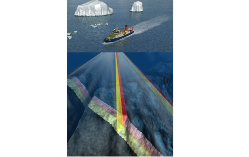
The Hydrosweep DS3 is a deep water multibeam echosounder ideally suited for seabed mapping in deep water up to full ocean depth based on a sonar frequency between 14 kHz to 16 kHz. Beside bathymetric depth information from 10 m to more than 11,000 m, sidescan data and backscatter data for seabed classification are acquired.
| Manufacturer | Teledyne RESON A/S |
|---|---|
| Model | Hydrosweep DS3 |
| Serial No. | n/a |
| Type | multi-beam echosounder |
| REGISTRY-Link | ↪ REGISTRY (1393) |
Transducer Frequency
Contacts
| Name | Institution | Role |
|---|---|---|
| Boris Dorschel | Alfred Wegener Institute, Helmholtz Centre for Polar and Marine Research | Data Scientist |
| Alfred Wegener Institute for Polar and Marine Research | Alfred Wegener Institute, Helmholtz Centre for Polar and Marine Research | Owner |
| Simon Dreutter | Alfred Wegener Institute, Helmholtz Centre for Polar and Marine Research | Engineer In Charge, Data Scientist, Editor |
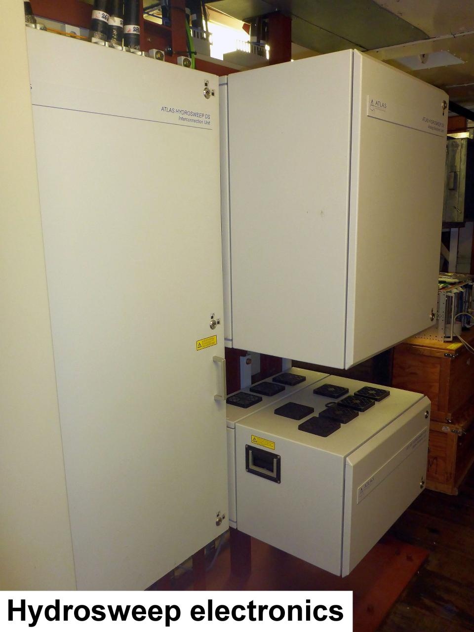
Components
Subdevices
| Name | Model | Serial Number | REGISTRY-Link |
|---|---|---|---|
| Hydrosweep RX transducer array | Hydrosweep DS3 | n/a | ↪ REGISTRY (1515) |
| Hydrosweep TX transducer array | Hydrosweep DS3 | n/a | ↪ REGISTRY (1514) |
Position
| Info | xyz-position calculated from Alignment Survey Report (2016) to be center between Tx and Rx transducer. Transducer arrays located in box keel, electronics located in E525A, operating computers located in E550 (HSPS-room) |
| X | 77.162 m X-0 is at the center of der rudder (ref. design drawing of the vessel), positive X-axis is forward and along vessel centerline |
| Y | 0.001 m Y-0 at centerline, positive Y-axis is portside |
| Z | 0.017 m Z-0 is set to the lowest point of the keel, positive Z-axis is upwards |
Data logging, storage and archiving
Logged parameters
| Parameter | O2ARegistry Output Type | Unit |
|---|---|---|
| hydroacoustic backscatter | backscatter strength | V |
| depth below transducer | depth | m |
Central geographical ship's position and time standard
Rawdata storage on board
Dship
Data archiving on land
Documentation
-
Kalibrierung und Genauigkeitsuntersuchungen zur neuen Hydrosweep DS-3 Anlage auf FS Polarstern (Article)
Bachelor Thesis 2011 -
Polarstern_HS-DS3_S7K.vessel (Configuration Sheet, 11 kB)
Polarstern Hydrosweep DS3 vessel configuration file for S7K raw data format in Caris HIPS *.vessel format (XML) -
Polarstern_HS-DS3_ASD.vessel (Configuration Sheet, 14 kB)
Polarstern Hydrosweep DS3 vessel configuration file for ASD raw data format in Caris HIPS *.vessel format (XML) -
HydroSweep DS Deep-Sea Multibeam Echosounder Datasheet (Factsheet, 978 kB)
Teledyne Hydrosweep DS3 Datasheet