Attention:
The Motion Sensor PHINS is operated by ship's command only.
Summary
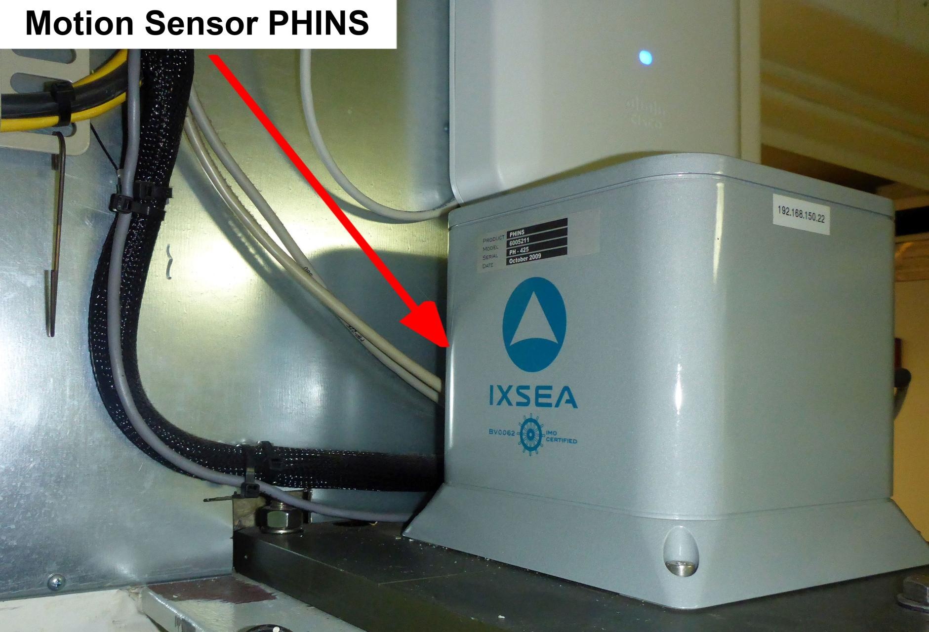
PHINS (Photonic Inertial Navigation System) outputs position, heading, roll, pitch, depth, velocity, and heave. Its high accuracy inertial measurement unit is based on IXSEA's FOG technology coupled with an embedded digital signal processor that runs an advanced Kalman filter.
| Manufacturer | iXblue |
|---|---|
| Model | PHINS 6005211 |
| Serial No. | PH-425 |
| Type | motion sensor |
| REGISTRY-Link | ↪ REGISTRY (8573) |
Contacts
| Name | Institution | Role |
|---|---|---|
| Ralf Krocker | Alfred Wegener Institute, Helmholtz Centre for Polar and Marine Research | Engineer In Charge |
Components
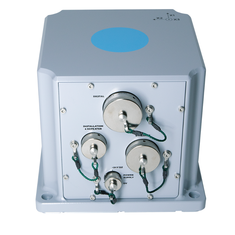
PHINS system consists of the sensor and the configuration and monitoring software IXRepeater.
No subdevices available.
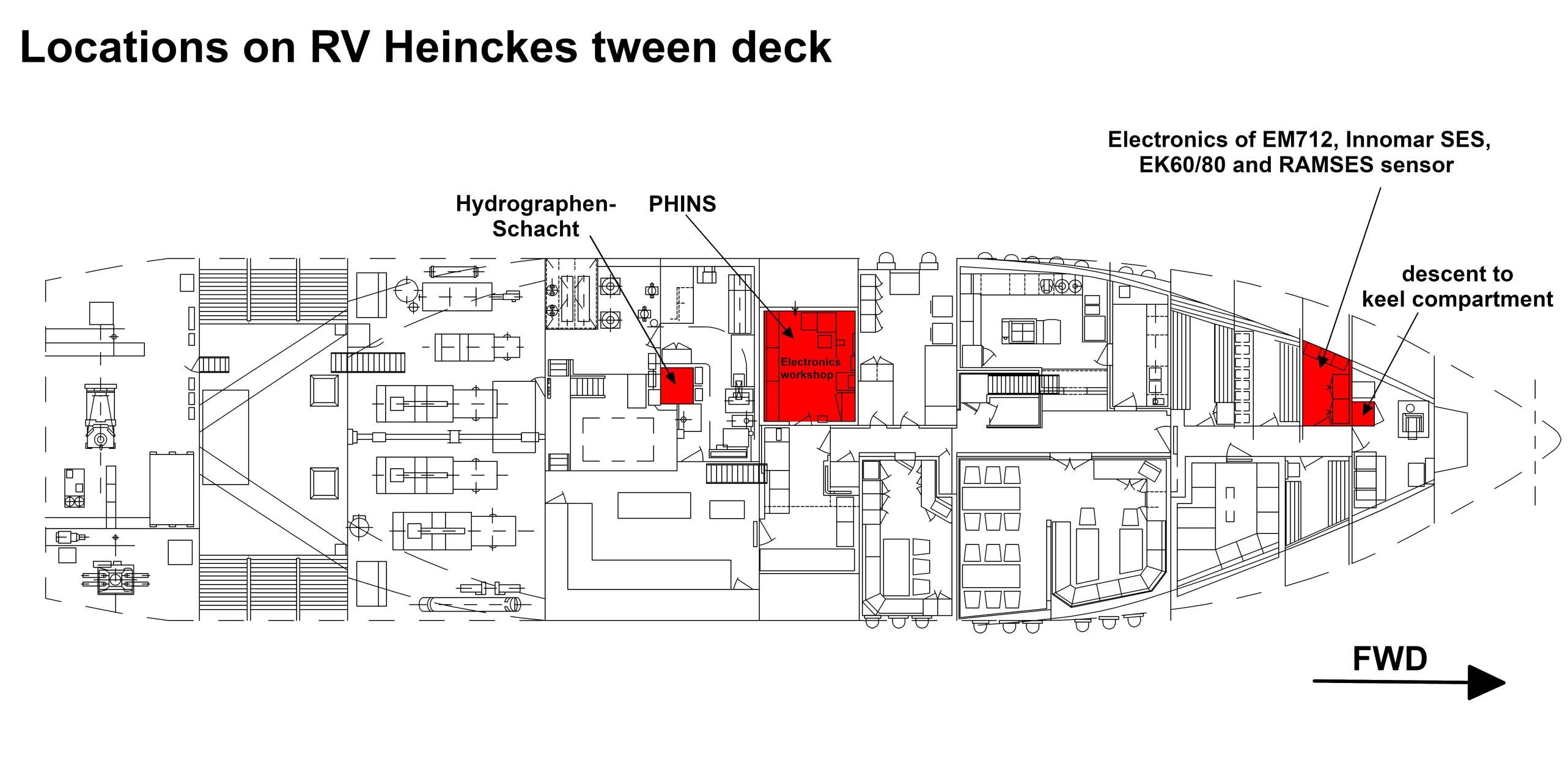
Position
| Info | xyz-position of PHINS from Alignment Survey Report RV Heincke (January 2016) |
| X | 25.952 m Positive X axis is forward and along the centerline of the vessel with X0 at the Stern point of the vessel. |
| Y | 0.847 m Positive Y axis is portside of centerline with Y0 at centerline at the Very stern point of the vessel. |
| Z | 5.027 m Positive Z axis is upwards of basis. Z0 is set to the hydrophone on midship. |
Data logging, storage and archiving
Logged parameters
| Parameter | O2ARegistry Output Type | Unit |
|---|---|---|
| heading | attitude | deg |
| heave | attitude | m |
| latitude | latitude | deg |
| longitude | longitude | deg |
| pitch | attitude | deg |
| roll | attitude | deg |