| Note | ||
|---|---|---|
| ||
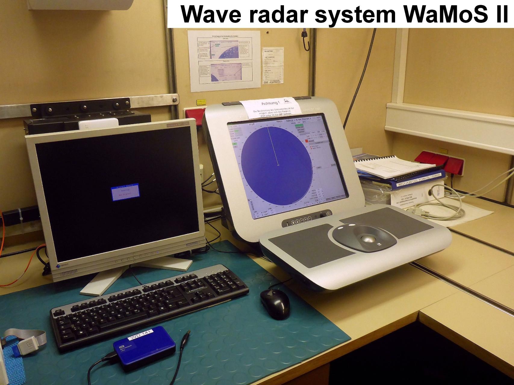
Nautical X band radar and WAMOSII X band radar are two independend systems. For scientific use only WAMOSII radar can be used. The system is run by staff of the Weather Station (DWD). Scientific co-use is possible according to prior agreement with AWI Logistics / Principal Investigator. |
Summary
| Sensorweb integration | ||||
|---|---|---|---|---|
| ||||
The wave radar system WaMoSII provides measurments and visualisation of waves and surface currents in a broad area. |
| Sensorweb integration | ||||||||||
|---|---|---|---|---|---|---|---|---|---|---|
| ||||||||||
|
| Sensorweb integration | ||||
|---|---|---|---|---|
| ||||
   |
Contacts
| Sensorweb integration | ||||||||||||
|---|---|---|---|---|---|---|---|---|---|---|---|---|
| ||||||||||||
|
Components
| Metadata (Metadata Plugin) | ||
|---|---|---|
| ||
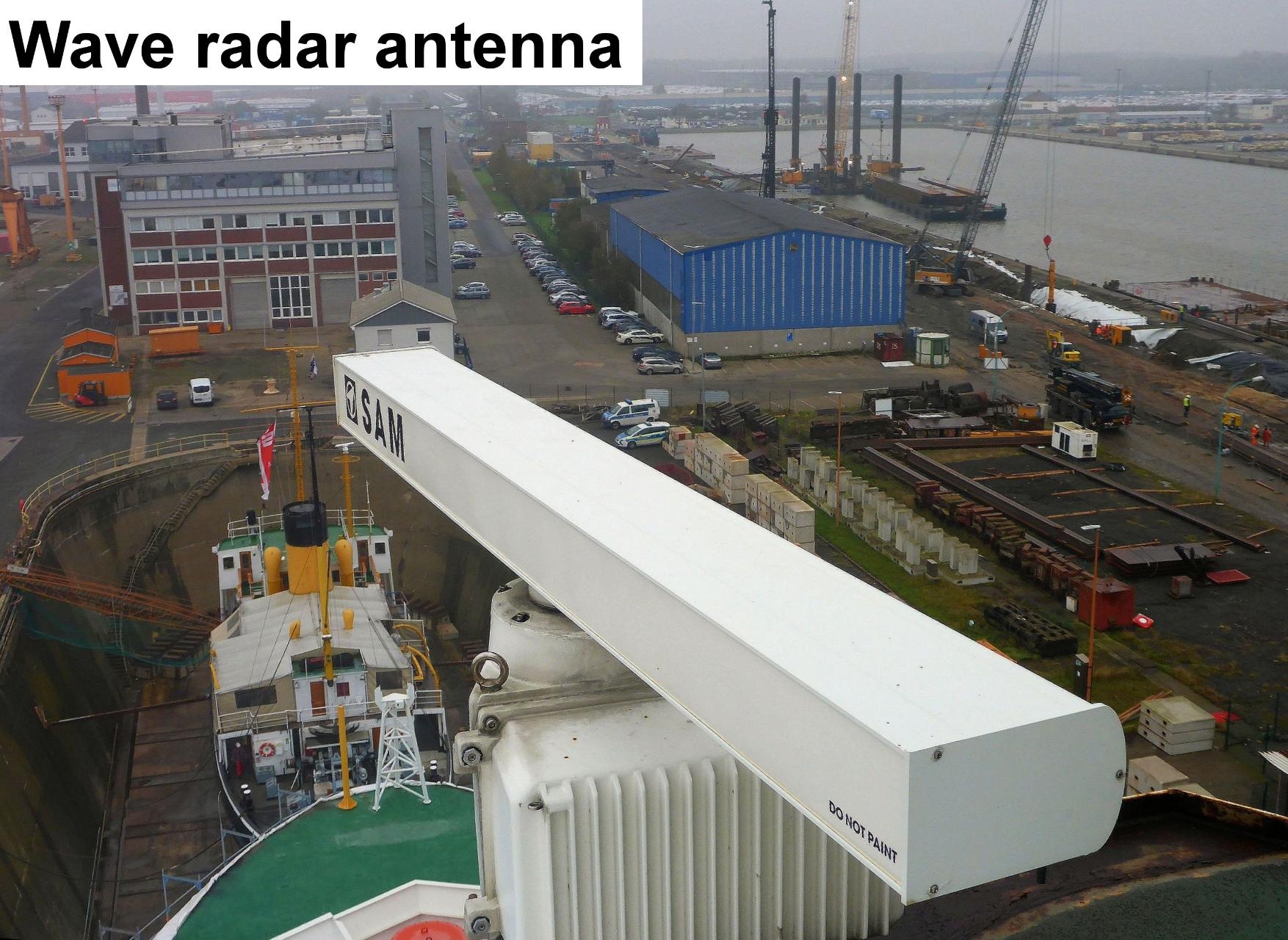
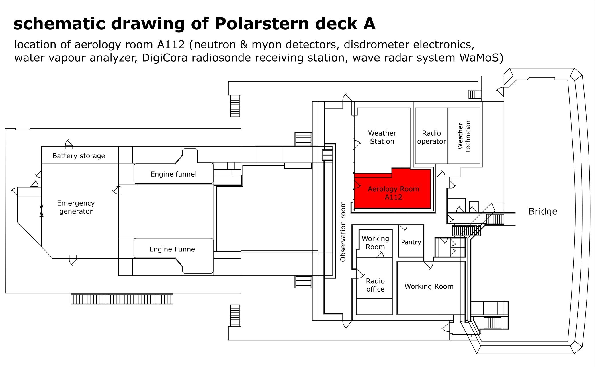
The system consists of an X-band radar situated on port side of crow's nest platform B. The radar control unit (SAM Radar Pilot 1100) as well as PC running WAMOS software and software for ice functionality are located in Aerologie Laboratory (A112). The system is receiving ships speed and heading, water depth, wind speed and averaged ADCP currents from DShip. |
Position
| Sensorweb integration | ||||
|---|---|---|---|---|
| ||||
|
Data logging, storage and archiving
Logged parameters
| Sensorweb integration | |||||||||||||||
|---|---|---|---|---|---|---|---|---|---|---|---|---|---|---|---|
| |||||||||||||||
|
Central geographical ship's position and time standard
| Metadata (Metadata Plugin) | ||
|---|---|---|
| ||
Time synchronising of the PC is performed via Windows-Domain-Affiliation. Geographical ship's position and orientation is provided by DShip. |
Rawdata storage on board
| Metadata (Metadata Plugin) | ||
|---|---|---|
| ||
All data are stored on board on USB drive mounted on operator PC. |
Data archiving on land
| Metadata (Metadata Plugin) | ||
|---|---|---|
| ||
Data are logged on USB drive mounted on operator PC. Full USB drives are archived at OceanWaves in Lüneburg (www.oceanwaves.de). |
Documentation
| Sensorweb integration | ||||
|---|---|---|---|---|
| ||||