...
| Sensorweb integration | ||||||||||
|---|---|---|---|---|---|---|---|---|---|---|
| ||||||||||
SENSOR-Link | ↪ | |
| Sensorweb integration | ||||
|---|---|---|---|---|
| ||||
   |
...
| Sensorweb integration | ||||||||||||||||||
|---|---|---|---|---|---|---|---|---|---|---|---|---|---|---|---|---|---|---|
| ||||||||||||||||||
|
Components
| Metadata (Metadata Plugin) | ||
|---|---|---|
| ||
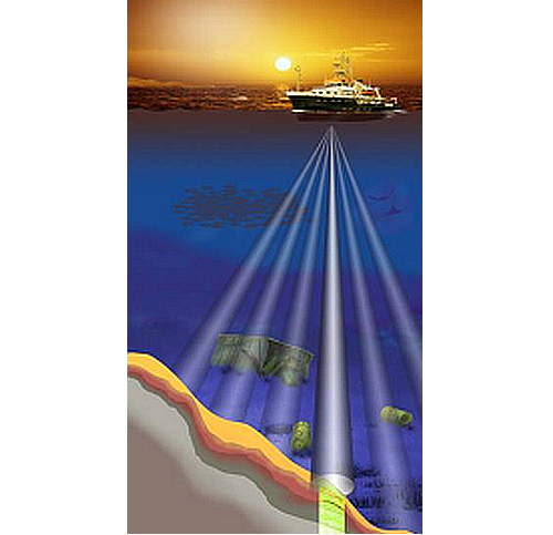
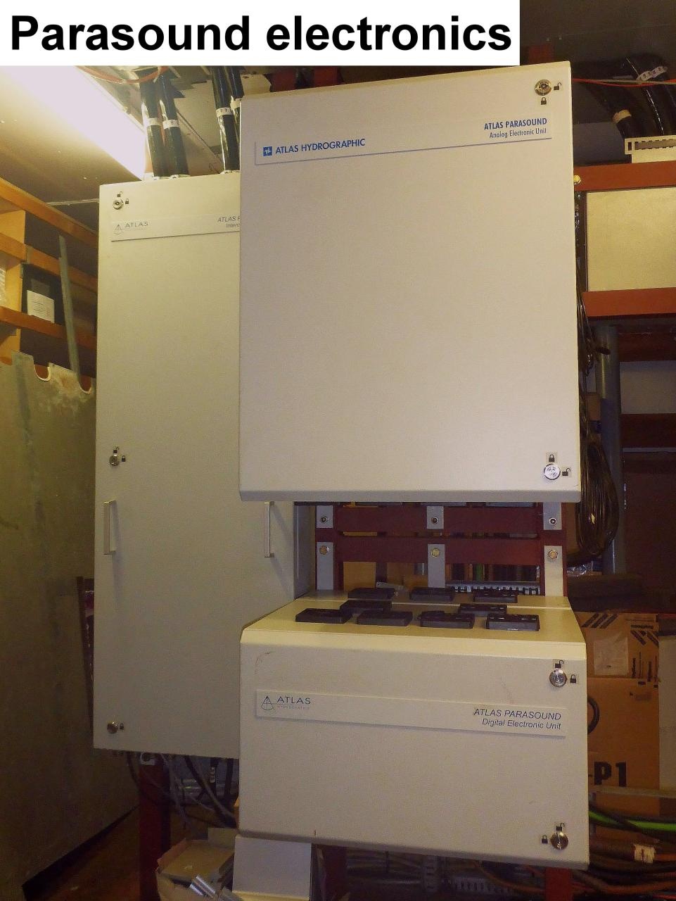
The system consits of the transducer, the electronic unit, two computers with installed data acquisition and processing software ParaStore and the subsidiary display on the bridge. The transducer consists of four segments and is mounted without ice protection window in the box keel. The transducer transmits in the frequency range of 18 - 39 kHz and reaches water depth of 10 to 11000m. Frequency interferences generate "parametric low frequencies" between 0.5 and 6.0 kHz. Penetration depth into the sediment accounts for > 200m (depending on sediment properties) and the resolution is 6.1 cm. |
...
| Sensorweb integration | ||||||
|---|---|---|---|---|---|---|
| ||||||
Info
|
Data logging, storage and archiving
...
| Sensorweb integration | ||||||
|---|---|---|---|---|---|---|
| ||||||
|
Central geographical ship's position and time standard
...
| Metadata (Metadata Plugin) | ||
|---|---|---|
| ||
After the cruise, the operator transfers the measurement data along with required meta data to AWI after consultaion with the data scientist and AWI Logistics. Then, the data (including meta data) can be extracted from https://www.pangaea.de/ (for authorized users only). The reduced, unevaluated DShip data set can be extracted from https://dmsdship.awi.de/. |
| Metadata list |
|---|
|| File format(s) | stored in PANGAEA or DShip system || || Calibration certificates | NO || |
...