| Excerpt | ||||||
|---|---|---|---|---|---|---|
The sea-ice thickness processing chain generates higher level data products (such as maps) from measurements along the ground track of the satellite. Sea-ice thickness information is therefore available at different data levels that differ in the extent and resolution of the corresponding dataset.
|
Daily Trajectory Summary
| Anchor | ||||
|---|---|---|---|---|
|
| Data Level | Level-2 Post-Processed (L2P) |
|---|---|
| Data Period | Daily (between 00:00:00 and 23:59:59.999 UTC) |
| Summary | Collection of daily along-track geophysical parameters and their uncertainties at full resolution of the altimeter. Product only includes data points with valid freeboard measurements. |
| Parameters | All fields are per single altimeter data point
|
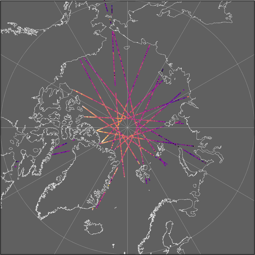
Figure: Example of daily sea-ice thickness point measurements at along-track resolution
Space-Time Grid
| Anchor | ||||
|---|---|---|---|---|
|
| Data Level | Level-3 Colocated (L3C) |
|---|---|
| Data Period | Weekly (Monday 00:00:00 and Sunday 23:59:59.999 UTC) Monthly (between 00:00:00 first day and 23:59:59.999 UTC last day of the month) Custom (between 00:00:00 first day and 23:59:59.999 UTC last day) |
| Summary | Gridded geophysical parameters, their uncertainties, retrieval area statistics and flags |
| Parameters | Time / Geolocation
Geophysical fields (per grid cell)
Flags (per grid cell)
|
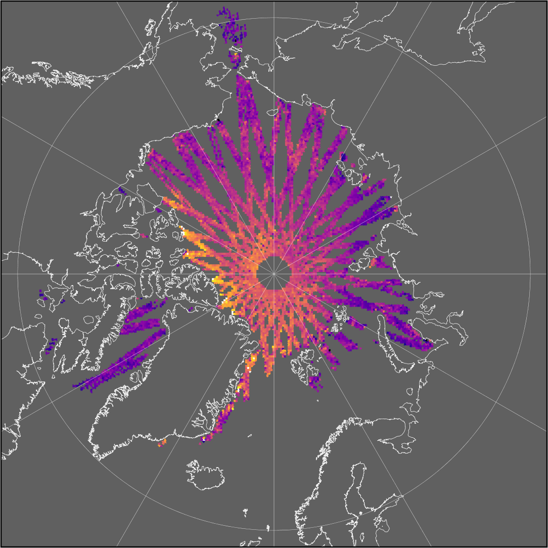
Figure: Example of weekly gridded sea-ice thickness product
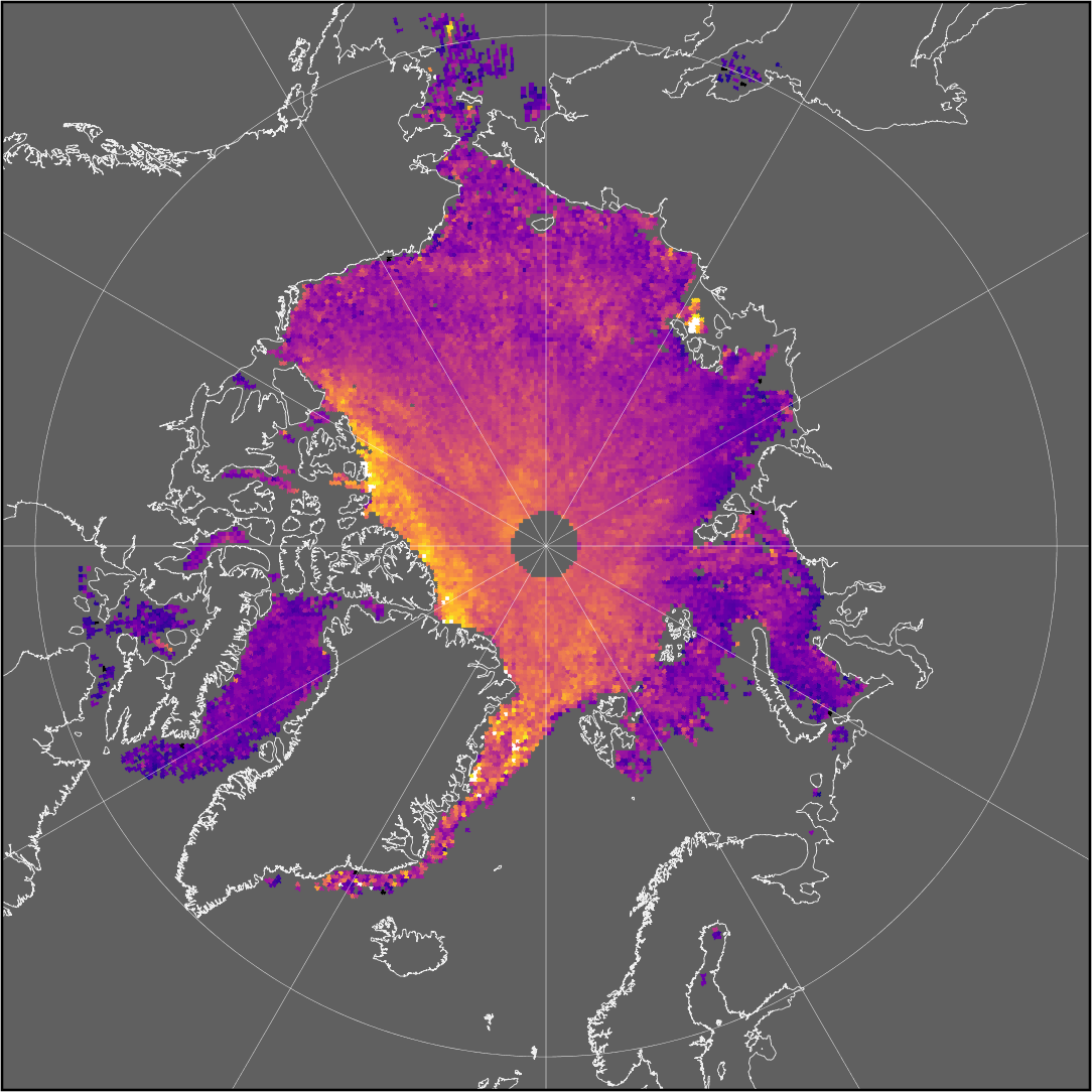
Figure: Example of monthly gridded sea-ice thickness product