| Note |
|---|
|
The need of the system has to be announced in cruise planning document "Einsatzplanung" prior to the cruise. The mounting of USBL antenna is executed by ships crew, the operation of the system must be executed by experienced scientific staff. GAPS underwater communication is conducted by using various frequencies, interferences with simultaneously operating Echo Sounders are possible. Attention: Submarine cable must be connected and device must be submerged in water before activating GAPS. |
Summary
| Sensorweb integration |
|---|
| urn | vessel:heincke:gaps |
|---|
| contenttype | Summary |
|---|
|
The Global Acoustic Positioning System (GAPS) combines an ultra-short baseline (USBL) acoustic positioning system and an inertial navigation system (INS) in the same housing to provide accurate position of any subsea object supplied with a transponder. Operating range is up to 4000m water depth with accuracy 0.2 percent of the distance to the object. The registration angle of 200 degree also enables position registration in shallow water. |
| Sensorweb integration |
|---|
| urn | vessel:heincke:gaps |
|---|
| contenttype | Metadata |
|---|
|
| Manufacturer | iXblue |
|---|
| Model | OIGAPS-Carbone, PN: 430 9000 |
|---|
| Serial No. | 097 |
|---|
| Type | ultra short baseline positioning systems |
|---|
| REGISTRY-Link | ↪ REGISTRY (2359) |
|---|
|
| Sensorweb integration |
|---|
| urn | vessel:heincke:gaps |
|---|
| contenttype | Images |
|---|
|
|
Transducer Frequency:
| Metadata (Metadata Plugin) |
|---|
|
|
| Sensorweb integration |
|---|
| urn | vessel:heincke:gaps |
|---|
| contenttype | Contacts |
|---|
|
| Name | Institution | Role |
|---|
| Ralf Krocker | Alfred Wegener Institute, Helmholtz Centre for Polar and Marine Research | Engineer In Charge |
|
Components
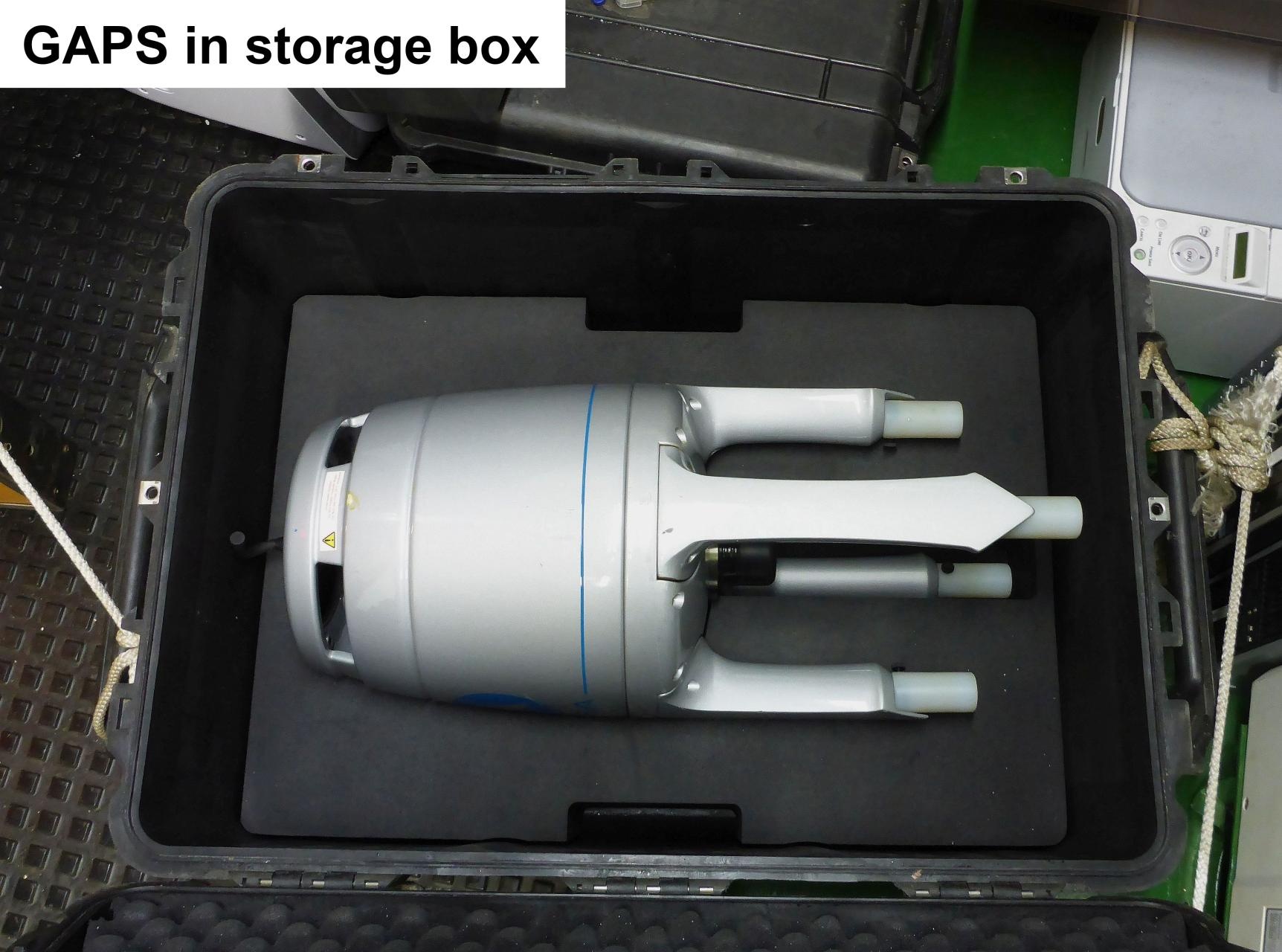
The system consists of the GAPS antenna itself, mounting for installation at the ships bottom, the Easy Connect Box (ECB) and monitoring software "GAPS MMI - Man Machine Interface". The transponders can be mounted to winch wire or to a submarine vehicle or other submarine object.
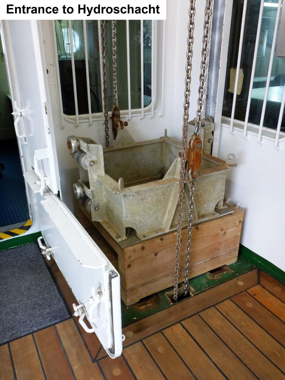
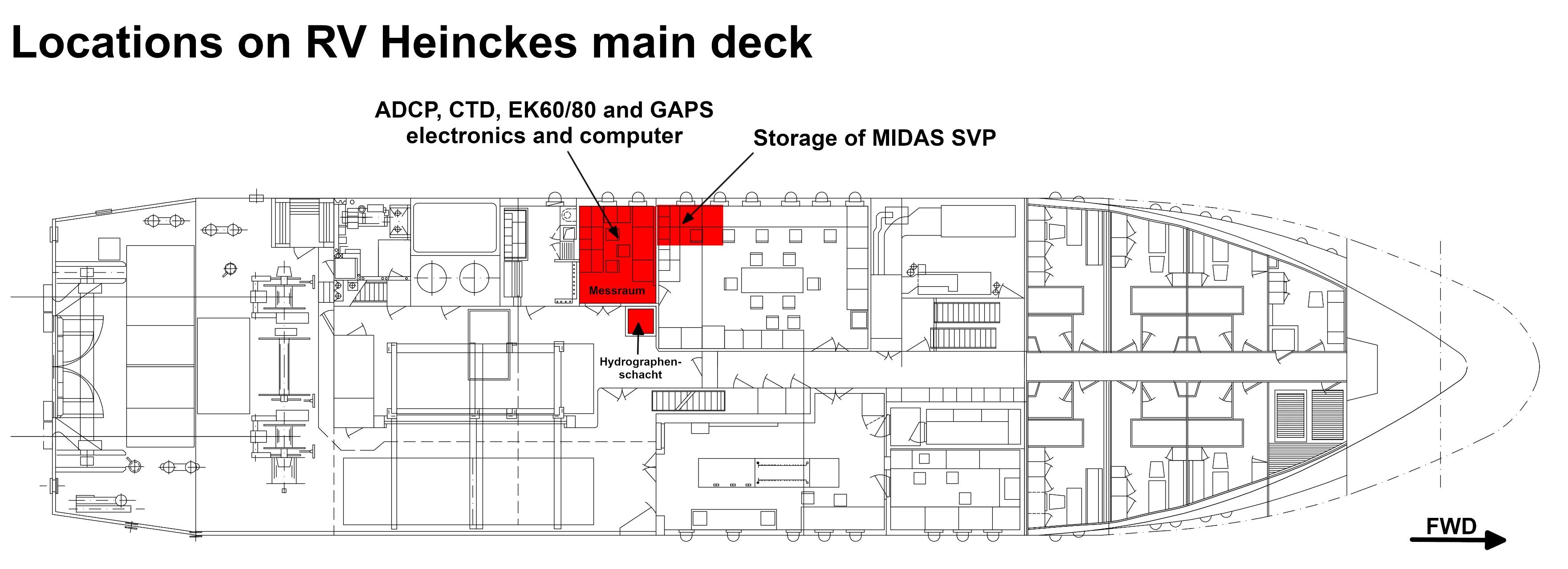
GAPS is a bi-directional acoustic positioning system, which communicates between ship (antenna) and one or more transponders. Positions of the transponders are determined relative to the ship or absolute in geographic frame. GAPS must be installed with custom-built mounting and is operated below the ship's hull. It is deployed via the Hydrographenschacht.
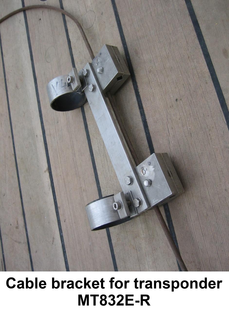
Two acoustic transponders (IXBLUE/Oceano MT832E-R and MT832E-HD-R) are available onboard RV Heincke. The transponders must mechanically be attached to underwater objects or vehicles. The transponders are synchronized to the GAPS and can be operated in transponder-mode (acoustic transmission and receiving) or in responder-mode (electric transmission and acoustic receiving; cables and plugs for responder-mode are not available on board). For transponder MT832E-R exists a winch cable mounting.
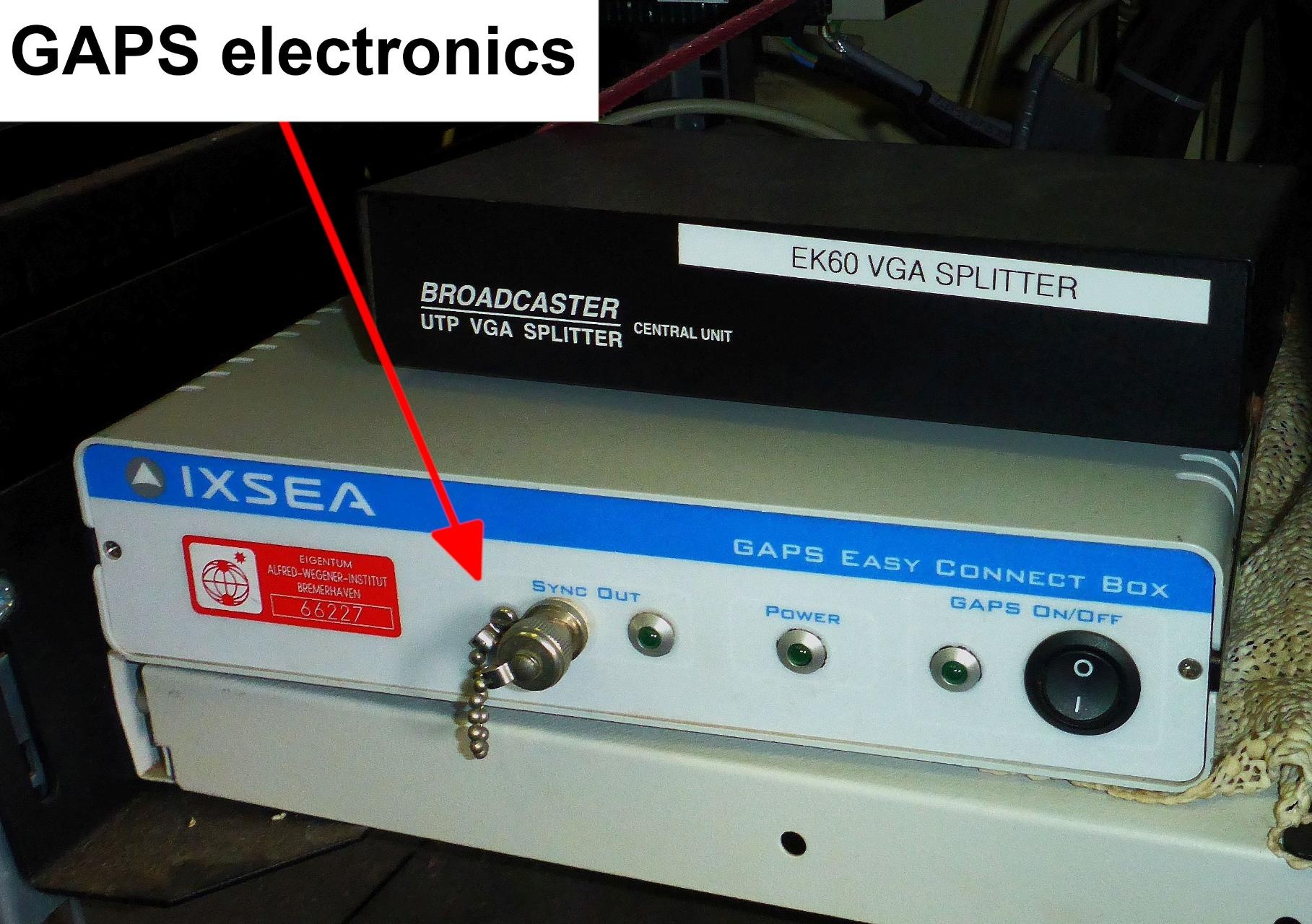
The Easy Connect Box (ECB) is a small interface to connect GAPS, external GPS receiver, PC with MMI-software and data management system DShip. It is switched on via the switch at the back of the ECB. The switch on the front is for the GAPS itself.
The GAPS MMI - Man Machine Interface - Software starts the GAPS and tracks the underwater transponders. It is installed on the CTD-PC in the Mess- und Registrierraum.
GAPS is connected to the GPS receiver on-board. Still there is an extra GPS receiver with accessories in case you want to use GAPS somewhere else.
| Sensorweb integration |
|---|
| urn | vessel:heincke:gaps |
|---|
| contenttype | Subdevices |
|---|
|
|
Position
| Sensorweb integration |
|---|
| urn | vessel:heincke:gaps |
|---|
| contenttype | LocalFrame |
|---|
|
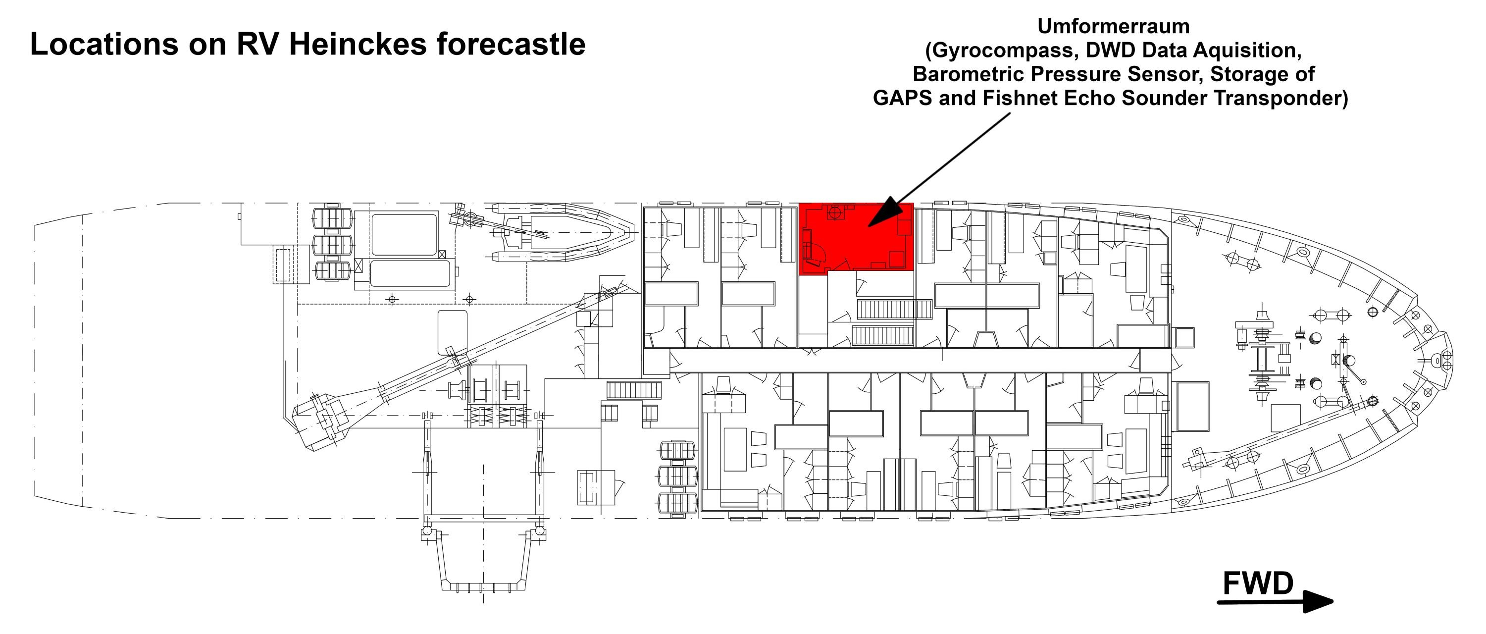
| Info | Electronics of the GAPS system are located in the server rack in the Mess- and Registrierraum and software is installed on the CTD-PC. The GAPS is deployed via the Hydrographenschacht. | | X | 0.0 (no unit given)
(no description given) | | Y | 0.0 (no unit given)
(no description given) | | Z | 0.0 (no unit given)
(no description given) |
|
Data logging, storage and archiving
Logged parameters
| Sensorweb integration |
|---|
| urn | vessel:heincke:gaps |
|---|
| contenttype | Parameters |
|---|
|
| Parameter | O2ARegistry Output Type | Unit |
|---|
| heading | attitude | deg | | latitude | latitude | deg | | longitude | longitude | deg | | altitude | attitude | m | | roll | attitude | deg | | pitch | attitude | deg | | transponder number | index | unknown | | x-coordinate | distance | m | | y-coordinate | distance | m | | z-coordinate | distance | m | | depth | depth | m | | month | date and time | unknown | | time in hours | date and time | unknown | | year | date and time | unknown | | day | date and time | unknown |
|
Central geographical ship's position and time standard
| Metadata (Metadata Plugin) |
|---|
|
|
Rawdata storage on board
| Metadata (Metadata Plugin) |
|---|
|
|
DShip
| Metadata (Metadata Plugin) |
|---|
|
|
Data archiving on land
| Metadata (Metadata Plugin) |
|---|
|
|
Documentation
| Sensorweb integration |
|---|
| urn | vessel:heincke:gaps |
|---|
| contenttype | Resources |
|---|
|
|