| Note | ||
|---|---|---|
| ||
Please note that the Magnetometer System can only be operated upon request. Request operations with the Magnetometer System to AWI-Logistics in sufficient time prior to the cruise. |
Summary
| Sensorweb integration | ||||
|---|---|---|---|---|
| ||||
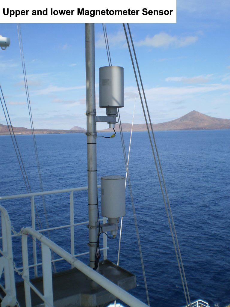
Magnetometers are used to measure the earth magnetic field. The magnetometer on board of Polarstern is a vector magnetometer that measures the vector components of the magnetic field. It consists of an upper and a lower sensor. |
| Sensorweb integration | ||||||||||
|---|---|---|---|---|---|---|---|---|---|---|
| ||||||||||
|
| Sensorweb integration | ||||
|---|---|---|---|---|
| ||||
 |
Contacts
| Sensorweb integration | ||||||||||||
|---|---|---|---|---|---|---|---|---|---|---|---|---|
| ||||||||||||
|
Components
| Metadata (Metadata Plugin) | ||
|---|---|---|
| ||
Subdevices
| Sensorweb integration | ||||||||||||
|---|---|---|---|---|---|---|---|---|---|---|---|---|
| ||||||||||||
|
Position
| Sensorweb integration | ||||||||
|---|---|---|---|---|---|---|---|---|
| ||||||||
|
Data logging, storage and archiving
Logged parameters
| Sensorweb integration | ||||||||||||||||||||||||||||||||||||||||||||||||
|---|---|---|---|---|---|---|---|---|---|---|---|---|---|---|---|---|---|---|---|---|---|---|---|---|---|---|---|---|---|---|---|---|---|---|---|---|---|---|---|---|---|---|---|---|---|---|---|---|
| ||||||||||||||||||||||||||||||||||||||||||||||||
|
Central geographical ship's position and time standard
| Metadata (Metadata Plugin) | ||
|---|---|---|
| ||
Rawdata storage on board
| Metadata (Metadata Plugin) | ||
|---|---|---|
| ||
Dship
| Metadata (Metadata Plugin) | ||
|---|---|---|
| ||
| Metadata list |
|---|
Data archiving on land
| Metadata (Metadata Plugin) | ||
|---|---|---|
| ||
| Metadata list |
|---|
Documentation
- König, M. (2006): Processing of shipborne magnetometer data and revision of the timing and geometry of the Mesozoic break-up of Gondwana = Auswertung schiffsfester Magnetometerdaten und die Neubestimmung des Zeitpunktes und der Geometrie des Mesozoischen Aufbruchs von Gondwana , Berichte zur Polar- und Meeresforschung (Reports on Polar and Marine Research), Bremerhaven, Alfred Wegener Institute for Polar and Marine Research, 525 , 137 p. .