...
| Note |
|---|
|
Please note that operations of the Sediment Echo Sounder Atlas Parasound P70 requires experienced scientific staff on board for permanent supervision of data aquisition and storage. The system is not operated by the ship's crew. Announce operations with the Sediment Echo Sounder Atlas Parasound P70 to AWI-Logistics prior to the cruise and clarify the data transfer after the cruise. |
Summary
Transducer Frequency
| Metadata (Metadata Plugin) |
|---|
|
High frequency: 19 - 38 kHz; Parametric signal: 0.5 - 6.0 kHz |
Responsible Persons
Components
| Metadata (Metadata Plugin) |
|---|
|
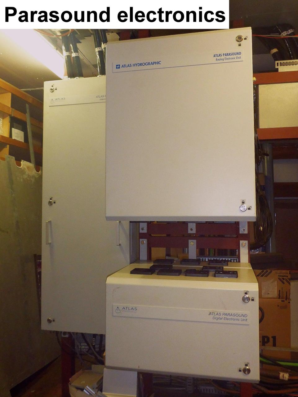
The system consits of the transducer, the electronic unit, two computers with installed data acquisition and processing software ParaStore and the subsidiary display on the bridge.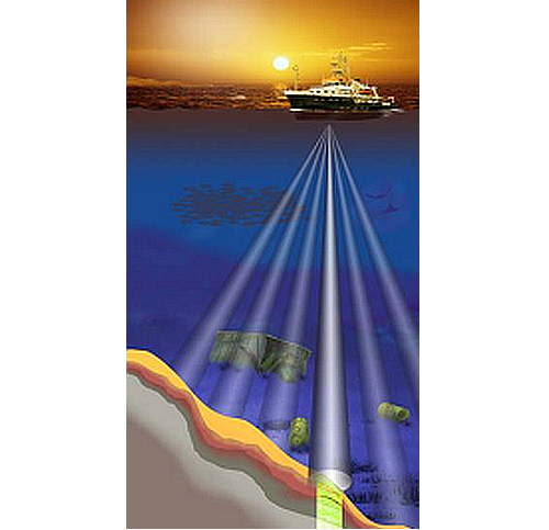
The transducer consists of four segments and is mounted without ice protection window in the box keel. The transducer transmits in the frequency range of 18 - 39 kHz and reaches water depth of 10 to 11000m. Frequency interferences generate "parametric low frequencies" between 0.5 and 6.0 kHz. Penetration depth into the sediment accounts for > 200m (depending on sediment properties) and the resolution is 6.1 cm. |
 Image Removed
Position
Data logging, storage and archiving
Logged parameters
Central geographical ship's position and time standard
| Metadata (Metadata Plugin) |
|---|
|
Time synchronising is carried out via NMEA-telegram from the ZDA data set or via ntp between DIP2 and the central ntp-server of the on-board network. DIP2 functions as ntp-server for the computers and residual DIPs of the Parasound System. |
| Metadata (Metadata Plugin) |
|---|
|
The recorded geographical ship's position is the location of the central motion sensor MINS. The lever between transducer and the central motionsensor MINS is considered. |
Rawdata storage on board
| Metadata (Metadata Plugin) |
|---|
|
The data acquisition and processing software ParaStore creates rawdata on the local drive depending on system configuration. PHF = primary high frequency beam amplitudes, SLF = secondary low frequency beam amplitudes, SHF = secondary high frequency beam amplitudes. Synchonising of the local data directory to mass storage has to be carried out manually in the following data structure: |
| Metadata list |
|---|
|| root directory | R:\data01\parasound\ || directory name | CruiseNo\XXX_ASD_YYYYMMDD\ \\ \\ CruiseNo\XXX_PS3_YYYYMMDD\ \\ CruiseNo\XXX_SGY_YYYYMMDD\ \\ CruiseNo\screenshots\ \\ CruiseNo\PSAUX\ \\ CruiseNo\DSHIP\ \\ with \\ XXX = PHF, SLF or SHF \\ YYYY = year \\ MM = month day \\ e.g. \\ ANT25-3\PHF_ASD_20090113\ \\ ... || file name | PS3XXX\_YYYY-MM-DDThhmmssZ\_<identNo>.asd.acf \\ PS3XXX\_YYYY-MM-DDThhmmssZ\_<identNo>.asd.acf.idx \\ XXXYYMMDDhhmm.ps3 \\ XXXYYMMDDhhmm.sgy \\ YYYYMMDD-YYYYMMDD\YYYYMMDD_hhmm*.bmp \\ ??? \\ NAV_YYYYMMDD-YYYYMMDD.txt \\ with \\ XXX = PHF, SLF or SHF \\ YYYY = year \\ MM = month \\ DD = day \\ hh = hour \\ mm = minute \\ ss = second \\ <identNo> = 8-digit running number || |
Resources
Events
Images
----------------------------------------------------------------------
Additional information
External Manuals
...
*Rohdaten an Bord:* Die herstellerspezifische Datenerfassungs\- und Verarbeitungs-Software ParaStore des PCs erzeugt Rohdaten je nach Systemkonfiguration auf der lokal Datenplatte. * PHF = primary high frequency beam amplitudes * SLF = secondary low frequency beam amplitudes * SHF = secondary high frequency beam amplitudes Diese Daten werden manuell auf dem Massenspeicher in der folgenden Dateistruktur abgespeichert: || Stammverzeichnis || Verzeichnisname || Dateiname || | R:\data01\parasound\ | Reisenummer\PHF_ASD_YYYYMMDD\ \\ \\ Reisenummer\PHF_PS3_YYYYMMDD\ \\ Reisenummer\PHF_SGY_YYYYMMDD\ \\ Reisenummer\SLF_ASD_YYYYMMDD\ \\ \\ Reisenummer\SLF_PS3_YYYYMMDD\ \\ Reisenummer\SLF_SGY_YYYYMMDD\ \\ Reisenummer\SHF_ASD_YYYYMMDD\ \\ \\ Reisenummer\SHF_ASD_3YYYYMMDD\ \\ Reisenummer\SHF_SGY_YYYYMMDD\ \\ Reisenummer\screenshots\ \\ Reisenummer\PSAUX\ \\ Reisenummer\DSHIP\ | PS3PHF\_YYYY-MM-DDThhmmssZ\_<identNo>.asd.acf \\ PS3PHF\_YYYY-MM-DDThhmmssZ\_<identNo>.asd.acf.idx \\ PHFYYMMDDhhmm.ps3 \\ PHFYYMMDDhhmm.sgy \\ PS3SLF\_YYYY-MM-DDThhmmssZ\_<identNo>.asd.acf \\ PS3SLF\_YYYY-MM-DDThhmmssZ\_<identNo>.asd.acf.idx \\ SLFYYMMDDhhmm.ps3 \\ SLFYYMMDDhhmm.sgy \\ PS3SHF\_YYYY-MM-DDThhmmssZ\_<identNo>.asd.acf \\ PS3SHF\_YYYY-MM-DDThhmmssZ\_<identNo>.asd.acf.idx \\ SHFYYMMDDhhmm.ps3 \\ SHFYYMMDDhhmm.sgy\\ YYYYMMDD-YYYYMMDD\YYYYMMDD_hhmm*.bmp \\ ??? \\ NAV_YYYYMMDD-YYYYMMDD.txt | mit YYYY = Jahr; MM = Monat; DD = Tag; hh = tunde; mm = Minute; ss = Sekunde; <identNo> = 8 stellige Laufende Nummer Dabei belegt die Dateistruktur das folgende Volumen: {metadata-list}|| Volumen (MB pro Tag) ca. | ??? || || Anzahl Dateien pro Tag ca. | ??? ||{metadata-list} *Rohdaten an Land:* Je nach Absprache mit der AWI-Logistik und mit dem oben genannten Geräteverantwortlichen besteht die Möglichkeit die gewonnenen Rohdaten, nachdem sie mit Metadaten versehen worden sind, über [PANGAEA|http://www.pangaea.de/search?l&q=polarstern+parasound] zur Verfügung zu stellen....
DShip-Daten:
Ein serieller Ausgang der Elektronik-Einheiten ist an einem
...
Lantronix 16-Port
Terminalserver im
...
Rechnerraum
angeschlossen.
| Metadata list |
|---|
|| Gerätename | PS || || Messwerte | water depth \[m\] |
...
| Sensorweb integration |
|---|
| urn | vessel:polarstern:parasound_p70 |
|---|
| contenttype | Summary |
|---|
|
The Sediment Echo Sounder surveys the upper layers of the seafloor via the reflection of acoustic signals. Depending upon the reflectivity of the sediments penetration depths of about 200m can be reached. |
| Sensorweb integration |
|---|
| urn | vessel:polarstern:parasound_p70 |
|---|
| contenttype | Metadata |
|---|
|
| Manufacturer | Teledyne RESON (ATLAS Hydrographic before takeover) |
|---|
| Model | Parasound P70 |
|---|
| Serial No. | n/a |
|---|
| Type | echo sounder |
|---|
| REGISTRY-Link | ↪ REGISTRY (1392) |
|---|
|
Transducer Frequency
| Metadata (Metadata Plugin) |
|---|
|
|
Contacts
| Sensorweb integration |
|---|
| urn | vessel:polarstern:parasound_p70 |
|---|
| contenttype | Contacts |
|---|
|
| Name | Institution | Role |
|---|
| Catalina Gebhardt | Alfred Wegener Institute, Helmholtz Centre for Polar and Marine Research | Principal Investigator | | Alfred Wegener Institute for Polar and Marine Research | Alfred Wegener Institute, Helmholtz Centre for Polar and Marine Research | Owner |
|
Components
| Metadata (Metadata Plugin) |
|---|
|
|
Position
| Sensorweb integration |
|---|
| urn | vessel:polarstern:parasound_p70 |
|---|
| contenttype | LocalFrame |
|---|
|
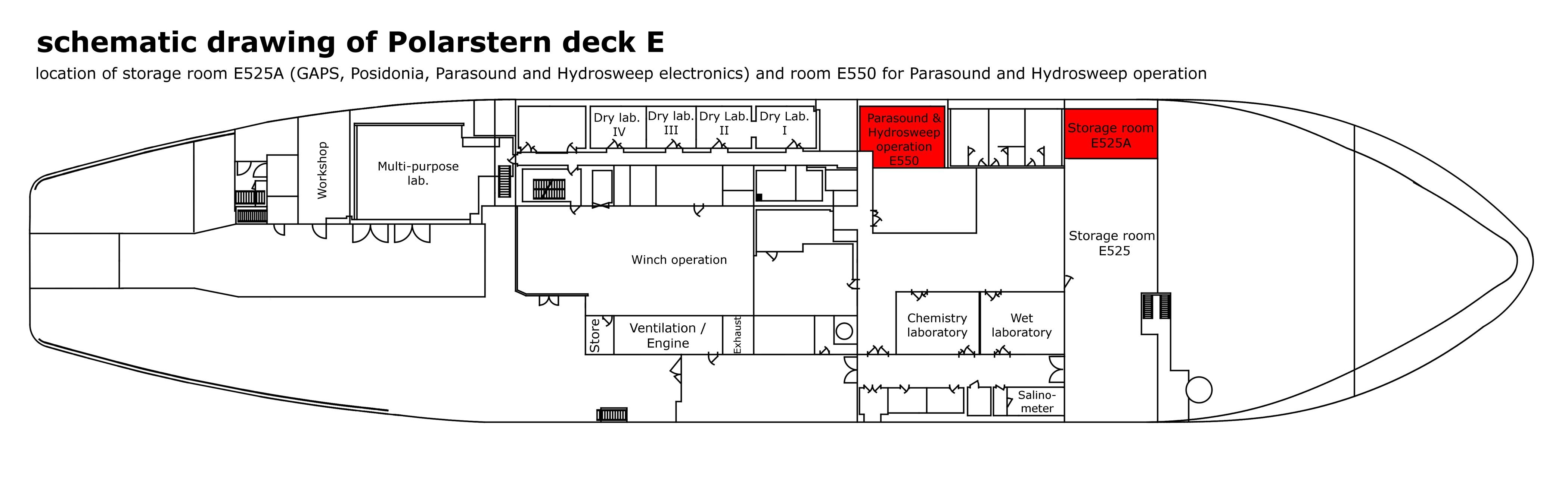
| Info | xyz-position calculated from Alignment Survey Report (2016), transducer array located in box keel, electronics located in E525A, computers located in E550 (HSPS room) | | X | 76.498 m
(X-0 is at the center of der rudder (ref. design drawing of the vessel), positive X-axis is forward and along vessel centerline) | | Y | 0.004 m
(Y-0 at centerline, positive Y-axis is portside ) | | Z | 0.0 m
(Z-0 is set to the lowest point of the keel, positive Z-axis is upwards) |
|
Data logging, storage and archiving
Logged parameters
| Sensorweb integration |
|---|
| urn | vessel:polarstern:parasound_p70 |
|---|
| contenttype | Parameters |
|---|
|
| Parameter | O2ARegistry Output Type | Unit |
|---|
| depth | depth | m |
|
Central geographical ship's position and time standard
| Metadata (Metadata Plugin) |
|---|
|
|
Rawdata storage on board
| Metadata (Metadata Plugin) |
|---|
|
|
Dship
| Metadata (Metadata Plugin) |
|---|
|
|
Data archiving on land
| Metadata (Metadata Plugin) |
|---|
|
|
Documentation
| Sensorweb integration |
|---|
| urn | vessel:polarstern:parasound_p70 |
|---|
| contenttype | Resources |
|---|
|
|