...
| Sensorweb integration | ||||||||||
|---|---|---|---|---|---|---|---|---|---|---|
| ||||||||||
|
| Sensorweb integration | ||||
|---|---|---|---|---|
| ||||
  |
...
| Metadata (Metadata Plugin) | ||||
|---|---|---|---|---|
| 13-17 kHz||||
Contacts
| Sensorweb integration | ||||||||||||
|---|---|---|---|---|---|---|---|---|---|---|---|---|
| ||||||||||||
|
...
| Metadata (Metadata Plugin) | ||||
|---|---|---|---|---|
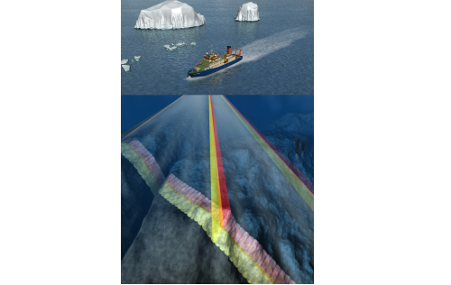
| The system consists of hull-mounted transducers, top side hardware and operation software.||||
Subdevices
| Sensorweb integration | ||||||||||||
|---|---|---|---|---|---|---|---|---|---|---|---|---|
| ||||||||||||
|
Position
| Sensorweb integration | ||||||||
|---|---|---|---|---|---|---|---|---|
| ||||||||
|
...
| Sensorweb integration | |||||||||
|---|---|---|---|---|---|---|---|---|---|
| |||||||||
|
...
| Metadata (Metadata Plugin) | ||
|---|---|---|
| ||
Time synchronising of the computers is regulated via Polarstern GPS.
Geographical ship's position centered to HYDRINS position. Post-processing relates data to the transducer position. | ||
Rawdata storage on board
| Metadata (Metadata Plugin) | ||
|---|---|---|
| ||
Mass data: The data acquisition and processing software creates rawdata to the directory structure of the mass storage. A reduced data set is also stored in DShip sytem. | ||
| Metadata list |
|---|
Dship
| Metadata (Metadata Plugin) | ||||
|---|---|---|---|---|
| Reduced set of measurement data.||||
| Metadata list |
|---|
Data archiving on land
| Metadata (Metadata Plugin) | ||
|---|---|---|
| ||
After consultation with the data scientist and AWI Logistics, the operator transfers the measurement data along with required meta data to AWI. Then, the data including meta data can be extracted from https://www.pangaea.de/ (for authorized users only). The reduced DShip data set can be extracted from https://dship.awi.de/. | ||
| Metadata list |
|---|
Documentation
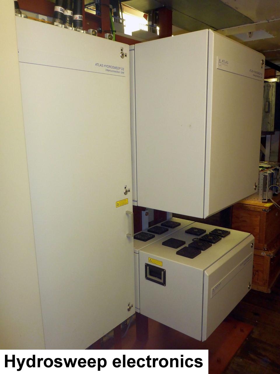
Internal Documentation Survival Guide to use the new Hydrosweep DS3 on FS-Polarstern
| Sensorweb integration | ||||
|---|---|---|---|---|
| ||||
|