...
| Sensorweb integration |
|---|
| urn | vessel:heincke:saab_100655-c1 |
|---|
| contenttype | Summary |
|---|
|
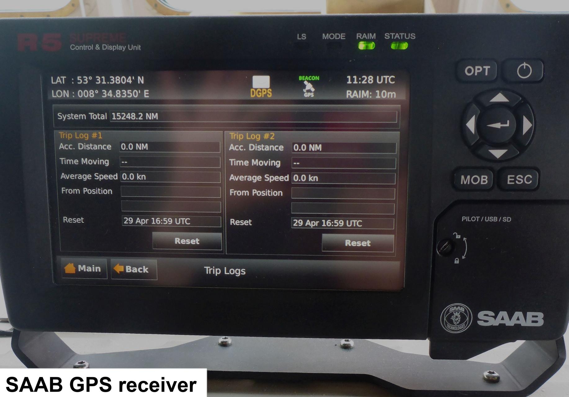
asdfasdfasdfThe DGPS SAAB R5 is a combined GPS, GLONASS, BeiDou and GALILEO receiver, with options for L1/L2/L5, L-Band and RTK operation with optional licenses or subscriptions. It is equipped with a MXB5 DGPS antenna. |
| Sensorweb integration |
|---|
| urn | vessel:heincke:saab_100655-c1 |
|---|
| contenttype | Metadata |
|---|
|
| Manufacturer | SAAB |
|---|
| Model | DGPS SAAB R5 |
|---|
| Serial No. | 100655-C1 |
|---|
| Type | satellite positioning system |
|---|
| REGISTRY-Link | ↪ REGISTRY (8572) |
|---|
|
Contacts
| Sensorweb integration |
|---|
| urn | vessel:heincke:saab_100655-c1 |
|---|
| contenttype | Contacts |
|---|
|
asdfasdfasdf |
Components
|
| Name | Institution | Role |
|---|
| Ralf Krocker | Alfred Wegener Institute, Helmholtz Centre for Polar and Marine Research | Engineer In Charge |
|
Components
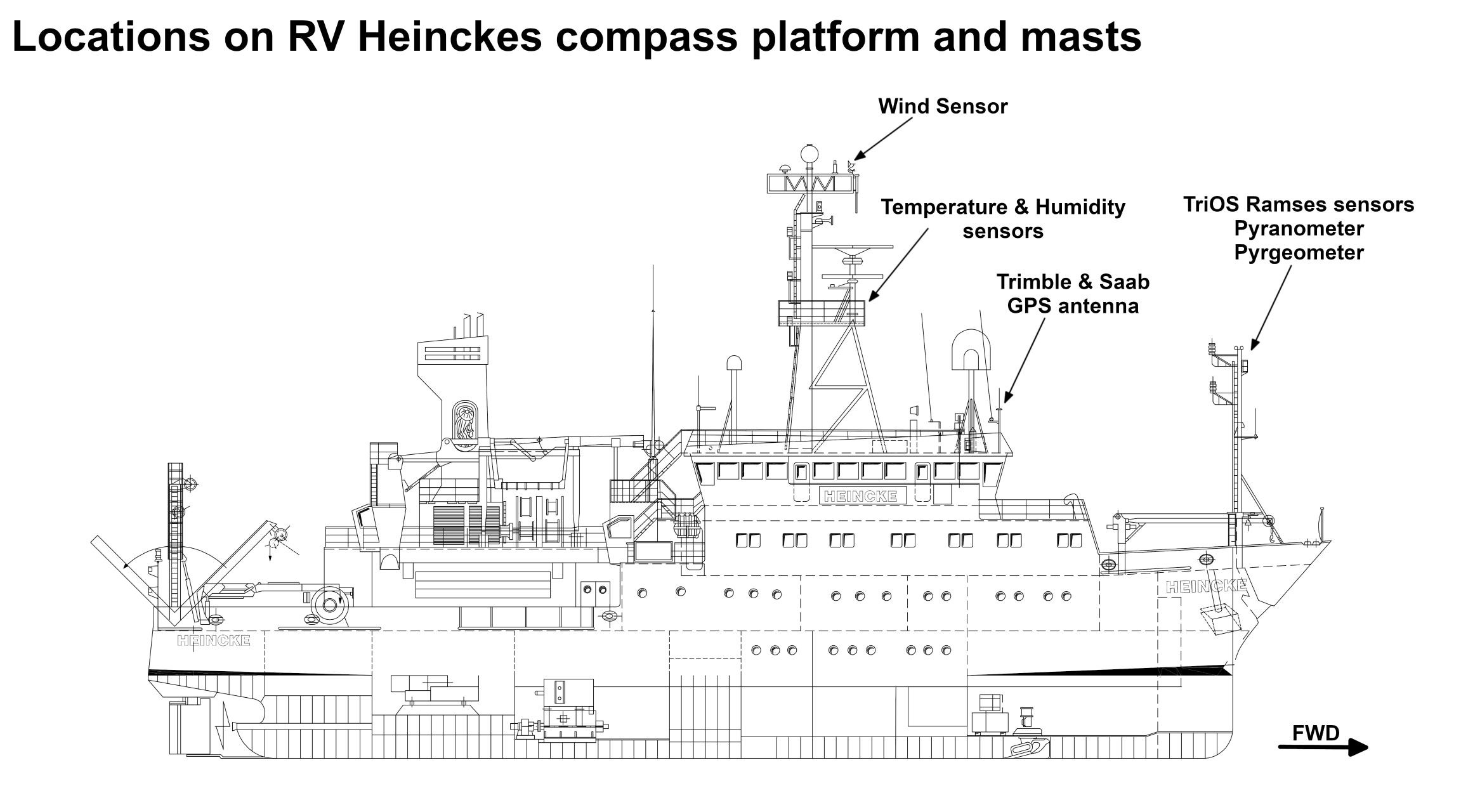
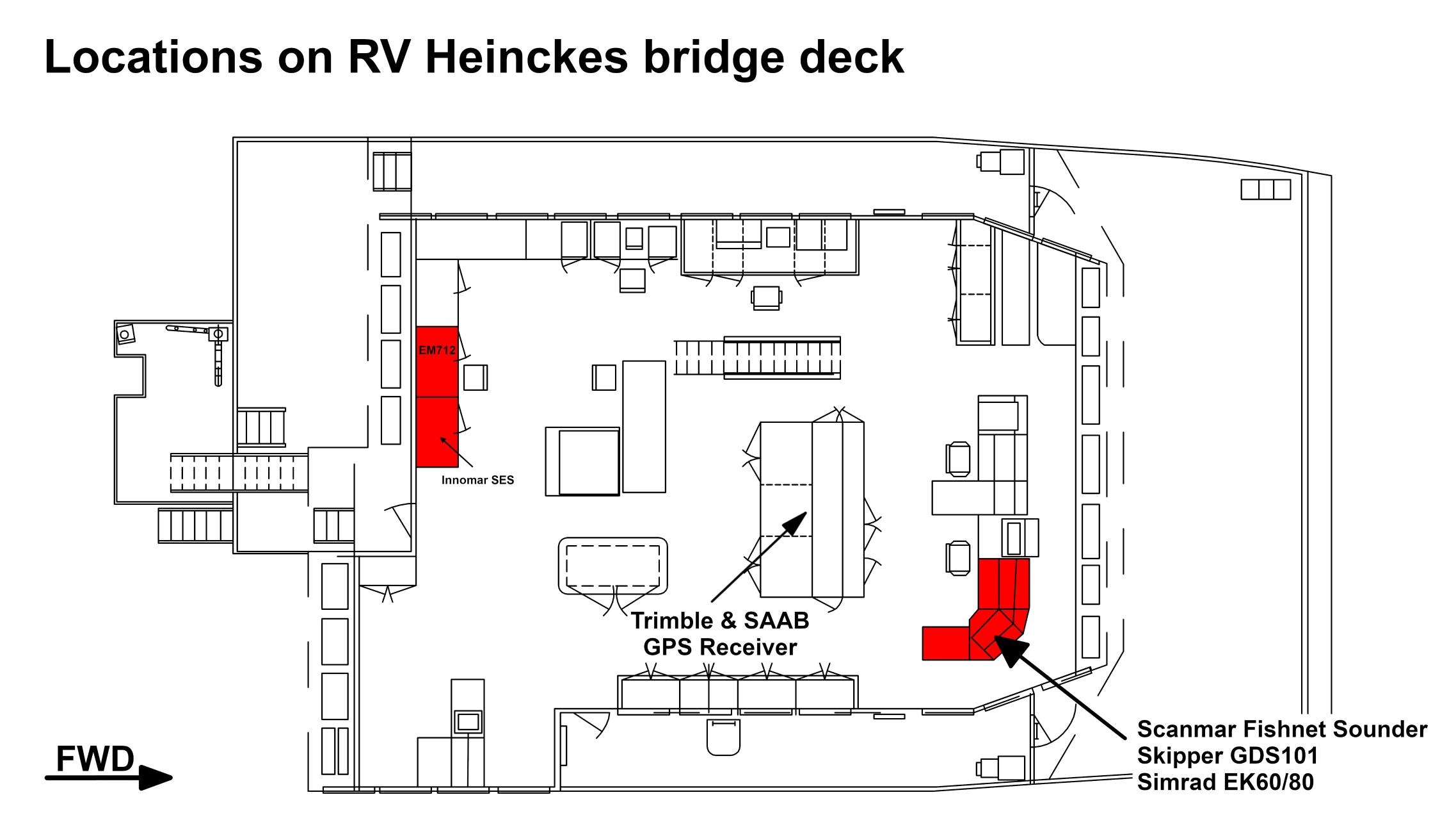
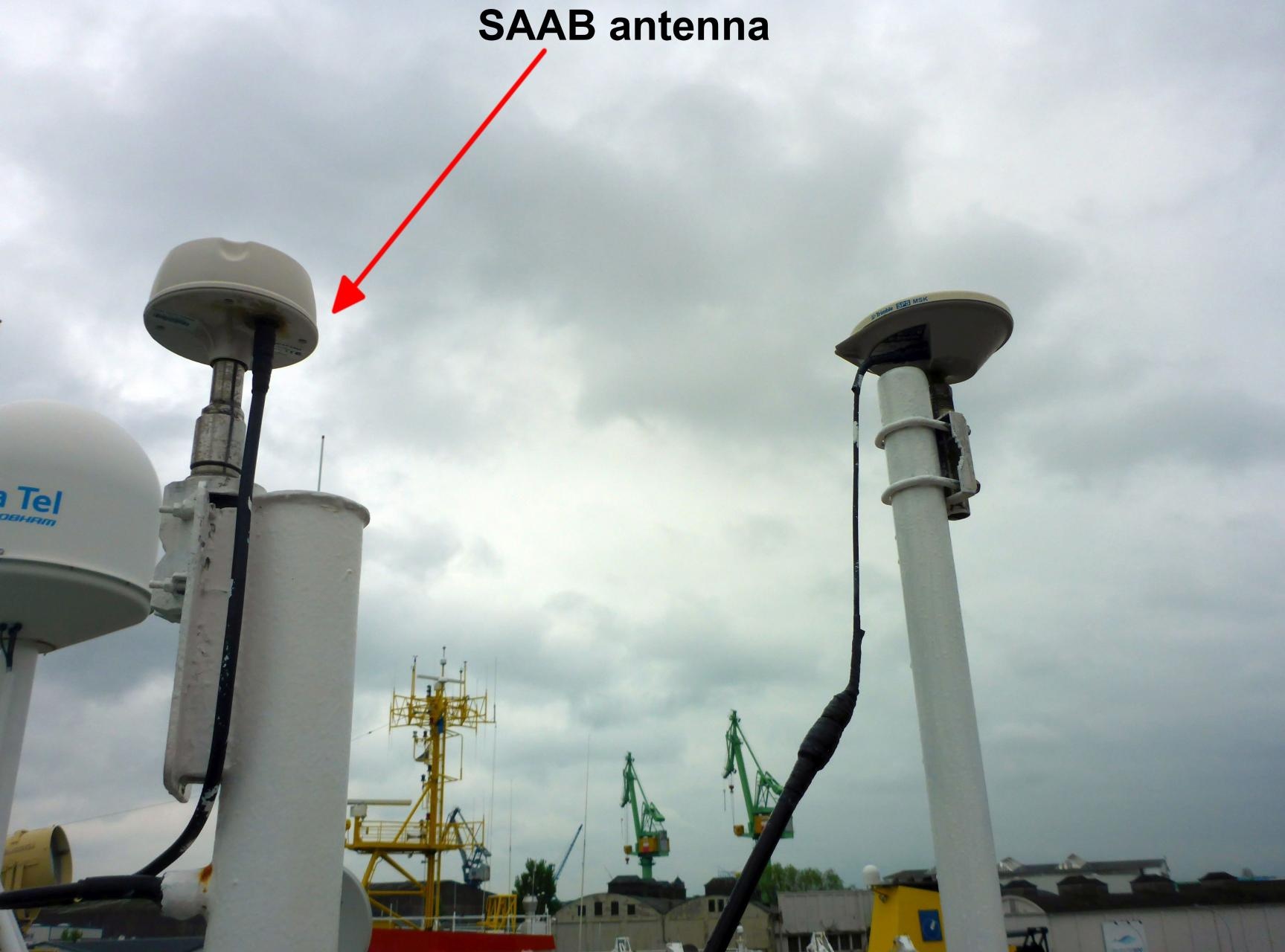
The GPS receiver is installed on the bridge deck. The antenna is installed on the observation deck.
| Sensorweb integration |
|---|
| urn | vessel:heincke:saab_100655-c1 |
|---|
| contenttype | Subdevices |
|---|
|
asdfasdfasdfNo subdevices available. |
Position
| Sensorweb integration |
|---|
| urn | vessel:heincke:saab_100655-c1 |
|---|
| contenttype | LocalFrame |
|---|
|
| Info | xyz-position of antenna from Alignment Survey Report RV Heincke (January 2016). Antenna located on observation deck, device located on bridge deck. | | X | 38.938 m
(Positive X axis is forward and along the centerline of the vessel with X0 at the Stern point of the vessel.) | | Y | -2.11 m
(Positive Y axis is portside of centerline with Y0 at centerline at the Very stern point of the vessel.) | | Z | 16.356 m
(Positive Z axis is upwards of basis. Z0 is set to the hydrophone on midship.) |
|
Data logging, storage and archiving
...
| Sensorweb integration |
|---|
| urn | vessel:heincke:saab_100655-c1 |
|---|
| contenttype | Parameters |
|---|
|
| Parameter | O2ARegistry Output Type | Unit |
|---|
| day | date and time | unknown | | GPS quality indicator | quality flag | unknown | | latitude | latitude | deg | | longitude | longitude | deg | | month | date and time | mo | | number of satellites | index | number | | speed over ground | speed | knot | | year | date and time | a | | course over ground | attitude | deg |
|
Central geographical ship's position and time standard
| Metadata (Metadata Plugin) |
|---|
|
|
Rawdata storage on board
| Metadata (Metadata Plugin) |
|---|
|
...
DShip
| Metadata (Metadata Plugin) |
|---|
|
|
Data archiving on land
| Metadata (Metadata Plugin) |
|---|
|
...
Documentation
| Sensorweb integration |
|---|
| urn | vessel:heincke:saab_100655-c1 |
|---|
| contenttype | Resources |
|---|
|
| asdfasdfasdf |