...
| Note |
|---|
|
Please note that the Marine Gravitymeter System can only be operated upon request. Request operations with the Marine Gravitymeter System to AWI-Logistics in sufficient time prior to the cruise. |
Summary
Responsible Persons
Components
| Metadata (Metadata Plugin) |
|---|
|
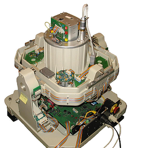
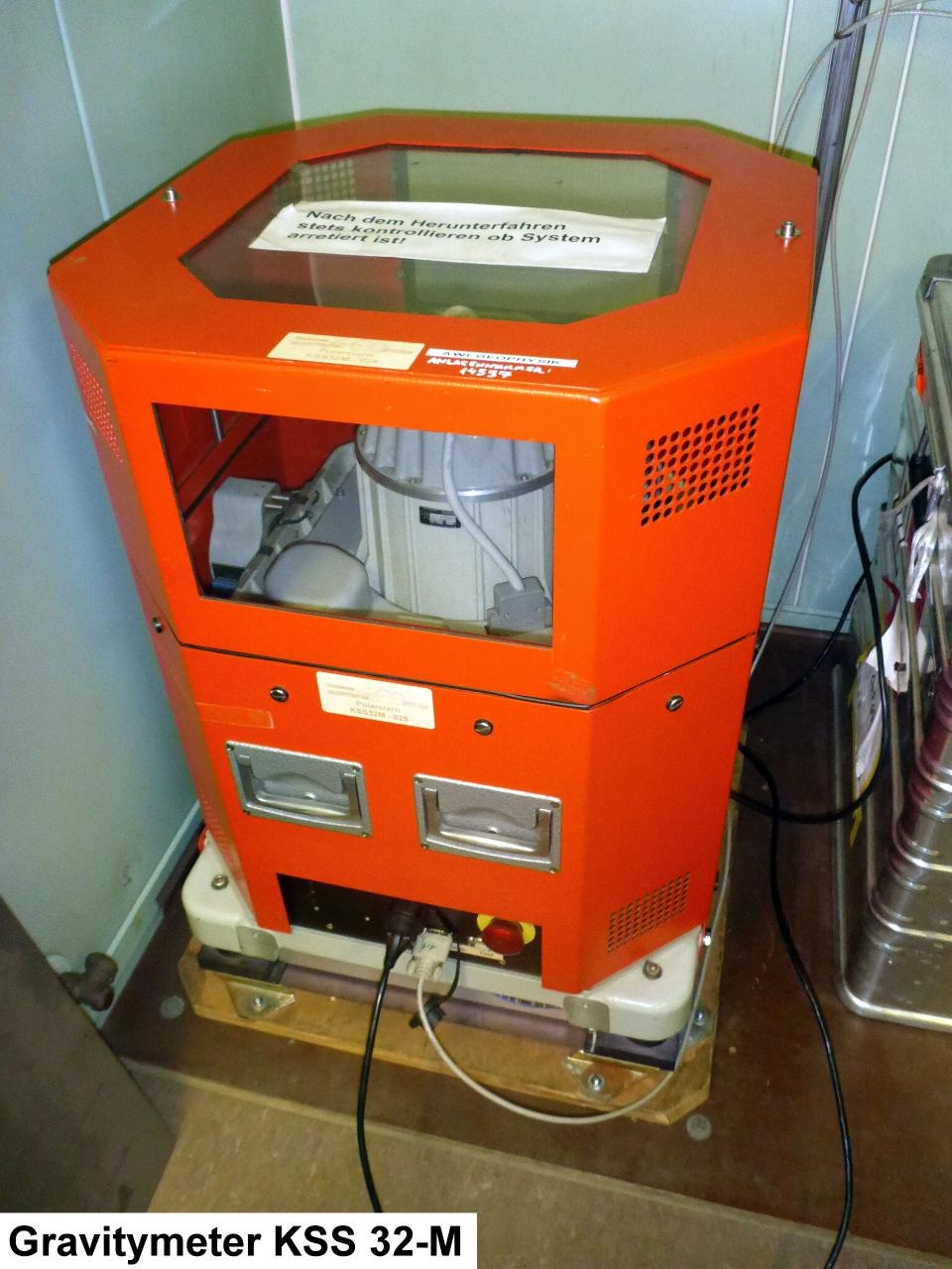
The Marine Gravitymeter System consits of the Gravitymeter KSS 32-M and the operator-laptop in the Gravitymeter Room on board. The Gravitymeter control system and data acquisition software BGGS DACQS is installed on the laptop.
|
| Sensorweb integration |
|---|
| urn | vessel:polarstern:gravimeter |
|---|
| contenttype | Summary |
|---|
|
A gravimeter is used to measure accelerations due to the gravitational field of the earth. The gravimeter on board of Polarstern is situated on a gyro-stabilized platform to compensate for the ship's movement. It is a spring and mass system with magnetic compensation, the extension of the spring being proportional to the gravitational force. |
| Sensorweb integration |
|---|
| urn | vessel:polarstern:gravimeter |
|---|
| contenttype | Metadata |
|---|
|
| Manufacturer | Bodensee Gravitymeter Geosystem GmbH (BGGS) |
|---|
| Model | KSS 32 M |
|---|
| Serial No. | n/a |
|---|
| Type | gravimeter |
|---|
| REGISTRY-Link | ↪ REGISTRY (1406) |
|---|
|
Contacts
| Sensorweb integration |
|---|
| urn | vessel:polarstern:gravimeter |
|---|
| contenttype | Contacts |
|---|
|
| Name | Institution | Role |
|---|
| Thorsten Eggers | Alfred Wegener Institute, Helmholtz Centre for Polar and Marine Research | Engineer In Charge | | Alfred Wegener Institute for Polar and Marine Research | Alfred Wegener Institute, Helmholtz Centre for Polar and Marine Research | Owner | | Graeme Eagles | Alfred Wegener Institute, Helmholtz Centre for Polar and Marine Research | Principal Investigator, Data Scientist |
|
Components
| Metadata (Metadata Plugin) |
|---|
|
|
Position
| Sensorweb integration |
|---|
| urn | vessel:polarstern:gravimeter |
|---|
| contenttype | LocalFrame |
|---|
|
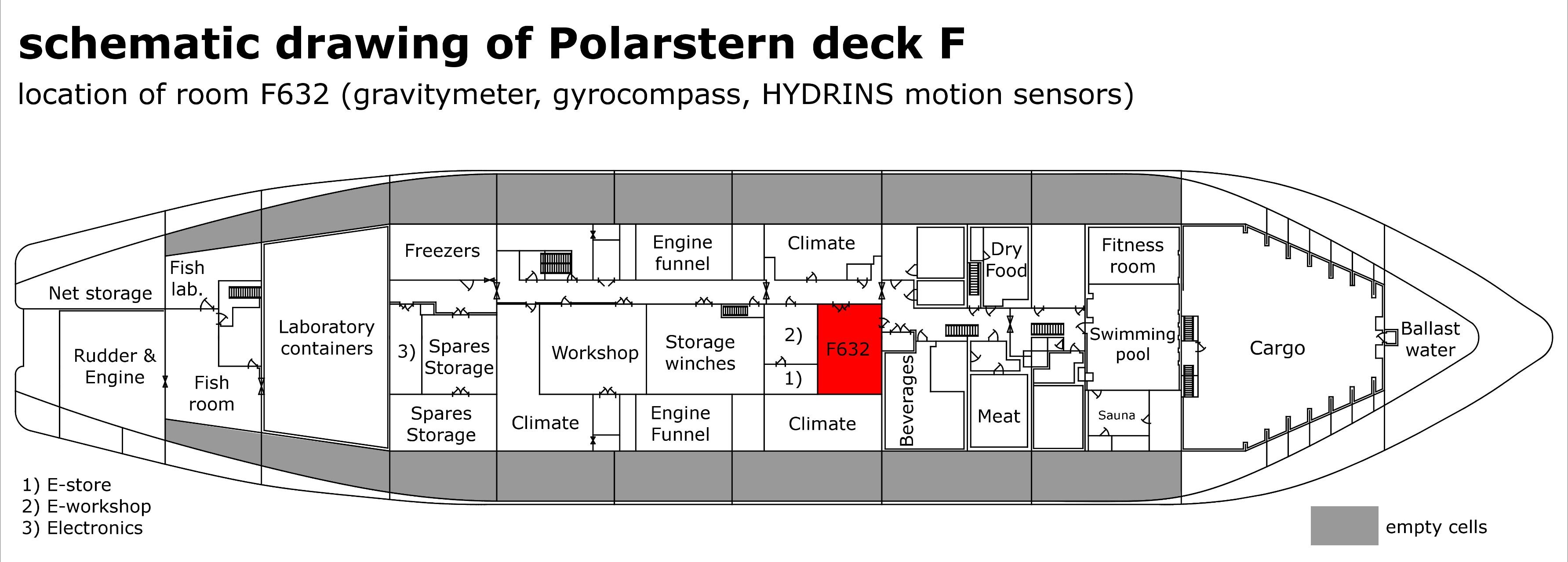
| Info | xyz-position from Alignment Survey Report RV Polarstern (June 2016), located in F632 | | X | 56.99 m
(X-0 is at the center of der rudder (ref. design drawing of the vessel), positive X-axis is forward and along vessel centerline) | | Y | 0.147 m
(Y-0 at centerline, positive Y-axis is portside) | | Z | 11.81 m
(Z-0 is set to the lowest point of the keel, positive Z-axis is upwards) |
|
...
Data logging, storage and archiving
Logged parameters
| Sensorweb integration |
|---|
| urn | vessel:polarstern:gravimeter |
|---|
| contenttype | Parameters |
|---|
|
| Parameter | O2ARegistry Output Type | Unit |
|---|
| acceleration | acceleration | m/s2 | | Gravity | gravity | mGal |
|
Central geographical ship's position and time standard
| Metadata (Metadata Plugin) |
|---|
|
Time stamp from DShip NMEA telegram. |
| Metadata (Metadata Plugin) |
|---|
|
A gyro-stabilized platform accounts for compensation of the ship's movements. Navigation data from DShip NMEA telegram. |
|
Rawdata storage on board
| Metadata (Metadata Plugin) |
|---|
| All measured values are stored to the DShip system. | backup to operator-laptop is possible.
|
|
Dship
| Metadata (Metadata Plugin) |
|---|
|
All measured values are stored to the DShip System: |
|
| Metadata list |
|---|
|| Device name | gravimeter ||
|| Parameters | ACC-X \[m/s ^2^\]; ACC-Y \[m/s ^2^\]; clockID; gravity \[mgal\]; seastate || |
|---|
|
Data archiving on land
| Metadata (Metadata Plugin) |
|---|
| ??? After the cruise, the operator transfers the measurement data along with required meta data to AWI after consultaion with the data scientist and AWI Logistics. Then, the data (including meta data) can be extracted from https://www.pangaea.de/ (for authorized users only). The unevaluated DShip data set can be extracted from https://dms.awi.de. ???
|
Documentation
The manuals are located in the Gravitymeter Room on board
...
.
| Sensorweb integration |
|---|
| urn | vessel:polarstern:gravimeter |
|---|
| contenttype | Resources |
|---|
|
|