...
| Sensorweb integration | ||||
|---|---|---|---|---|
| ||||
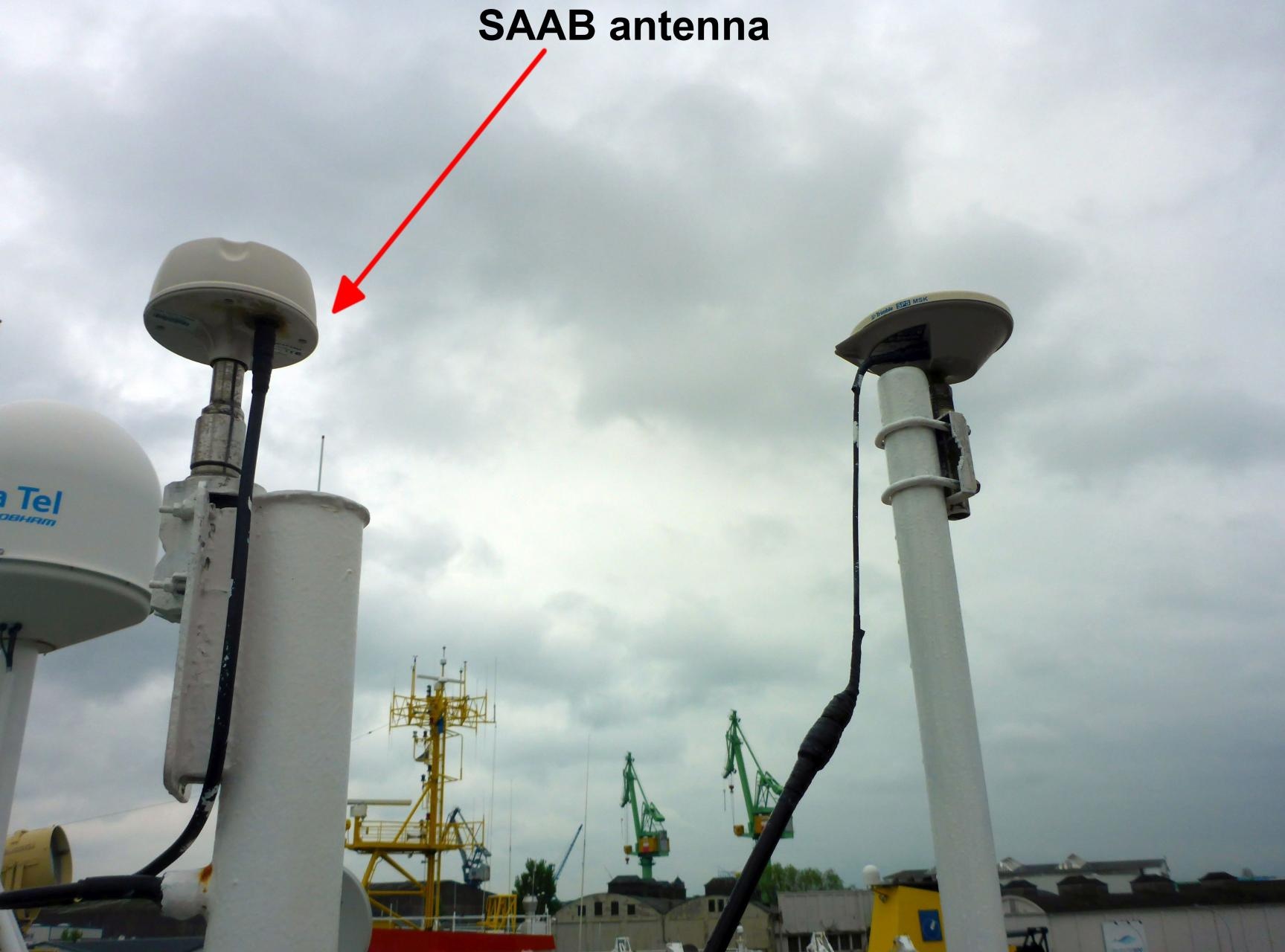
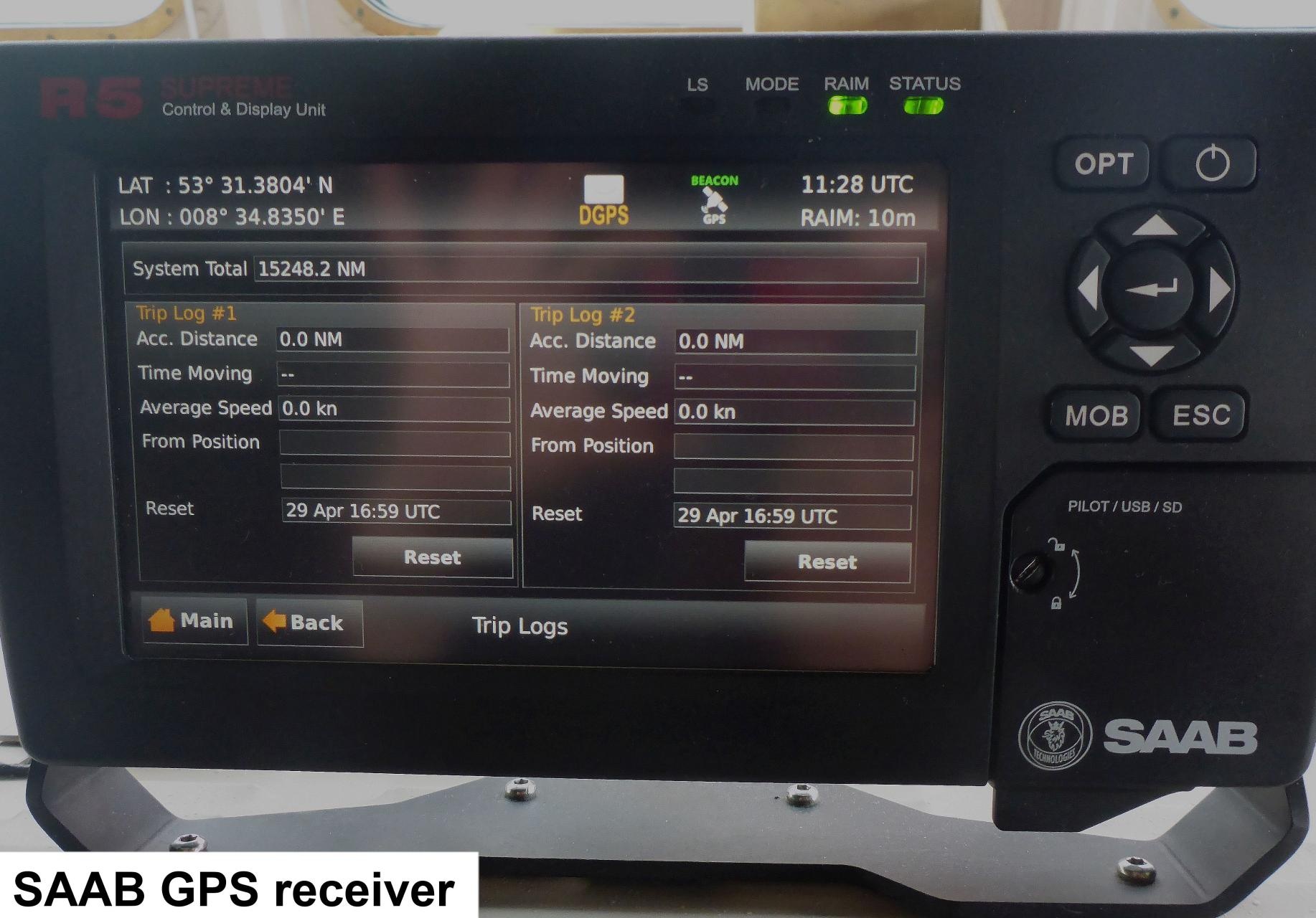
The DGPS SAAB R5 is a combined GPS, GLONASS, BeiDou and GALILEO receiver, with options for L1/L2/L5, L-Band and RTK operation with optional licenses or subscriptions. It is equipped with a MXB5 DGPS antenna. |
...
| Sensorweb integration | ||||||||||
|---|---|---|---|---|---|---|---|---|---|---|
| ||||||||||
|
| Sensorweb integration | ||||
|---|---|---|---|---|
| ||||
    |
Contacts
| Sensorweb integration | |||||||||
|---|---|---|---|---|---|---|---|---|---|
| |||||||||
|
Components
...
| Sensorweb integration | ||||
|---|---|---|---|---|
| ||||
No subdevices available. |
...
| Sensorweb integration | ||||||||
|---|---|---|---|---|---|---|---|---|
| ||||||||
|
...
| Sensorweb integration | |||||||||||||||||||||||||||||||||
|---|---|---|---|---|---|---|---|---|---|---|---|---|---|---|---|---|---|---|---|---|---|---|---|---|---|---|---|---|---|---|---|---|---|
| |||||||||||||||||||||||||||||||||
|
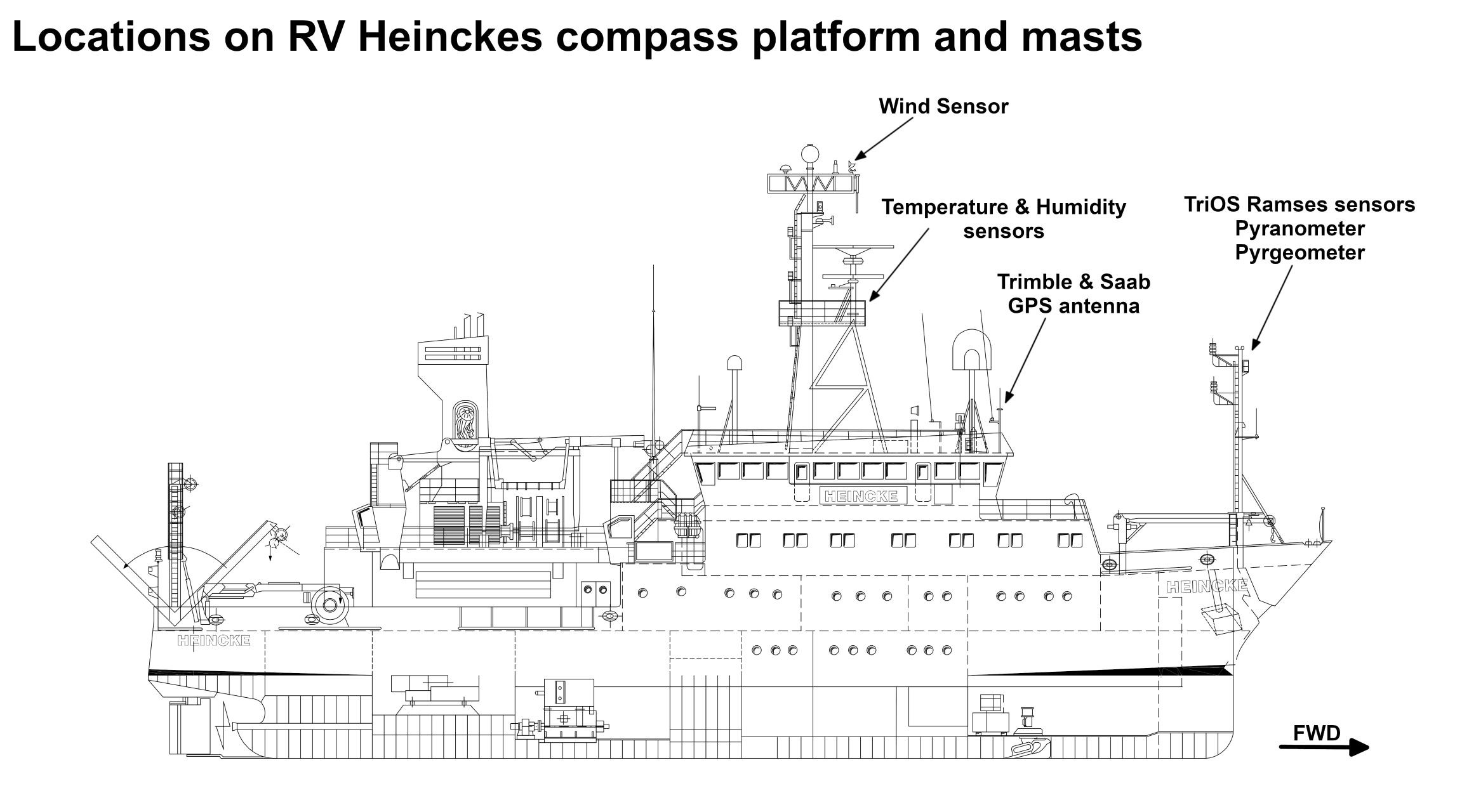
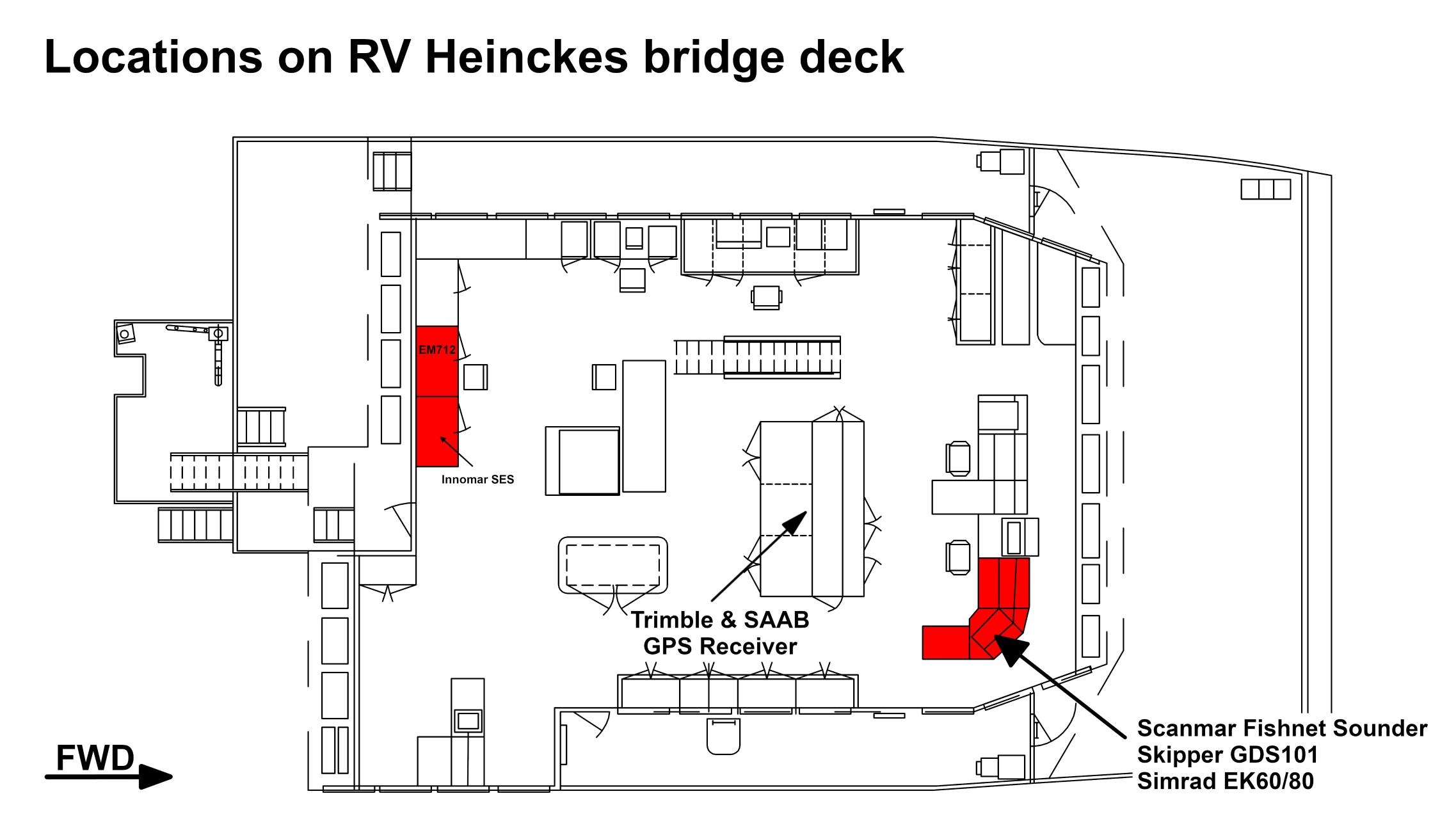
Central geographical ship's position and time standard
| Metadata (Metadata Plugin) | ||||
|---|---|---|---|---|
| Time synchronization is done by DShip receiving the data for logging. Still the data itself contains GPS time information.||||
Rawdata storage on board
| Metadata (Metadata Plugin) | ||||
|---|---|---|---|---|
| Data storage in DShip system.
||||
DShip
| Metadata (Metadata Plugin) | ||
|---|---|---|
| ||
Uncorrected measurement data. | ||
| Metadata list |
|---|
Data archiving on land
| Metadata (Metadata Plugin) | ||||
|---|---|---|---|---|
| After the cruise the DShip data set can be extracted from https://dship.awi.de/.
||||
Documentation
| Sensorweb integration | ||||
|---|---|---|---|---|
| ||||
...