...
| Sensorweb integration | ||||
|---|---|---|---|---|
| ||||
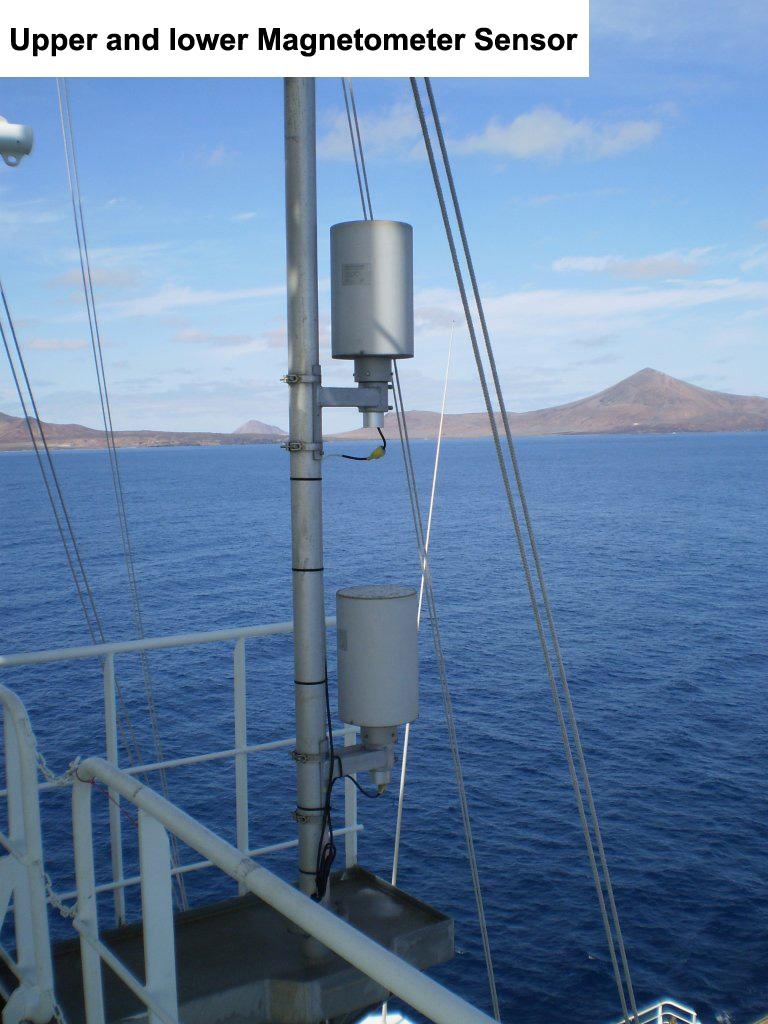
Magnetometers are used to measure the earth magnetic field. The magnetometer on board of Polarstern is a vector magnetometer that measures the vector components of the magnetic field. It consists of an upper and a lower sensor. vessel:polarstern:magnetometer (1407) |
| Sensorweb integration | ||||||||||
|---|---|---|---|---|---|---|---|---|---|---|
| ||||||||||
|
| Sensorweb integration | ||||
|---|---|---|---|---|
| ||||
 |
...
| Sensorweb integration | ||||||||||||||
|---|---|---|---|---|---|---|---|---|---|---|---|---|---|---|
| ||||||||||||||
|
Components
| Metadata (Metadata Plugin) | ||||
|---|---|---|---|---|
| The system consits of two fluxgate magnetometers mounted at the crows nest.||||
Subdevices
| Sensorweb integration | ||||||||||||
|---|---|---|---|---|---|---|---|---|---|---|---|---|
| ||||||||||||
|
Position
| Sensorweb integration | ||||||||
|---|---|---|---|---|---|---|---|---|
| ||||||||
|
...
| Sensorweb integration | ||||||||||||||||||||||||||||||||||||||||||||||||
|---|---|---|---|---|---|---|---|---|---|---|---|---|---|---|---|---|---|---|---|---|---|---|---|---|---|---|---|---|---|---|---|---|---|---|---|---|---|---|---|---|---|---|---|---|---|---|---|---|
| ||||||||||||||||||||||||||||||||||||||||||||||||
|
Central geographical ship's position and time standard
| Metadata (Metadata Plugin) | ||||
|---|---|---|---|---|
| Time stamp via NMEA telegram.
Geographical ship's position via NMEA telegram.||||
Rawdata storage on board
| Metadata (Metadata Plugin) | ||||
|---|---|---|---|---|
| Data storage in DShip system.
||||
Dship
| Metadata (Metadata Plugin) | ||||
|---|---|---|---|---|
| Uncorrected measurement data.||||
| Metadata list |
|---|
|| Device name | magnetics ||
|| Parameters| electronics temperature port \[°C\]; electronics temperature starbord \[°C\]; FP \[nT\]; FS \[nT\]; gyro heading \[deg\]; gyro pitch \[deg\]; gyro roll \[deg\]; sensor temperature port \[°C\]; sensor temperature starbord \[°C\]; XP-component \[nT\]; XS-component \[nT\]; YP-component \[nT\]; YS-component \[nT\]; ZP-component \[nT\]; ZS-component \[nT\] || |
Data archiving on land
| Metadata (Metadata Plugin) | ||
|---|---|---|
| ||
After the cruise the DShip data set can be extracted from https://dms.awi.de. | ||
| Metadata list |
|---|
Documentation
- König, M. (2006): Processing of shipborne magnetometer data and revision of the timing and geometry of the Mesozoic break-up of Gondwana = Auswertung schiffsfester Magnetometerdaten und die Neubestimmung des Zeitpunktes und der Geometrie des Mesozoischen Aufbruchs von Gondwana , Berichte zur Polar- und Meeresforschung (Reports on Polar and Marine Research), Bremerhaven, Alfred Wegener Institute for Polar and Marine Research, 525 , 137 p. .