| Note | ||
|---|---|---|
| ||
??? Please note that operations of the GPS Wave Buoys (GPS Waverider) can only be operated upon request. Request operations with the GPS Wave Buoys (GPS Waverider) require experienced scientific staff on board. The system is not operated by the ship's crew. Announce operations with the system to AWI-Logistics in sufficient time prior to the cruise . ??? |
Summary
...
and clarify the data transfer after the cruise. |
Summary
| Sensorweb integration | ||||
|---|---|---|---|---|
| ||||
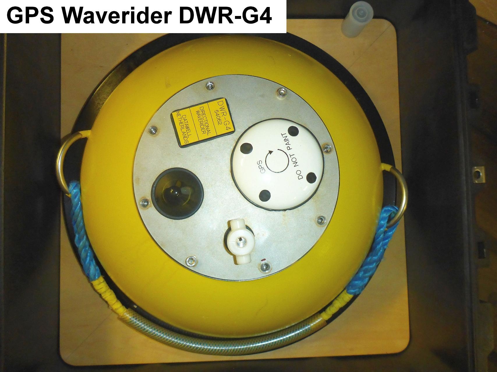
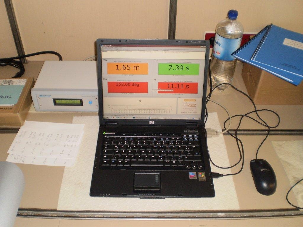
The directional waverider DWG-G4 measures wave motion, height and direction. Temperature may also be obtained. The waverider is deployed when needed. The antenna is fixed installed in the upper mast platform. The receiver and operation laptop running software SeaSaw 21 are positioned in aerologie lab A-112. |
| Sensorweb integration | ||||||||||
|---|---|---|---|---|---|---|---|---|---|---|
| ||||||||||
|
| Sensorweb integration | ||||
|---|---|---|---|---|
| ||||
   |
Contacts
| Sensorweb integration | ||||||
|---|---|---|---|---|---|---|
| ||||||
|
Components
| Metadata (Metadata Plugin) | ||
|---|---|---|
| ||
??? |
...
Position
| Sensorweb integration | ||||||||
|---|---|---|---|---|---|---|---|---|
| ||||||||
|
Data logging, storage and archiving
Logged parameters
| Sensorweb integration | |||||||||||||||
|---|---|---|---|---|---|---|---|---|---|---|---|---|---|---|---|
| |||||||||||||||
|
Central geographical ship's position and time standard
| Metadata (Metadata Plugin) | ||
|---|---|---|
| ||
??? Time synchronising ??? | ||
| Metadata (Metadata Plugin) | ||
| ||
Rawdata storage on board
| Metadata (Metadata Plugin) | ||
|---|---|---|
| ||
???
|
Dship
| Metadata (Metadata Plugin) | ||
|---|---|---|
| ||
??? No data transfer to DShip. ??? |
Data archiving on land
| Metadata (Metadata Plugin) | ||
|---|---|---|
| ||
??? After the cruise, the operator transfers the measurement data along with required meta data to AWI after consultaion with the data scientist and AWI Logistics. Then, the data (including meta data) can be extracted from https://www.pangaea.de/ (for authorized users only). ??? |
Documentation
Documentation
| Sensorweb integration | ||||
|---|---|---|---|---|
| ||||
...