...
| Note | ||
|---|---|---|
| ||
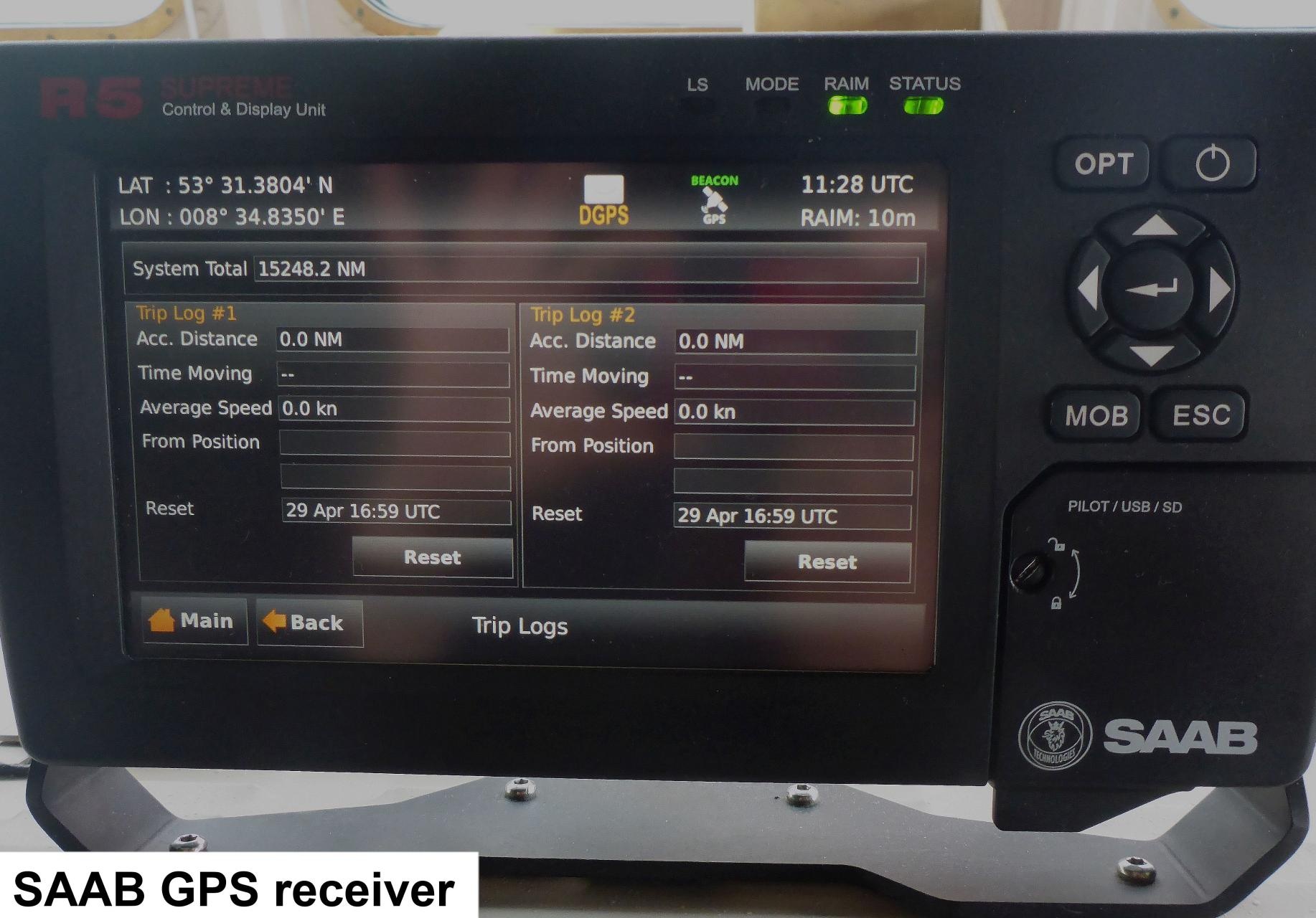
| The DGPS SAAB R5 receiver is connected to the navigation system of RV Heincke and may only be used for scientific purposes in case of breakdown of the Trimble GPS receiver. In this case the serial connections of the GPS receivers to the scientific devices can be switch over by a manual switch on the bridge. |
Summary
| Sensorweb integration | ||||
|---|---|---|---|---|
| ||||
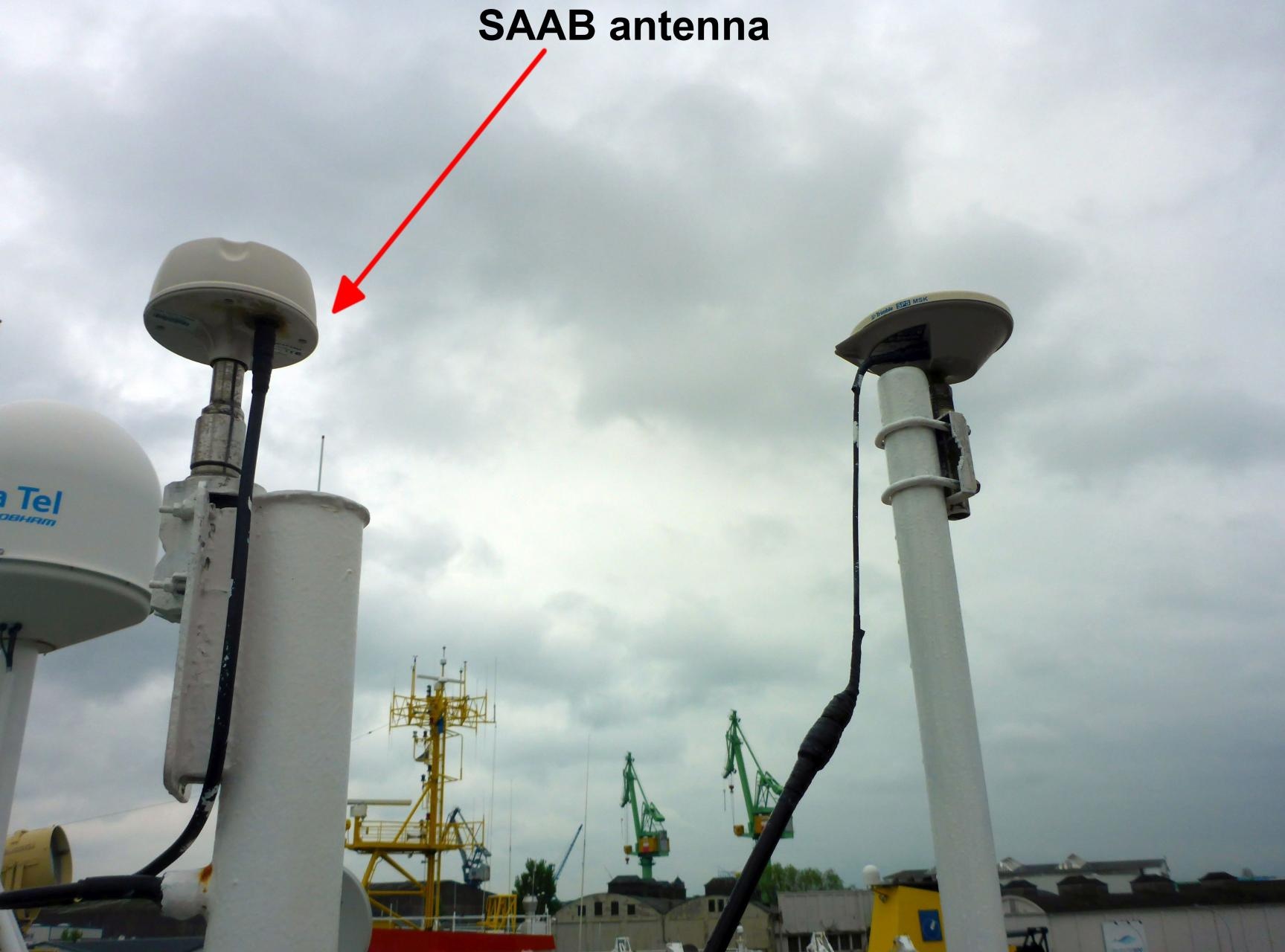
The DGPS SAAB R5 is a combined GPS, GLONASS, BeiDou and GALILEO receiver, with options for L1/L2/L5, L-Band and RTK operation with optional licenses or subscriptions. It is equipped with a MXB5 DGPS antenna. |
| Sensorweb integration | ||||||||||
|---|---|---|---|---|---|---|---|---|---|---|
| ||||||||||
|
| Sensorweb integration | ||||
|---|---|---|---|---|
| ||||
    |
Contacts
Components
| Sensorweb integration | ||||||
|---|---|---|---|---|---|---|
| ||||||
| ||||||
| Metadata (Metadata Plugin) | ||||||
Components
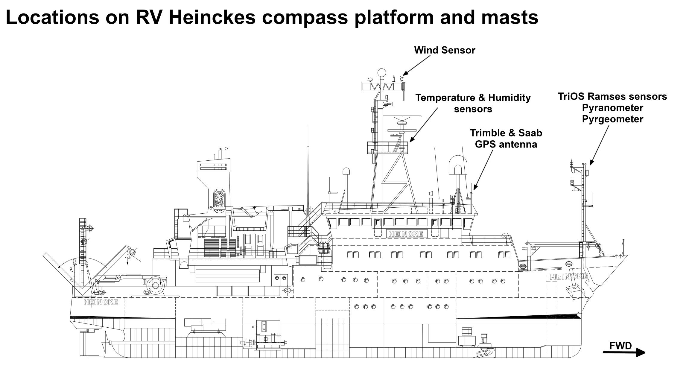
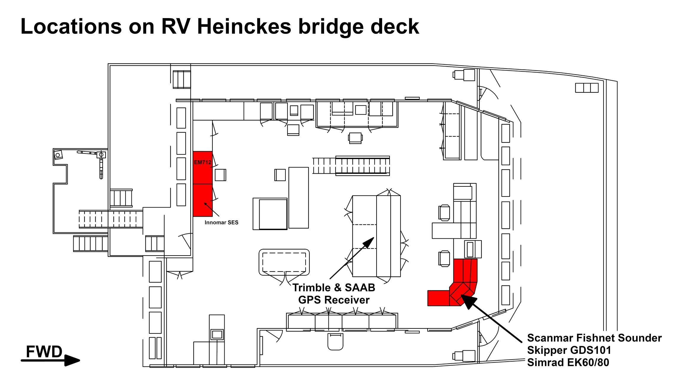
The
...
GPS
...
receiver
...
is
...
installed
...
on
...
the
...
bridge
...
deck.
...
The
...
antenna
...
is
...
installed
...
on
...
the
...
observation
...
deck.
| Sensorweb integration | ||||
|---|---|---|---|---|
| ||||
No subdevices available. |
Position
| Sensorweb integration | ||||||||
|---|---|---|---|---|---|---|---|---|
| ||||||||
|
Position
...
Data logging, storage and archiving
Logged parameters
| Sensorweb integration | ||||||||||||||||||||||||||||||
|---|---|---|---|---|---|---|---|---|---|---|---|---|---|---|---|---|---|---|---|---|---|---|---|---|---|---|---|---|---|---|
| ||||||||||||||||||||||||||||||
|
Central geographical ship's position and time standard
| Metadata (Metadata Plugin) | ||||
|---|---|---|---|---|
| Time synchronization is done by DShip receiving the data for logging. Still the data itself contain GPS time information||||
Rawdata storage on board
| Metadata (Metadata Plugin) | ||
|---|---|---|
| Data storage in ||
DShip
...
| Metadata (Metadata Plugin) | ||||
|---|---|---|---|---|
| Unevaluated and uncorrected measurement data.||||
| Metadata list |
|---|
Data archiving on land
| Metadata (Metadata Plugin) | ||
|---|---|---|
| ||
After the cruise the DShip data set can be extracted from https://dms.awi.de. |
| Metadata list |
|---|
|| File format(s) | *.dat ||
|| Calibration certificates | NO || |
...
Documentation
| Sensorweb integration | ||||
|---|---|---|---|---|
| ||||