...
| Note |
|---|
|
The Motion Sensors (Hydrins 1 and Hydrins 2) are Sensor PHINS is operated by ship's command only. |
Summary
Hydrins 1
Hydrins 2
Contacts
Components
| Metadata (Metadata Plugin) |
|---|
|
The sensor is an essential device providing motion and position data for a large number of scientific instruments. The system is receiving posiion data from GPS receiver and is delivering positions centered to Hydrins 1.
Several output interfaces are defined to deliver different formatted data strings with different frequency to customers.
The main device is a three component laser accerelometer. It is installed in Gravity Meter Room F-632. For backup there is a second system installed.
Downstream equipment of Hydrins 1 and Hydrins 2 is ment to select on of both Hydrins to be active one and to deliver data to customers. Additionally converter boxes (Provided by firm FIELAX) are installed to split outgoing data stream and to convert it into several formats requested by customers. Nautical system NACOS is receiving position data from Hydrins as backup. |
Position
Hydrins 1
Hydrins 2
| Sensorweb integration |
|---|
| urn | vessel:heincke:phins_ph-425 |
|---|
| contenttype | Summary |
|---|
|
PHINS (Photonic Inertial Navigation System) outputs position, heading, roll, pitch, depth, velocity, and heave. Its high accuracy inertial measurement unit is based on IXSEA's FOG technology coupled with an embedded digital signal processor that runs an advanced Kalman filter. |
| Sensorweb integration |
|---|
| urn | vessel:heincke:phins_ph-425 |
|---|
| contenttype | Metadata |
|---|
|
| Manufacturer | iXblue |
|---|
| Model | PHINS 6005211 |
|---|
| Serial No. | PH-425 |
|---|
| Type | motion sensor |
|---|
| REGISTRY-Link | ↪ REGISTRY (8573) |
|---|
|
| Sensorweb integration |
|---|
| urn | vessel:heincke:phins_ph-425 |
|---|
| contenttype | Images |
|---|
|
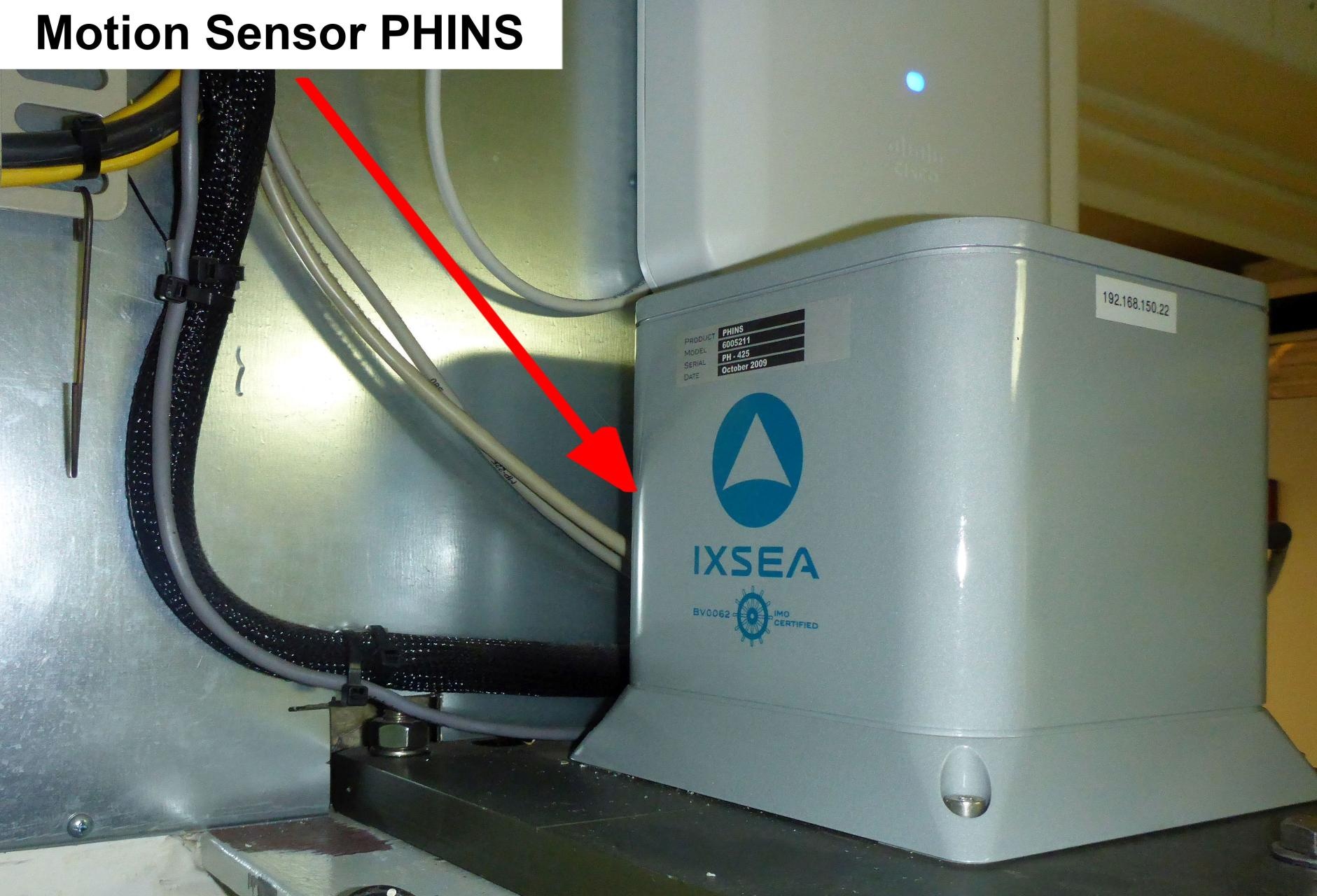 Image Added Image Added 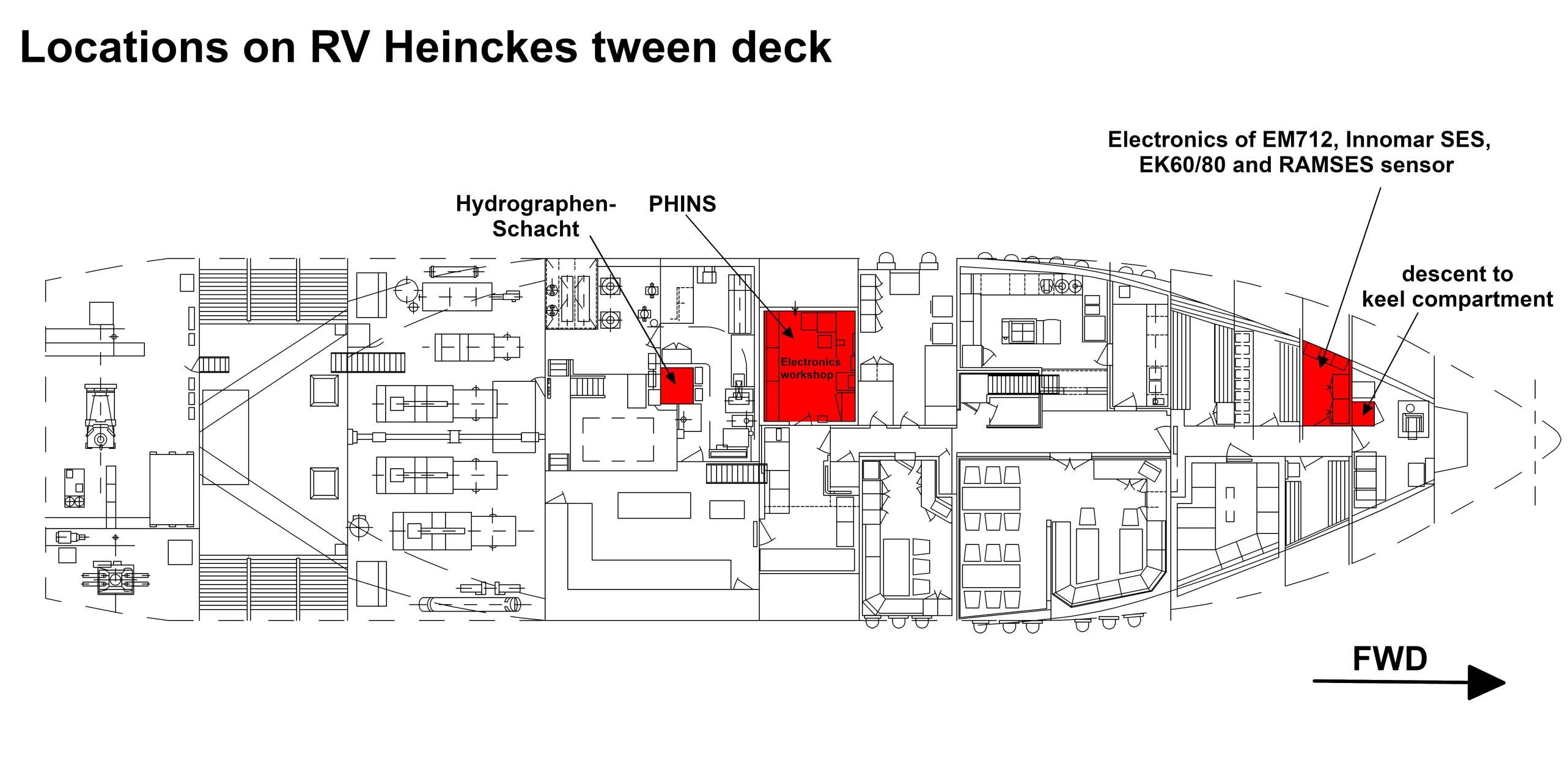 Image Added Image Added 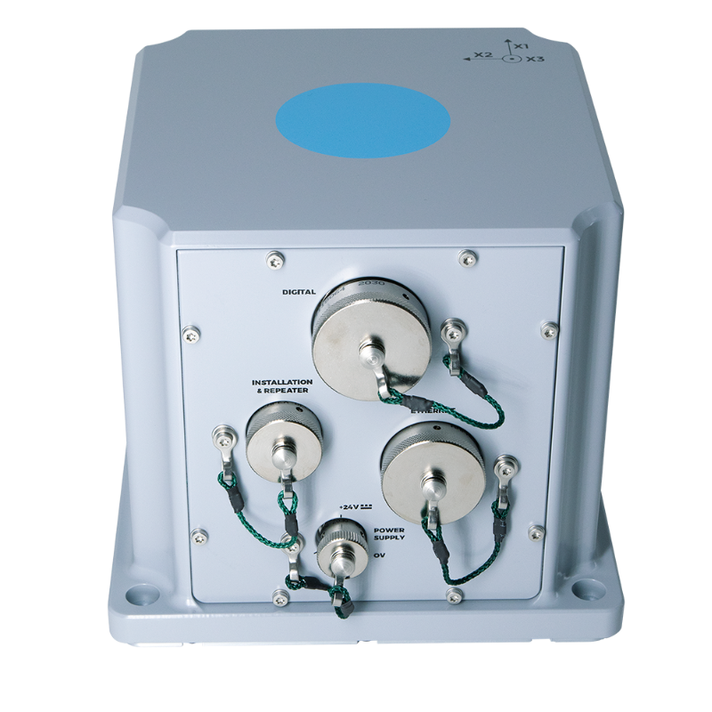 Image Added Image Added |
Contacts
| Sensorweb integration |
|---|
| urn | vessel:heincke:phins_ph-425 |
|---|
| contenttype | Contacts |
|---|
|
| Name | Institution | Role |
|---|
| Ralf Krocker | Alfred Wegener Institute, Helmholtz Centre for Polar and Marine Research | Engineer In Charge |
|
Components
PHINS system consists of the sensor and the configuration and monitoring software IXRepeater.
| Sensorweb integration |
|---|
| urn | vessel:heincke:phins_ph-425 |
|---|
| contenttype | Subdevices |
|---|
|
No subdevices available. |
Position
| Sensorweb integration |
|---|
| urn | vessel:heincke:phins_ph-425 |
|---|
| contenttype | LocalFrame |
|---|
|
| Info | xyz-position of PHINS from Alignment Survey Report RV Heincke (January 2016) | | X | 25.952 m
(Positive X axis is forward and along the centerline of the vessel with X0 at the Stern point of the vessel.) | | Y | 0.847 m
(Positive Y axis is portside of centerline with Y0 at centerline at the Very stern point of the vessel.) | | Z | 5.027 m
(Positive Z axis is upwards of basis. Z0 is set to the hydrophone on midship.) |
|
Data logging, storage and archiving
Logged parameters
| Sensorweb integration |
|---|
| urn | vessel:heincke:phins_ph-425 |
|---|
| contenttype | Parameters |
|---|
|
| Parameter | O2ARegistry Output Type | Unit |
|---|
| heading | attitude | deg | | heave | attitude | m | | latitude | latitude | deg | | longitude | longitude | deg | | pitch | attitude | deg | | roll | attitude | deg |
|
Central geographical ship's position and time standard
| Metadata (Metadata Plugin) |
|---|
|
Time synchronising is received from responsible Trimble GPS receiver (Hydrins 1 is receiving data from Trimble 1, Hydrins 2 from Trimble 2).
Geographical ship's position is received from responsible Trimble GPS receiver (Hydrins 1 is receiving data from Trimble 1, Hydrins 2 from Trimble 2). Positions provided by Hydrins 1 and Hydrins 2 are both centered to Hydrins 1. |
|
Rawdata storage on board
| Metadata (Metadata Plugin) |
|---|
| Data storage in
|
DShip
...
Dship
| Metadata (Metadata Plugin) |
|---|
| Unevaluated measurement data. |
|
| Metadata list |
|---|
|| Device name | hydrins ||
|| Parameters | course \[deg\]; gyro heading \[deg\]; gyro heading ang. rate \[°/s\]; gyro pitch \[deg\]; gyro pitch ang. rate \[°/s\]; heave \[m\]; position latitude \[°\]; position longitude \[°\]; speed \[kn\]; x-velocity \[m/s\]; y-velocity \[m/s\]; z-velocity \[m/s\] || |
|---|
|
Data archiving on land
| Metadata (Metadata Plugin) |
|---|
|
After the cruise the DShip data set can be extracted from https://dms.awi.de.
Quality checked positions are published as "Master Track" in PANGAEA https://www.pangaea.de/ (for authorized users only). |
| Metadata list |
|---|
|| File format(s) | *.txt ||
|| Calibration certificates | NO || |
...
Documentation
| Sensorweb integration |
|---|
| urn | vessel:heincke:phins_ph-425 |
|---|
| contenttype | Resources |
|---|
|
|