...
| Note |
|---|
|
Please note that operations of the Fishing Echo Sounder Simrad EK 60 / EK 80 requires experienced scientific staff on board and can be only operated on request. The system is not operated by the ship's crew. Announce Request operations with the Fishing the Fishing Echo Sounder Simrad EK 60 / EK 80 to AWI-Logistics in sufficient time prior to the cruise and clarify the data transfer after the cruise. Data quality of Fishing Echo Sounder Simrad EK 60 / EK 80 is decreased by operating other Echo Sounders. Repeatable disturbances wered were detected from simultaneously operating a) POSIDONIA, b) Deep Water Sounder Simrad EA 500, c) Sonar Doppler Speed Log DOLOG and dc) Sediment Echo Sounder Parasound P70. Switch off these Echo Sounders for high data quality. |
Summary
...
html-Links Spaces:
Summary
Description
Contacts
Parameters
Resources
Events
Subdevices
Images
Position
----------------------------------------------------------------------
Additional information
Transducer Frequency
| Metadata (Metadata Plugin) |
|---|
|
18, 38, 70, 120, 200kHz |
External Manuals
 Image Removed
Komponenten
Das System besteht aus den vier Schwingern mit Einbauort im Kastenkiel, den vier GPTs im Geräteraum sowie dem PC im wissenschaftlichen Arbeitsraum. Auf dem PC ist eine herstellerspezifische Datenerfassungs - und Verarbeitungs-Software installiert.
Schwinger
Das System beinhalten die fünf "split beam" Schwinger ES-18, ES-38B, ES-70C, ES-120C und ES-200C.
...
38 kHz
...
70 kHz
...
120 und 200 kHz
...
 Image Removed
...
 Image Removed
...
 Image Removed
Eine Liste der an Bord befindlichen Schwinger mit ihren Frequenzen finden Sie hier.
Zentrale geographische Schiffsposition und Zeitnormal
Die Zeitsynchronisierung der PCs wird über die Zugehörigkeit zur Windows-Domain geregelt. In den Datendateien wird zusätzlich der NMEA-String ZDA abgespeichert.
Die geographische Schiffsposition wird mit dem NMEA-String an den Master-PC übergeben und in den Datendateien abgespeichert.
Eine Zentrierung der GPS-Position auf die Schwinger findet nicht statt.
Datenspeicherung und Archivierung
...
*Rohdaten an Bord:* Die herstellerspezifische Datenerfassungs\- und Verarbeitungs-Software ER60 erzeugt Rohdaten mit folgender Dateistruktur: || Stammverzeichnis || Verzeichnisname || Dateiname || | \\polsrv1\data01\fishsounder\ | Reisenummer | Dateipräfix-Dyyyymmdd-Thhmmss.raw | mit yyyy = Jahr; mm = Monat; dd = Tag; hh = Stunde; mm = Minute; ss = Sekunde. so z.B.: || Stammverzeichnis || Verzeichnisname || Dateiname || | \\polsrv1\data01\fishsounder\ | ANT25-3\ | ANT25_3-D20090113-T144735.raw | | | | ANT25_3-D20090113-T145849.raw| Dabei belegt die Dateistruktur das folgende Volumen: {metadata-list}|| Volumen (MB pro Tag) ca. | 3500 || || Anzahl Dateien pro Tag ca. | 100 ||{metadata-list} *Rohdaten an Land:* Je nach Absprache mit der AWI-Logistik und mit dem oben genannten Geräteverantwortlichen besteht die Möglichkeit die gewonnenen Rohdaten, nachdem sie mit Metadaten versehen worden sind, über [PANGAEA|http://www.pangaea.de/search?l&q=polarstern] zur Verfügung zu stellen.| integration |
|---|
| urn | vessel:polarstern:simrad_ek80_ps |
|---|
| contenttype | Summary |
|---|
|
The sounder operates several frequencies simultaneously thus allowing to detect fish in different depths. |
| Sensorweb integration |
|---|
| urn | vessel:polarstern:simrad_ek80_ps |
|---|
| contenttype | Metadata |
|---|
|
| Manufacturer | Kongsberg |
|---|
| Model | Simrad EK 80 |
|---|
| Serial No. | n/a |
|---|
| Type | echo sounder |
|---|
| REGISTRY-Link | ↪ REGISTRY (8406) |
|---|
|
| Sensorweb integration |
|---|
| urn | vessel:polarstern:simrad_ek80_ps |
|---|
| contenttype | Images |
|---|
|
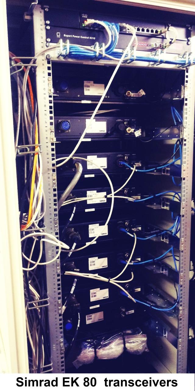 Image Added Image Added 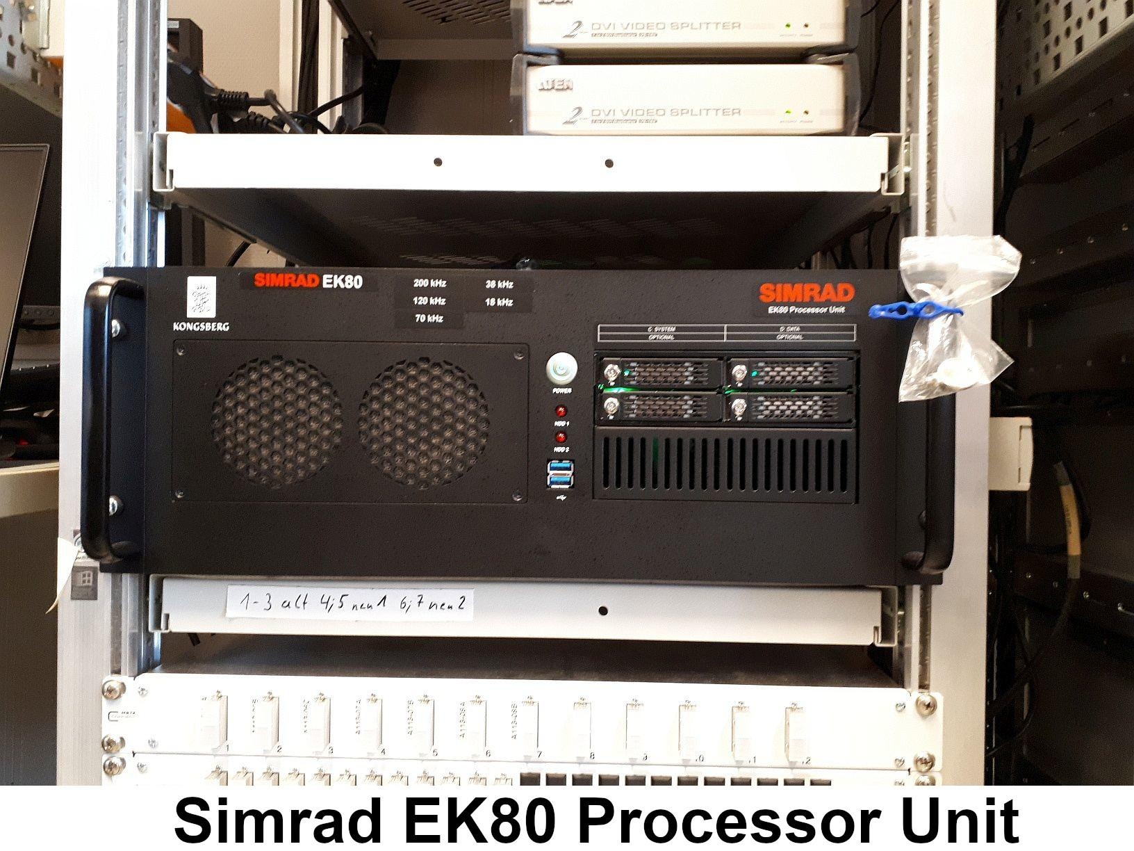 Image Added Image Added 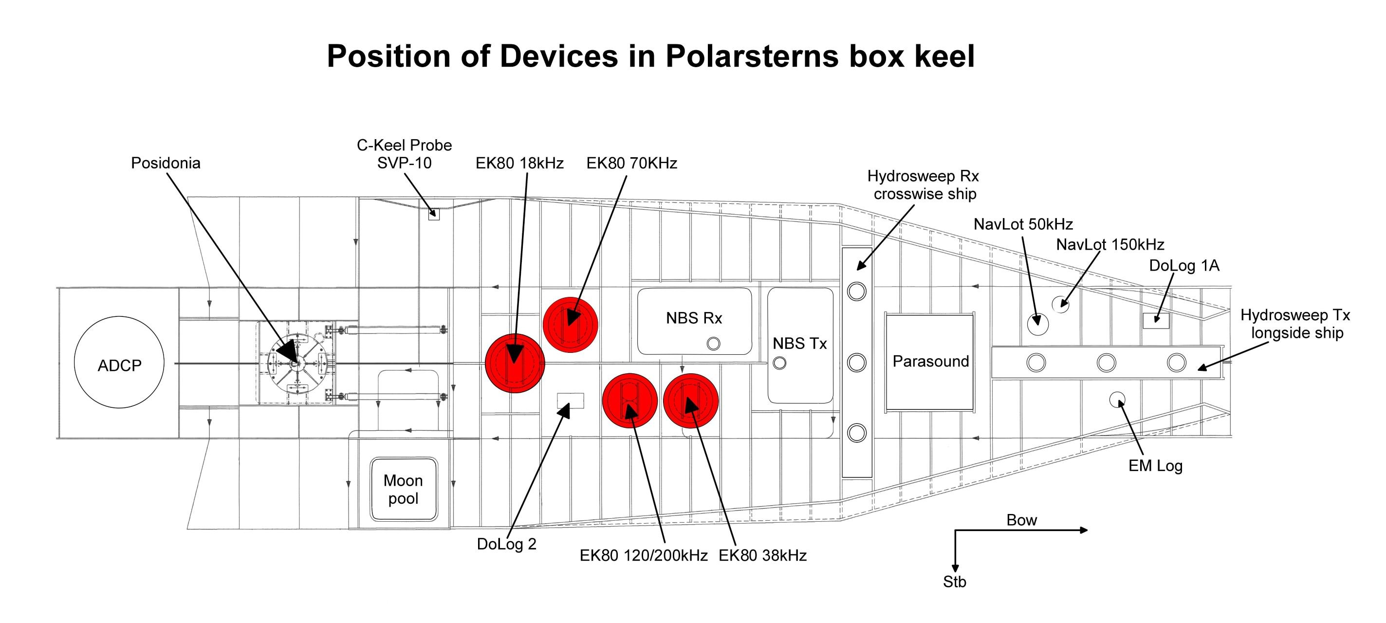 Image Added Image Added |
Transducer Frequency:
| Metadata (Metadata Plugin) |
|---|
|
|
Contacts
| Sensorweb integration |
|---|
| urn | vessel:polarstern:simrad_ek80_ps |
|---|
| contenttype | Contacts |
|---|
|
| Name | Institution | Role |
|---|
| Sören Krägefsky | Alfred Wegener Institute, Helmholtz Centre for Polar and Marine Research | Engineer In Charge, Principal Investigator, Data Scientist | | Alfred Wegener Institute for Polar and Marine Research | Alfred Wegener Institute, Helmholtz Centre for Polar and Marine Research | Owner |
|
Components
| Metadata (Metadata Plugin) |
|---|
|
|
Subdevices
| Sensorweb integration |
|---|
| urn | vessel:polarstern:simrad_ek80_ps |
|---|
| contenttype | Subdevices |
|---|
|
|
Position
| Sensorweb integration |
|---|
| urn | vessel:polarstern:simrad_ek80_ps |
|---|
| contenttype | LocalFrame |
|---|
|
| Info | xyz-position calculated from Alignment Survey Report RV Polarstern (2016), transducers located in box keel, electronics located in E525, computers located in A113 | | X | 73.14 m
(X-0 is at the center of der rudder (ref. design drawing of the vessel), positive X-axis is forward and along vessel centerline) | | Y | 0.022 m
(Y-0 at centerline, positive Y-axis is portside ) | | Z | 0.012 m
(Z-0 is set to the lowest point of the keel, positive Z-axis is upwards) |
|
Data logging, storage and archiving
Logged parameters
| Sensorweb integration |
|---|
| urn | vessel:polarstern:simrad_ek80_ps |
|---|
| contenttype | Parameters |
|---|
|
| Parameter | O2ARegistry Output Type | Unit |
|---|
| depth | depth | m |
|
Central geographical ship's position and time standard
| Metadata (Metadata Plugin) |
|---|
|
|
Rawdata storage on board
| Metadata (Metadata Plugin) |
|---|
|
|
Dship
| Metadata (Metadata Plugin) |
|---|
|
|
Data archiving on land
| Metadata (Metadata Plugin) |
|---|
|
|
Calibration
The EK80 system must be calibrated. Ideally, the calibration is executed before and after the measurement in the working area. So, the calibration parameters can be defined dependent the actual water conditions. For this reason a calibration on previous cruises will not lead to optimal results.
The calibration is performed using three winch systems positioning the calibration sphere below the transducers.
The winch system as well as their control must operated by the scientists. The laboratory electronic engineer may assist the setup of the system.
A calibration must be planned like all other scrientific work prior the cruise, because the calibration work needs time. Ideally half a day is requested, but will take longer (may be a whole day), if weather conditions decrease.
Ideally the calibration is performed in calm sea without wind. If wind forces the drift of the ship, the winches will not hang vertical anymore but will also drift. Under this conditions it is very difficult, to move the calibration sphere to the requested locations.
Furthermore, the calibration must be planned, because calibration equipment is not permanently on board. The winches etc. need storage capacities and are stored during harbour visit in Bremerhaven, only.
If you are planning to execute a calibration, please add the that work in formula "Einsatzplanung" and step in contact with schiffskoord@awi.de for further planning.
Documentation
| Sensorweb integration |
|---|
| urn | vessel:polarstern:simrad_ek80_ps |
|---|
| contenttype | Resources |
|---|
|
|
...
...