...
| Note |
|---|
|
Please note that operations of the Multibeam Echo Sounder Hydrosweep DS3 EM712 requires experienced scientific staff on board and can be only operated upon request. The system is not operated by the ship's crew. Request operations with the Multibeam Echo Sounder Hydrosweep DS3 to AWI-Bathymetry and EM712 to AWI-Logistics in sufficient time prior to the cruise and clarify the data transfer after the cruise. |
Summary
| Sensorweb integration |
|---|
| urn | vessel:heincke:em712pu_sn10071 |
|---|
| contenttype | Summary |
|---|
|
Multibeam EM712 is a high-resolution seafloor mapping system. It is suitable for water depths up to 2000m depending on the configuration of the transducers. Maximum ping rate is 30Hz and maximum fan width 140° and depth resolution 1cm. Data from the water column may also be stored. |
| Sensorweb integration |
|---|
| urn | vessel:heincke:em712pu_sn10071 |
|---|
| contenttype | Metadata |
|---|
|
| Manufacturer | Kongsberg Maritime AS |
|---|
| Model | 405125 |
|---|
| Serial No. | 10071 |
|---|
| Type | multi-beam echosounder |
|---|
| REGISTRY-Link | ↪ REGISTRY (8547) |
|---|
|
Transducer Frequency
| Metadata (Metadata Plugin) |
|---|
|
13-17 kHz |
Contacts
Components
Contacts
| Sensorweb integration |
|---|
| urn | vessel:heincke:em712pu_sn10071 |
|---|
| contenttype | Contacts |
|---|
|
| Name | Institution | Role |
|---|
| FIELAX GmbH | FIELAX Gesellschaft für wissenschaftliche Datenverarbeitung mbH | Engineer In Charge |
|
| Metadata (Metadata Plugin) |
|---|
0 |
Components
The
...
EM712 consists
...
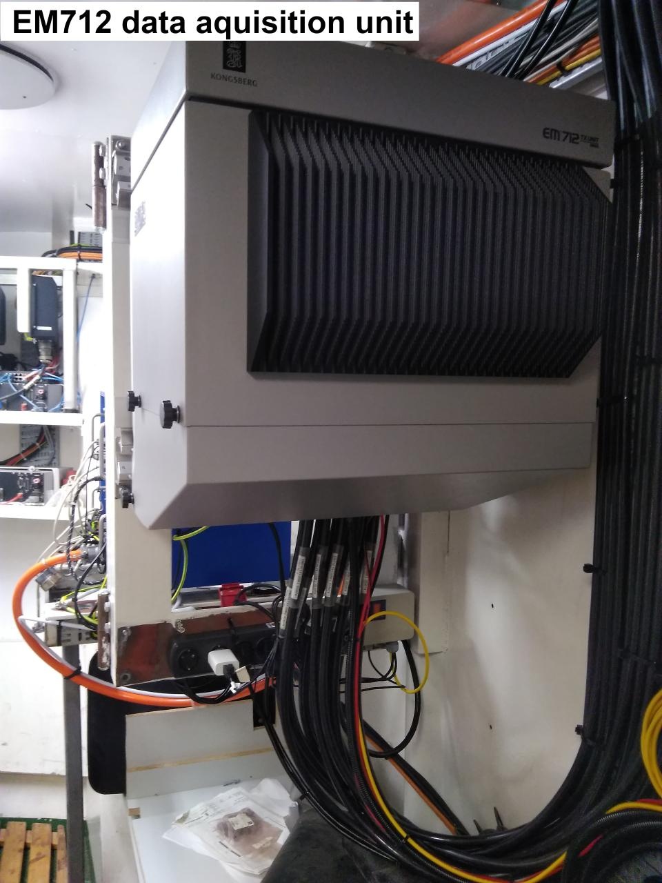
of a transducer array for transmitting (Tx) and an array for receiving (Rx), the transceiver unit, the data aquisition PC with the aquisition software SIS and two processing PCs (bridge and Messraum) with the software Caris HIPS/SIPS.
The software "Seafloor Information System" (SIS) contains several graphic displays for quality checks and for system calibration as well as other tools. SIS supports an online/realtime data cleansing. Both SIS and the processing software Caris HIPS/SIPS are protected via a dongle. Please contact the bridge staff for suppport.
Sound velocity can alternatively been received from two sensors: from Sound Velocity Probe (Valeport Mini SVS) or calculated velocities from sensor Thermosalinograph.
Ships position is received from GPS Receiver Trimble Marine SPS461 . Ships orientation is received from Motion Sensor (PHINS).
Subdevices
| Sensorweb integration |
|---|
| urn | vessel:heincke:em712pu_sn10071 |
|---|
| contenttype | Subdevices |
|---|
|
|
Position
| Sensorweb integration |
|---|
| urn | vessel:heincke:em712pu_sn10071 |
|---|
| contenttype | LocalFrame |
|---|
|
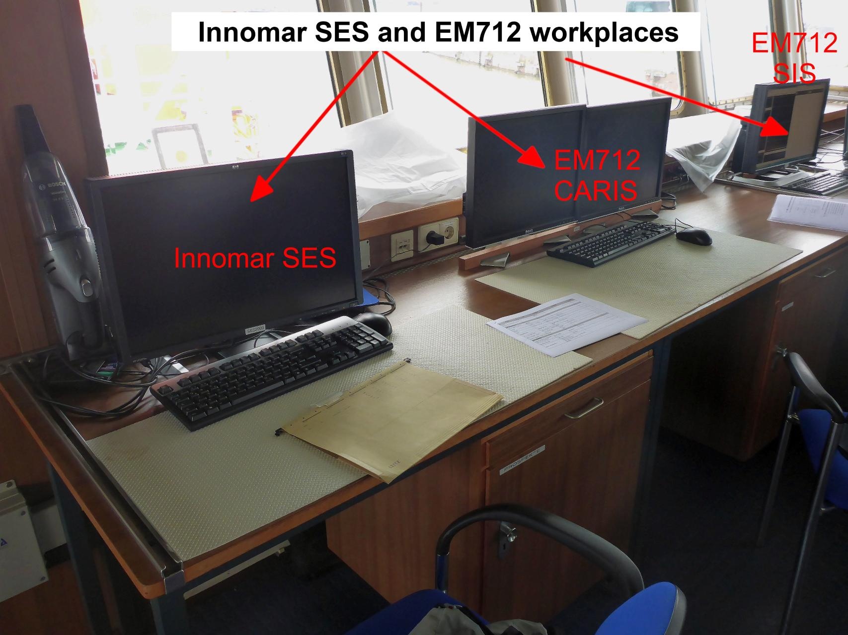
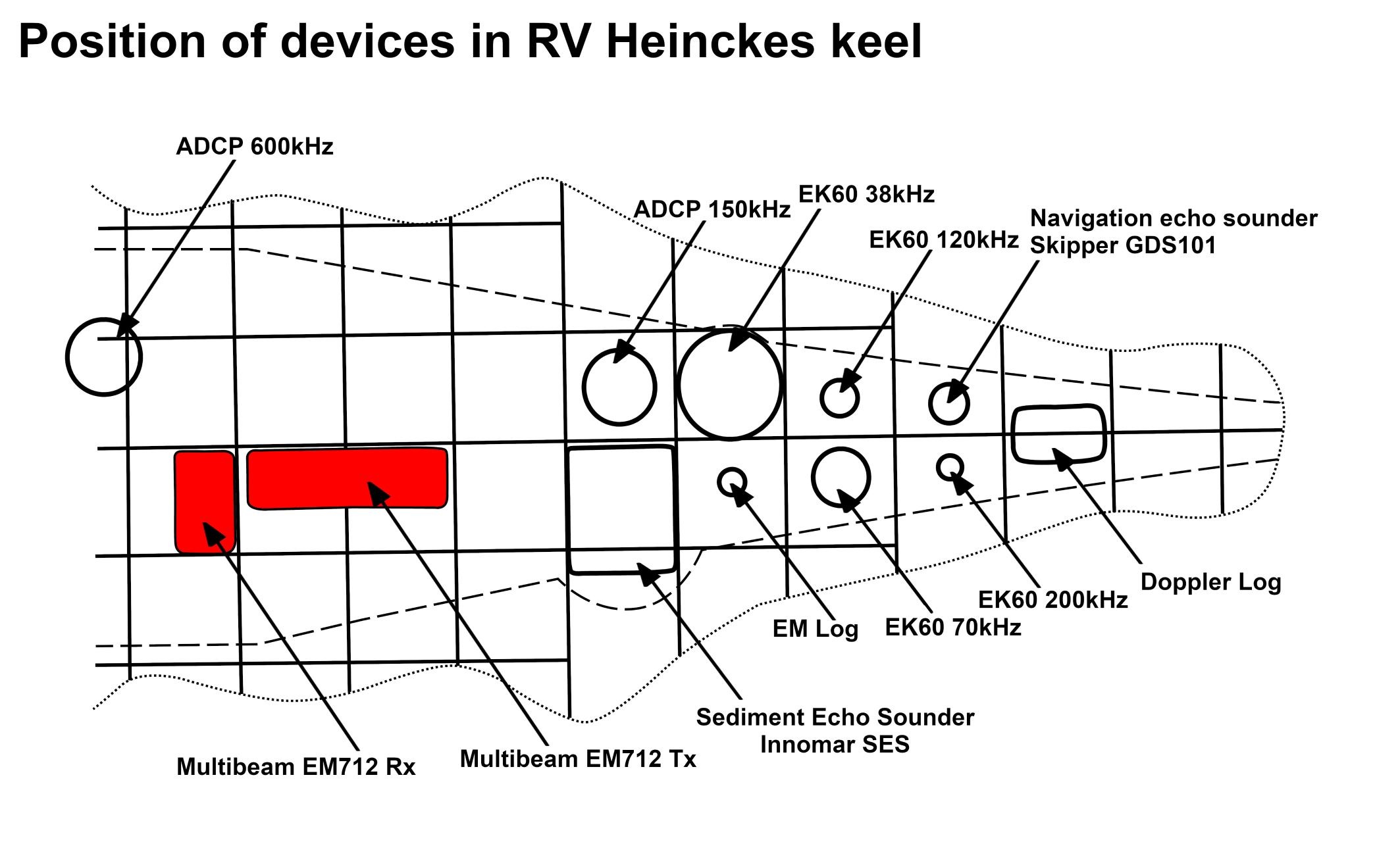
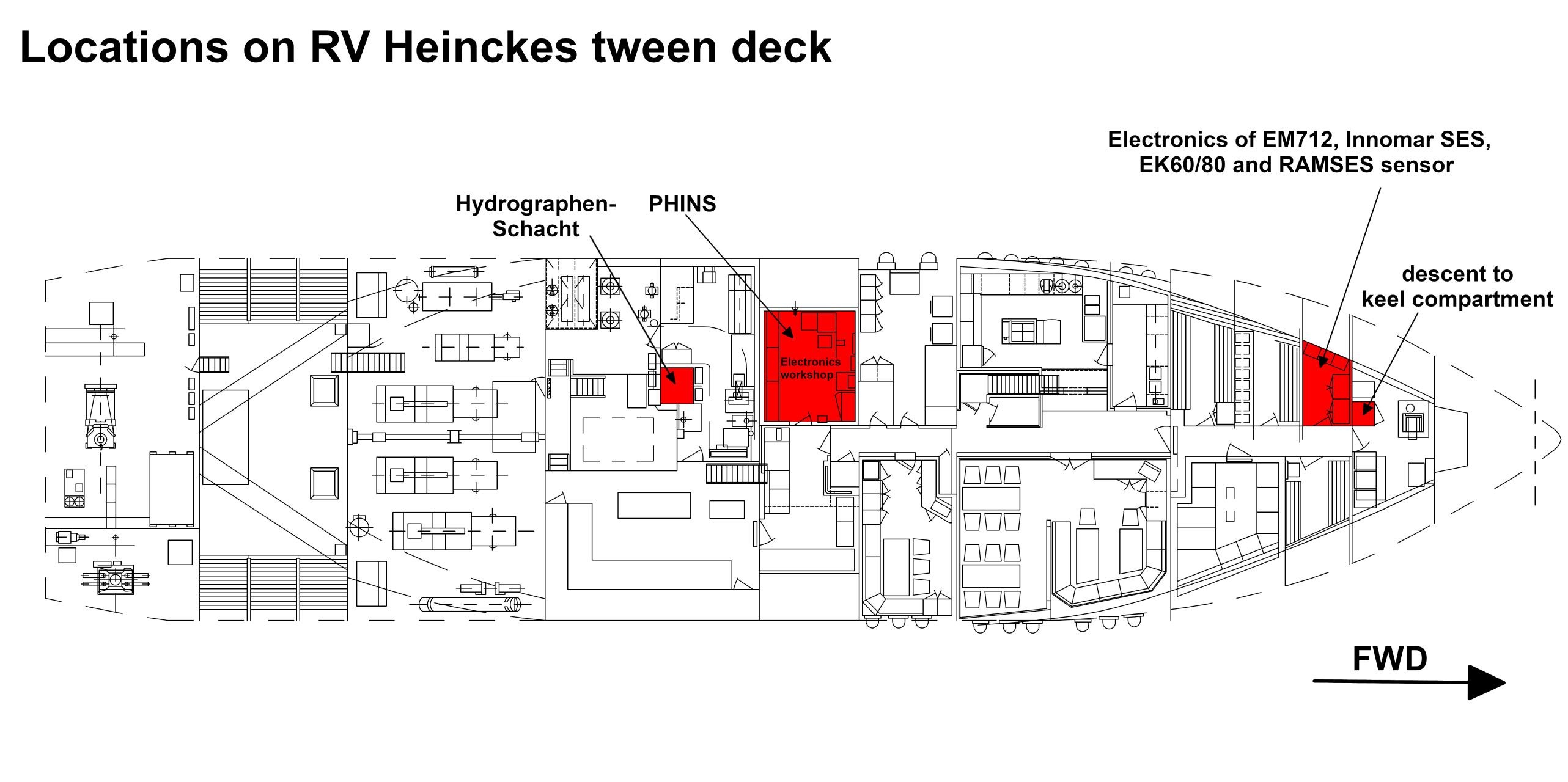
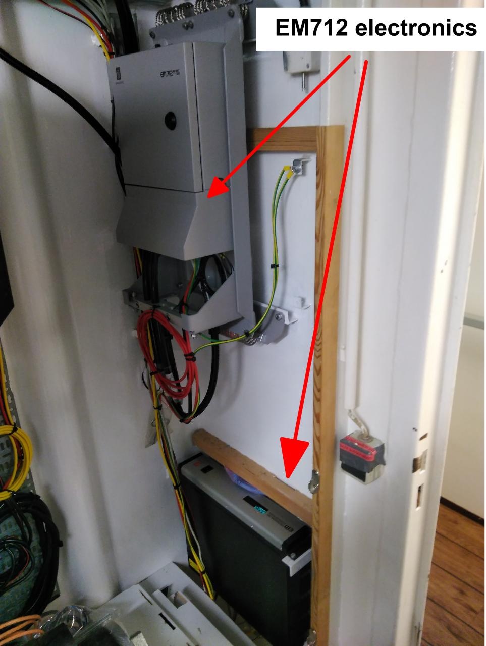
| Info | The system consists of several units. Transducer arrays are installed in the keel of RV Heincke. Electronics are found in the Lotgeraeteraum. Work places are situated on the bridge and in the Messraum. | | X | 0.0 (no unit given)
(no description given) | | Y | 0.0 (no unit given)
(no description given) | | Z | 0.0 (no unit given)
(no description given) |
|
Subdevices
Position
Data logging, storage and archiving
Logged parameters
| Sensorweb integration |
|---|
| urn | vessel:heincke:em712pu_sn10071 |
|---|
| contenttype | Parameters |
|---|
|
| Parameter | O2ARegistry Output Type | Unit |
|---|
| depth | depth | m |
|
Central geographical ship's position and time standard
| Metadata (Metadata Plugin) |
|---|
|
Time synchronising of the computers is regulated via Polarstern GPS.
Geographical ship's position via HYDRINS centering to HYDRINS offset correction in AHC. |
|
Rawdata storage on board
| Metadata (Metadata Plugin) |
|---|
| Mass data: The data acquisition and processing software creates rawdata to the directory structure of the mass storage. A reduced data set is also stored in DShip sytem. |
|
| Metadata list |
|---|
|| root directory | data01 ||
|| directory name | CruiseNo \\ e.g. \\ ANT25_3 ||
|| file name | HS3PHF_YYYY-MM-DDThhmmssZ_XXXXXXXX.asd.acf ||
|| Data volume (MB per day) ca | 4000 ||
|| Number of files per day ca | 48 || |
|
Dship
| Metadata (Metadata Plugin) |
|---|
| Reduced set of measurement data. |
|
| Metadata list |
|---|
|| Device name | hydrosweep ||
|| Parameters | depth \[m\] || |
|
Data archiving on land
| Metadata (Metadata Plugin) |
|---|
|
After the cruise, the operator transfers the measurement data along with required meta data to AWI after consultaion with the data scientist and AWI Logistics. Then, the data including meta data can be extracted from https://www.pangaea.de/ (for authorized users only). The reduced DShip data set can be extracted from https://dms.awi.de. |
| Metadata list |
|---|
|| File format(s) | *.asf, *.hsx ||
|| Calibration certificates | NO || |
Documentation
Documentation
| Sensorweb integration |
|---|
| urn | vessel:heincke:em712pu_sn10071 |
|---|
| contenttype | Resources |
|---|
|
|
...