| Note |
|---|
|
The Navigation Echo Sounder is part of nautical equipment. The operation belongs to the bridge only. |
Summary
| Sensorweb integration |
|---|
| urn | vessel:heincke:navigation_sounder |
|---|
| contenttype | Summary |
|---|
|
The navigation echo sounder delivers depth information in order to avoid grounding and ensure save ship navigation. vessel:heincke:navigation_sounder (2348) |
| Sensorweb integration |
|---|
| urn | vessel:heincke:navigation_sounder |
|---|
| contenttype | Metadata |
|---|
|
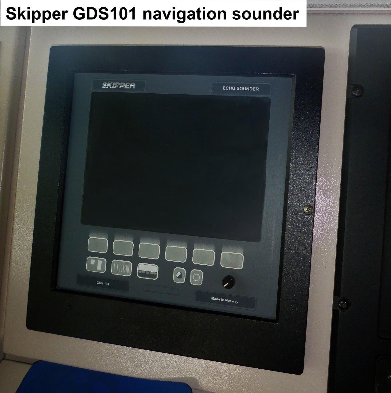
| Manufacturer | Skipper Electronics AS |
|---|
| Model | Skipper GDS 101 |
|---|
| Serial No. | n/a |
|---|
| Type | echo sounder |
|---|
|
| Sensorweb integration |
|---|
| urn | vessel:heincke:navigation_sounder |
|---|
| contenttype | Images |
|---|
|
|
Transducer Frequency:
| Metadata (Metadata Plugin) |
|---|
|
30, 50 and 200 kHz |
| Sensorweb integration |
|---|
| urn | vessel:heincke:navigation_sounder |
|---|
| contenttype | Contacts |
|---|
|
| Name | Institution | Role |
|---|
| Reederei Briese | Reederei Briese | Engineer In Charge |
|
Components
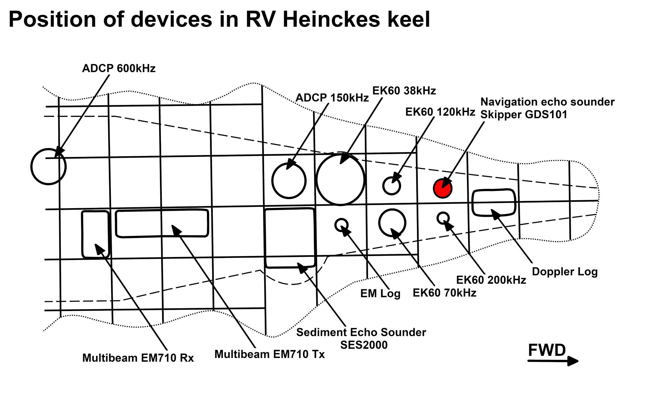
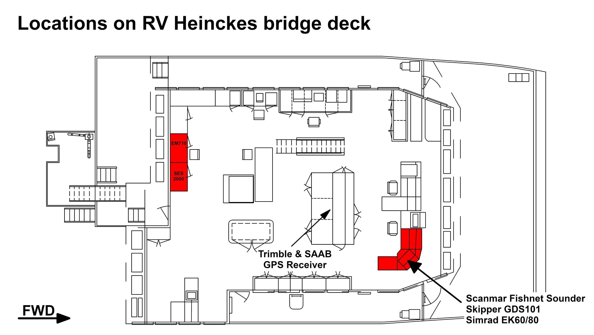
The system consists of the Navigation Sounder transducer located in the keel and an operational unit on the bridge deck.
| Sensorweb integration |
|---|
| urn | vessel:heincke:navigation_sounder |
|---|
| contenttype | Subdevices |
|---|
|
No subdevices available. |
Position
| Sensorweb integration |
|---|
| urn | vessel:heincke:navigation_sounder |
|---|
| contenttype | LocalFrame |
|---|
|
| Info | xyz-position of transducer from Alignment Survey Report RV Heincke (January 2016). The console is located on the bridge deck. | | X | 46.668 m
(Positive X axis is forward and along the centerline of the vessel with X0 at the Stern point of the vessel.) | | Y | 0.138 m
(Positive Y axis is portside of centerline with Y0 at centerline at the Very stern point of the vessel.) | | Z | -0.077 m
(Positive Z axis is upwards of basis. Z0 is set to the hydrophone on midship.) |
|
Data logging, storage and archiving
Logged parameters
| Sensorweb integration |
|---|
| urn | vessel:heincke:navigation_sounder |
|---|
| contenttype | Parameters |
|---|
|
| Parameter | Sensor Output Type | Unit |
|---|
| depth | depth | m |
|
Central geographical ship's position and time standard
| Metadata (Metadata Plugin) |
|---|
|
Time synchronization and geographical positioning is done by DShip receiving the data for logging |
Rawdata storage on board
| Metadata (Metadata Plugin) |
|---|
|
Data storage in DShip system.
|
Dship
| Metadata (Metadata Plugin) |
|---|
|
Uncorrected measurement data. |
| Metadata list |
|---|
|| Device name | Navlot ||
|| Parameters| Depth \[m\] || |
Data archiving on land
| Metadata (Metadata Plugin) |
|---|
|
After the cruise the DShip data set can be extracted from https://dms.awi.de.
|
Documentation
| Sensorweb integration |
|---|
| urn | vessel:heincke:navigation_sounder |
|---|
| contenttype | Resources |
|---|
|
|