Versions Compared

Key

  • This line was added.
  • This line was removed.
  • Formatting was changed.
Comment: Automatically updated by Sensor2Confluence-Transporter (fsupport@binf02p165)

...

Sensorweb integration
urnvessel:polarstern:hydrosweep_ds3
contenttypeSummary

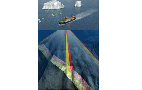
The Multibeam Echo Sounder uses several frequencies to map the topography of the seafloor. It also provides information about the texture of the seafloor as well as the structure of the water body.

Sensorweb integration
urnvessel:polarstern:hydrosweep_ds3
contenttypeMetadata
ManufacturerTeledyne RESON (ATLAS Hydrographic before takeover)
ModelHydrosweep DS3
Serial No.n/a
Typemulti-beam echosounder
Sensorweb integration
urnvessel:polarstern:hydrosweep_ds3
contenttypeImages

Image Added Image Added Image Added

Transducer Frequency

Metadata (Metadata Plugin)
0Frequency
13-17 kHz

...

Sensorweb integration
urnvessel:polarstern:hydrosweep_ds3
contenttypeContacts
Name Institution Role
Boris DorschelAlfred-Wegener-Institute for Polar and Marine ResearchEngineer In Charge
Boris DorschelAlfred-Wegener-Institute for Polar and Marine ResearchData Scientist


Components

Metadata (Metadata Plugin)
0Components
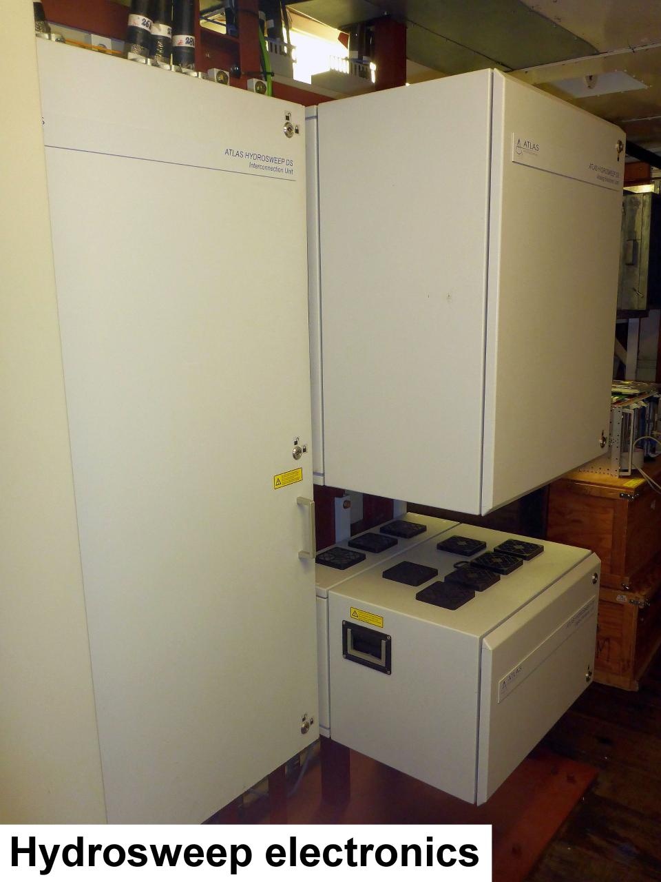
The system consists of hull-mounted transducers, top side hardware and operation software.

...

Sensorweb integration
urnvessel:polarstern:hydrosweep_ds3
contenttypeSubdevices
Name Model Type
Hydrosweep TX transducer array Hydrosweep DSecho sounder
Hydrosweep RX transducer array Hydrosweep DS3echo sounder


Position

Sensorweb integration
urnvessel:polarstern:hydrosweep_ds3
contenttypeLocalFrame
Origin Description:xyz-position calculated from Alignment Survey Report (2016) to be center between Tx and Rx transducer. Transducer arrays located in box keel, electronics located in E525A, operating computers located in E550 (HSPS-room)
X:77.162 m
(X-0 is at the center of der rudder (ref. design drawing of the vessel), positive X-axis is forward and along vessel centerline)
Y:0.001 m
(Y-0 at centerline, positive Y-axis is portside)
Z:0.017 m
(Z-0 is set to the lowest point of the keel, positive Z-axis is upwards)


Data logging, storage and archiving

...

Sensorweb integration
urnvessel:polarstern:hydrosweep_ds3
contenttypeParameters
Parameter Sensor Output Type Unit
depthdepthm
Hydroacoustic backscatterbackscatter strengthV


Central geographical ship's position and time standard

...

Sensorweb integration
urnvessel:polarstern:hydrosweep_ds3
contenttypeResources