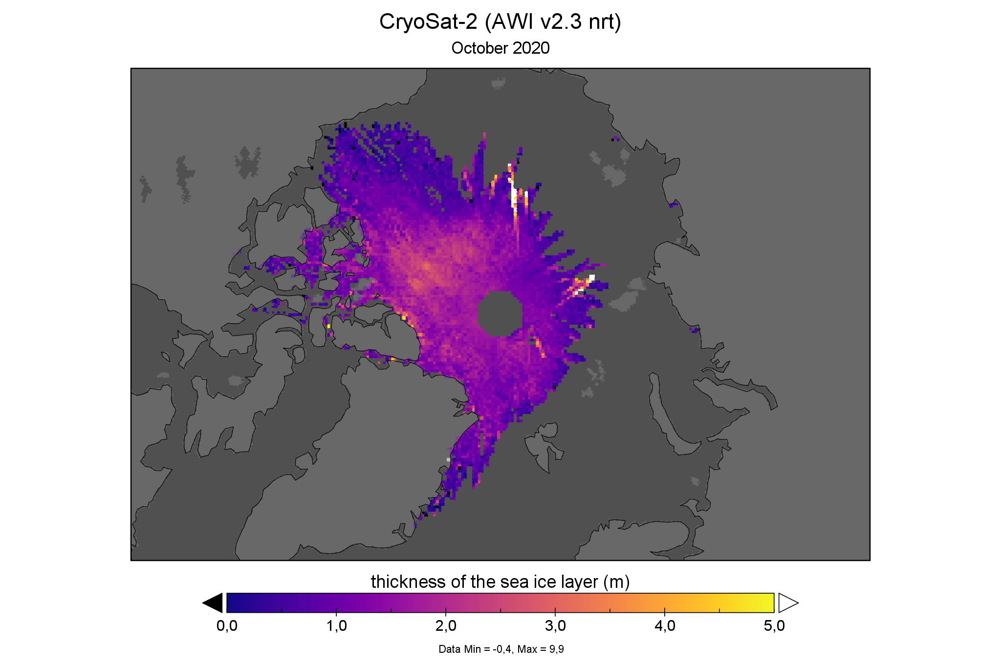
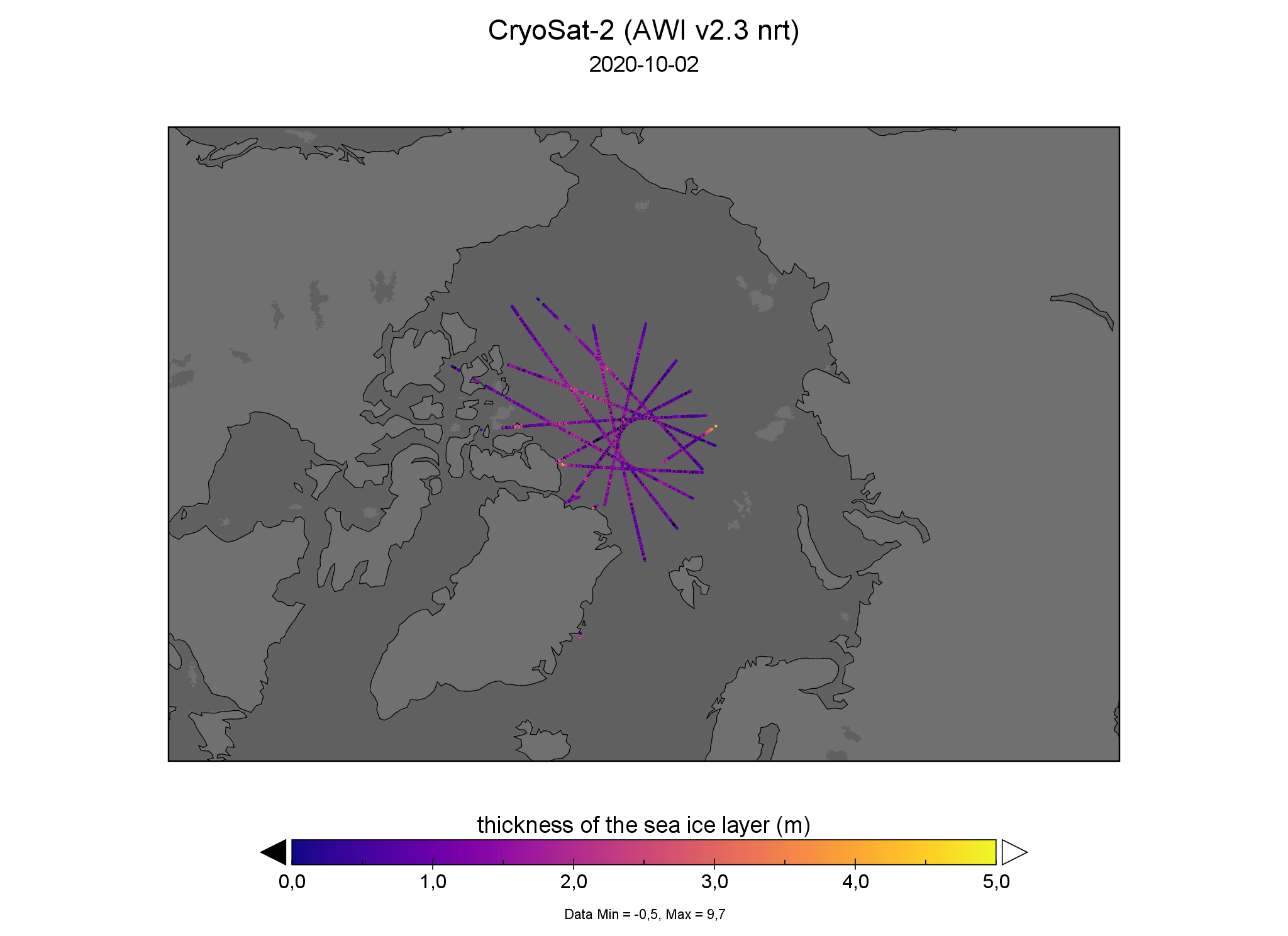
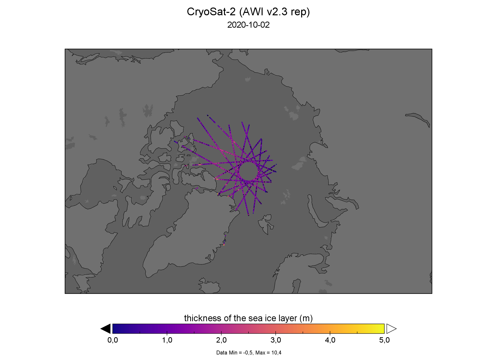
Gridded sea-ice thickness from near-real time CryoSat-2 data in October displays a few orbits with large thickness values in the Russian Arctic (see figure below). These are the result of an anomaly in the processing chain/input data and are under investigation. A temporary solution is to omit the orbits entirely from the daily orbit data until a fix has been developed.
The offline reprocessed (rep) CryoSat-2 data is not affected.
Daily (incomplete and partially errornous) orbit data from CryoSat-2 near-real time (NRT) data
Daily (complete) orbit data from CryoSat-2 offline reprocessed (REP) data
Update
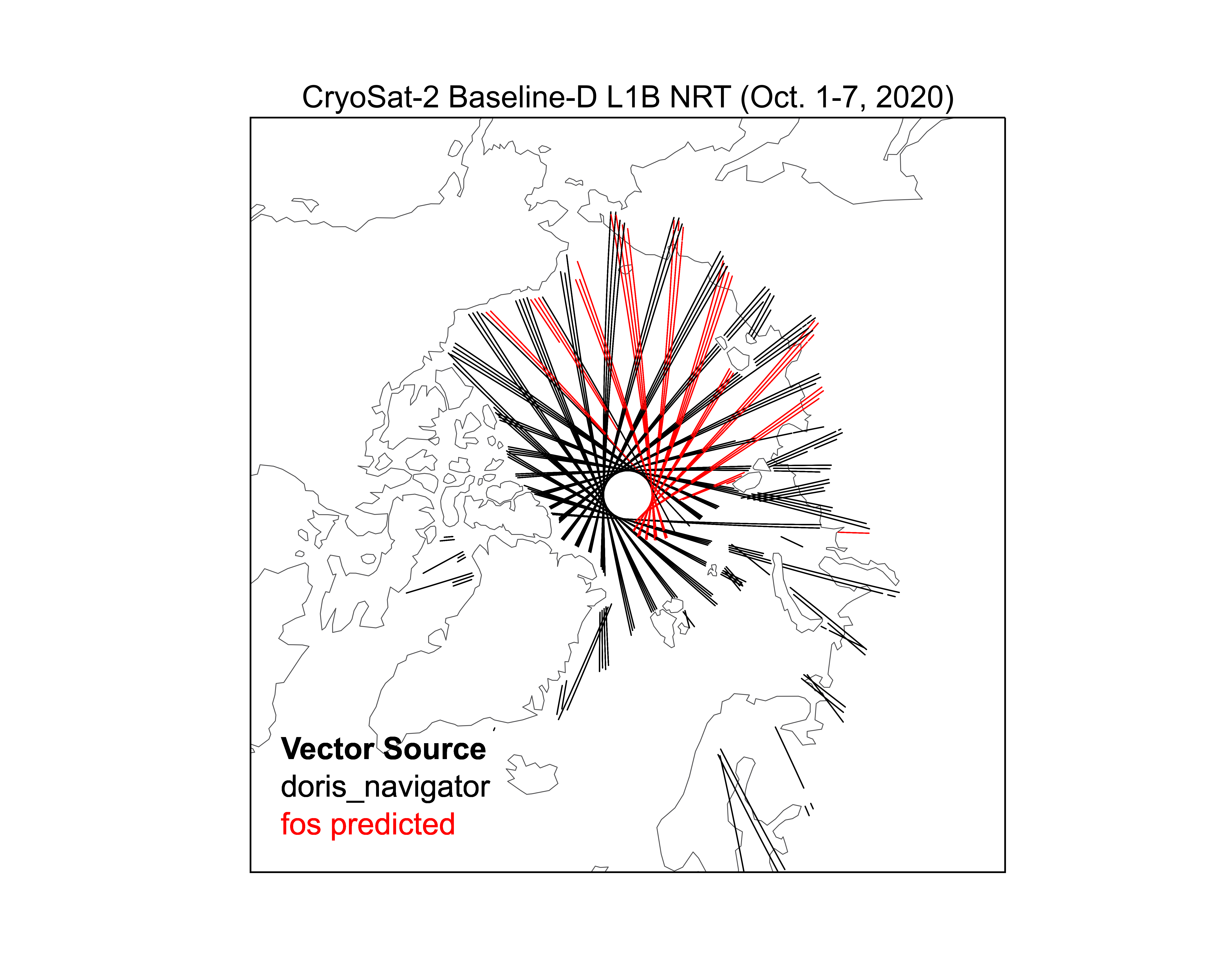
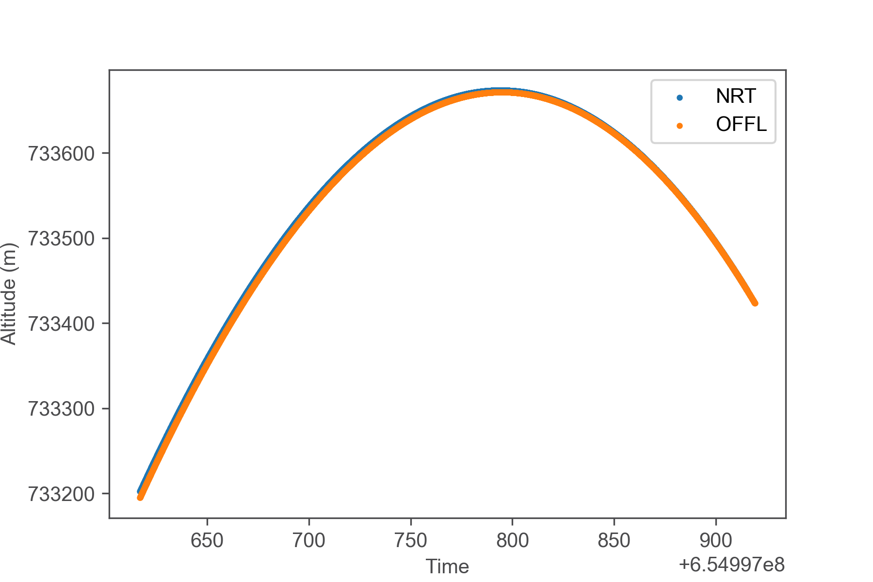
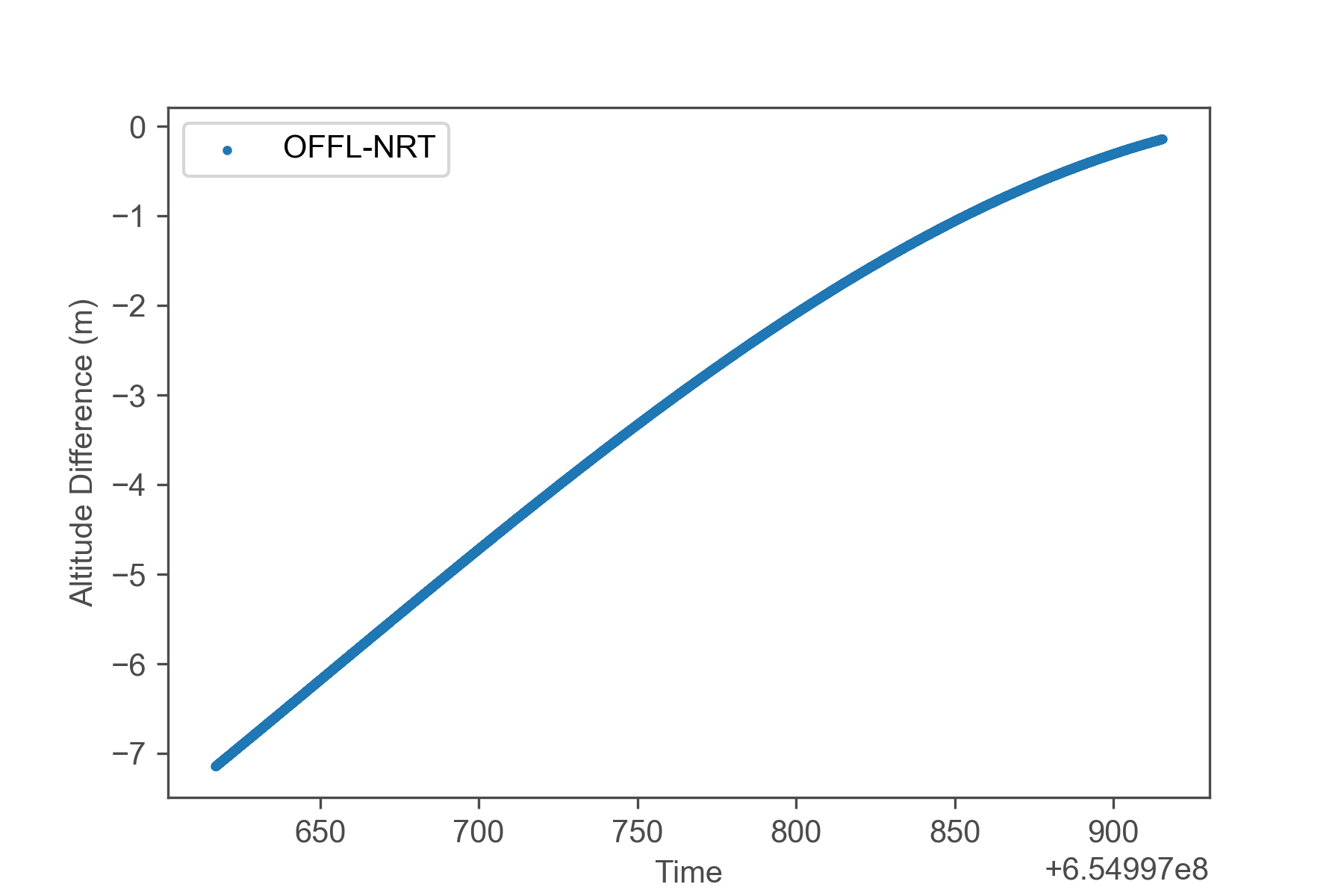
The source of the issue has been identified as imprecise satellite altitude values (l1b parameter `alt_20_ku`) since some orbits rely on the predicted orbits (`vector_source: fos predicted`) instead of observed (`vector_source: doris_navigator`). Both orbit solutions differ from the final solution in the offline reprocessed L1b data (`vector_source: doris_precise`), but the altitude of the predicted orbit may vary in the orders of several meters with respect to the final solution. For some orbits this effect is non-linear and negatively effects the estimation of the sea-level anomaly which in turn impacts freeboard and thickness.
As a fix, orbit data with (`vector_source: fos predicted`) will be excluded from the processing leading to reduced data availability in the Russian Arctic.
CryoSat-2 NRT L1b orbit trajectory color-coded with source of orbit solution (global attribute `vector_source` in netCDF files)
Altitude field (alt_20_ku) vs. time (time_20_ku) for one orbit (absolute orbit number: 55588) compared for NRT and OFFL products. The orbit corresponds to the anomalous freeboard values in the figures above.
Difference (OFFL-NRT) between both orbit altitude solutions
*Used data files:
- CS_NRT__SIR_SARN1B_20201002T234620_20201002T235118_D001.nc
- CS_OFFL_SIR_SAR_1B_20201002T234620_20201002T235122_D001.nc
